The calm before the (next) Western Washington storm
Dec 22, 2015, 7:46 AM | Updated: 8:34 am
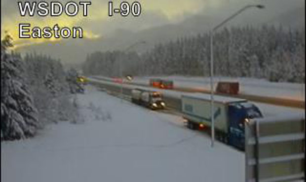
The passes got a break from the snow Tuesday morning. But more snow is on the way, according to the National Weather Service. (WSDOT)
(WSDOT)


Enjoy the break in precipitation while it lasts.
Forecasts show more rain and possibly wet snow in areas of Puget Sound beginning Tuesday afternoon.
By Tuesday evening snow levels could fall as low as 500 feet, according to the National Weather Service. That could lead to rain/snow mixes, or wet snow with little to no accumulation.
Related: Chance of snowflakes in lowlands on Christmas Day
It will be an entirely different situation in the mountain passes Tuesday night. The National Weather Service issued a winter storm warning for the Cascades of King, Lewis, Pierce, and Snohomish counties. The 24-hour warning begins at 6 p.m.
The amount of snow that fell Monday has made navigation over the passes difficult. The Washington State Department of Transportation reported 26 inches fell on Snoqualmie Pass.
Beautiful morning over the pass. Weather forecast to be calm today, next storm rolls in tonight/Wed and it's a doozy pic.twitter.com/a6D1Q6CQJB
— I-90 Snoqualmie Pass (@SnoqualmiePass) December 22, 2015
Over on Stevens Pass, crews closed Highway 2 early Tuesday morning for avalanche control.
Cold temperatures caused several crashes in the morning as well.
We have 10+ reported collisions and growing. Roads are sneaky slick with black ice. #driveforconditions
— Trooper Russ Winger (@wspd8pio) December 22, 2015