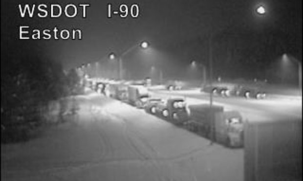
State closes I-90 over Snoqualmie Pass until at least Thursday morning
Jan 18, 2017, 10:00 AM | Updated: 12:51 pm


Wednesday afternoon update
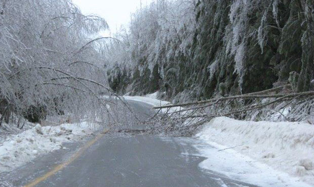
The Washington State Department of Transportation reports there were 30 trees down on I-90 around 1 p.m. Roughly 12 more need to be removed Thursday morning.
Snoqualmie Pass may not open until Thursday afternoon or later.
30 trees on I-90, roughly 12 more need to be removed starting Thurs AM. The pass won't be open until Thurs. afternoon. https://t.co/6JKJVose1y
— KIRO Radio Traffic (@KIROTraffic) January 18, 2017
Update
The Washington State Department of Transportation has shut down I-90 over Snoqualmie Pass due to “substantially unstable” conditions.
Ice and fallen trees have made the pass treacherous, according to WSDOT.
The pass will remain closed until at least Thursday morning, when crews have a chance to reevaluate.
Wednesday morning update
Wind and rain will continue to soak the lowlands Wednesday, while freezing rain and snow are predicted for the mountains.
“We got really strong easterly winds that are pulling the cold air from Eastern Washington into the passes,” National Weather Service’s Dana Felton said. “So it’s going to be freezing rain up there — might be a little sleet at times — but it’s just going to be a mess up there.”
Snoqualmie Pass is closed right now because of avalanche danger and downed trees.
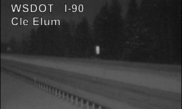
Eastbound I-90 is closed at milepost 34 near North Bend due to falling trees and rocks between milepost 43 and 44. “Numerous snow slides” by milepost 50 has westbound I-90 is closed at milepost 106 near Ellensburg, milepost 84 near Cle Elum, and milepost 70 near Easton.
Both directions will remain closed until WSDOT can assess the situation in daylight.
Felton says the Wind Advisory will remain in effect until this afternoon.
There’s also a Flood advisory for urban flooding around parts of Puget Sound about 10 a.m. Excessive runoff will cause flooding of small creeks and streams, urban areas, highways and streets.
Tuesday evening update
A winter storm warning is in effect for the Cascade Mountains while urban flooding is possible in the lowlands as a “series of weather threats” strike Western Washington, according to KIRO 7.
KIRO 7 reports that as rain continues to fall in Western Washington, a flood watch is on for Skohomish, Elwha, Satsop, Nooksack, and White Rivers through Wednesday.
Urban flooding is possible through Puget Sound communities amid the heavy rainfall.
As the snow level rises to about 7,000 feet, an avalanche warning has been issued for the Olympic Mountains and also the North Cascades over Tuesday and Wednesday.
In Central Washington, ice storms are possible over the next couple of days.
Check the original post for details on the heavy rain and wind striking Washington.
Original post
It’s been cold around Western Washington lately. Now, Washington weather is about to bring the rain with temperatures that the National Weather Services notes will be “Hawaii-like.”
Related: Check the weather forecast
According to the National Weather Service, the region can expect two days of rain from Washington’s coast, through the lowlands, and into the mountains.
The interior lowlands are likely to see up to 4 inches of rain by Wednesday. The mountains and the coast could see up to 8 inches of rain.
Washington weather
The wet Washington weather is expected to strike in two waves. The first began on the coast late Monday.
The second wave will hit sometime Tuesday afternoon and is expected to be much, much heavier.
Along with the rain, strong winds are expected to blow along the coast and into the north interior lowlands starting Tuesday night. The Weather Service notes that, as with any windy weather, people should expect tree limbs to take down power lines and cause outages.
A winter storm watch is in effect for the Cascade Mountains for Tuesday night through Wednesday.
Temperatures will also rise as the rain enters the region. In Seattle, temperatures will rise into the high 40s, according to some predictions. The Weather Service, however, reports that temperatures will head above 50 degrees in the lowlands over Tuesday and Wednesday and will feel “Hawaii-like after the rather cold conditions” the region has recently experienced.