Volcano experts weigh in on effects of possible Mt. Rainier eruption
May 14, 2019, 1:41 PM | Updated: 2:10 pm
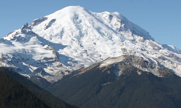
Mount Rainier. (Wikimedia Commons)
(Wikimedia Commons)

What would happen to the state’s biggest metropolitan area should the third-highest risk volcano in the U.S. ever blow?
U.S. volcano experts based primarily out of the Pacific Northwest took to Reddit Tuesday, answering questions regarding active volcanoes across the country, and detailing how exactly Washington state is prepared for the possible eruption of Mount Rainier.
RELATED: Who is at risk from volcanic eruptions in Washington state?
RELATED: Washington’s forgotten volcano
“The biggest (misconception about volcanoes) I’ve seen is an overestimation of hazards, such as an assumption that a Mt. Rainier eruption will cause widespread destruction in Seattle,” Washington State Emergency Management Division Volcano Program Coordinator Brian Terbush said.
Terbush points to hazard maps laid out by the U.S. Geological Survey, that outline the areas that would be most affected by a Rainier eruption. In terms of where lahars — volcanic flows of mud and debris — would end up after an eruption, the closest to Seattle they would likely get is Tacoma.
The USGS estimates that these high-speed debris flows typically can cause devastation in low-lying areas roughly 50 miles away; Tacoma is just over 40 miles away from Mount Rainier.
That all being so, another expert recommends that those living in the shadow of Rainier be aware of their own evacuation plans should the worst occur.
“Ideally, every resident in the valleys around Mount Rainier should know whether they live, work, or go to school in a hazard zone, and have knowledge of evacuation route and plans for living away from home,” said Carolyn Driedger with the USGS.
The biggest risks to the area would likely be posed by a “major landslide that transforms rapidly into a volcanic mudflow,” and likely hitting both Orting and Puyallup, cautions USGS geologist Larry Mastin.
Driegder went on to point out that a handful of safety and preparedness measures are already “established parts of life in the Puyallup Valley” near Rainier. That includes a detection and notification system for lahars, signage for evacuation routes, volcano drills in Orting and Puyallup schools, training for officials in the area, and more.
“Maintaining vigilance is a long-term proposition, but necessary,” she noted.
Because of Mount Rainier’s status as one of the country’s most dangerous volcanoes, “it is heavily monitored,” Terbush said. Scientists are constantly provided with data on what exactly is occurring below the surface, allowing officials the chance to provide forewarning prior to an eruption.