Close
MyNorthwest
Home
News
Sports
KIRO Opinion
KTTH Opinion
Traffic
Weather
Lifestyle
Podcasts
LIVE Radio
KIRO Newsradio 97.3 FM
Seattle Sports
770 KTTH AM
News
MyNorthwest News
MyNorthwest Weather
MyNorthwest Traffic
MyNorthwest History
MyNorthwest Politics
MyNorthwest Lifestyle
National News
World News
Money
Odd News
Photo Galleries
Sponsored Stories
Opinion
Dave Ross
Gee and Ursula
Jack and Spike
John and Shari
KIRO Nights
Jason Rantz
Bryan Suits
Michael Medved
MyNorthwest Blog
Sports
Sports
Seahawks
Mariners
Kraken
UW Huskies
Brock and Salk
Bump and Stacy
Wyman and Bob
Tools
Search the Site
Earthquake Tracker
School Closings
Advertise With Us
Employment
Contest Rules
Connect
Contact Us
Newsletters
Contests and Events
Community Outreach
Just Serve
Facebook
X (Twitter)
Instagram
KIRO on YouTube
KTTH on YouTube
RSS
KIRO NEWSRADIO
SEATTLE SPORTS
AM 770 KTTH
News
Sports
Traffic
Weather
Podcasts
Video
Listen Live
Menu
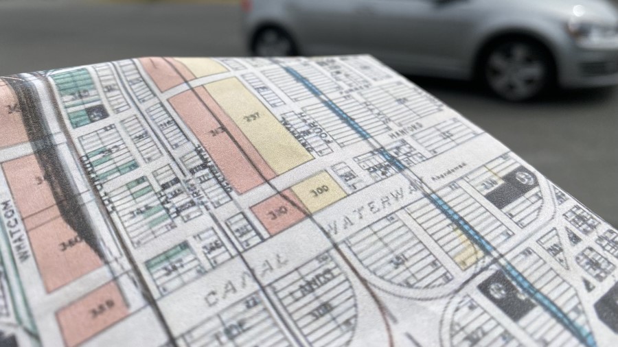
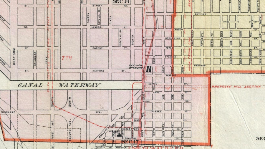
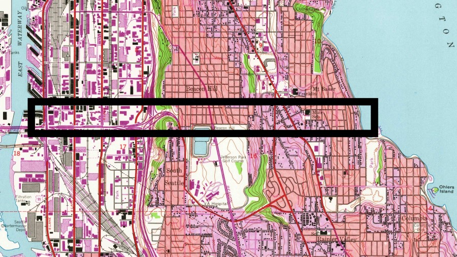
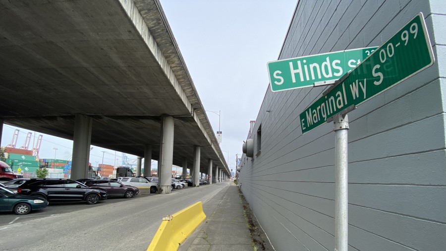
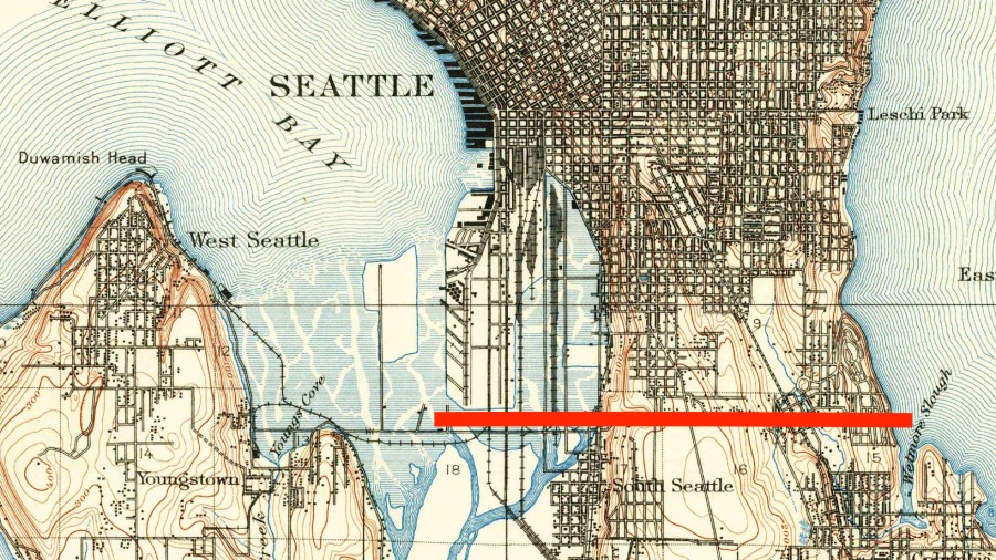
All Over The Map: The Mystery of the Phantom Canal
Close
All Over The Map: The Mystery of the Phantom Canal
Facebook
< path id="pathAttribute" d="M 8.917969 7.773438 L 367.417969 7.773438 L 367.417969 366.273438 L 8.917969 366.273438 Z M 8.917969 7.773438 " />
Twitter
LinkedIn
Email Story