Western Washington’s heat wave has peaked
Jul 30, 2018, 10:12 AM
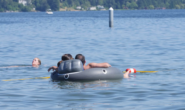
(Matt Pitman/KIRO Radio)
(Matt Pitman/KIRO Radio)
Sunday’s high of 94 degrees in Seattle was the hottest yet, and Monday is expected to be more of the same.
RELATED: The temperature sensor conspiracy
But relief is on the way.
According to KIRO 7 meteorologists, things will begin to cool starting Tuesday. Temperatures, according to Meteorologist Morgan Palmer, tend to peak before cooler air arrives.
Meteorologist Nick Allard says we’re nearly there.
“This crazy heat will be done and we’ll be absolutely closer to normal soon,” he said.
On Tuesday, we’ll see highs in the 70s and 80s. The rest of the week will remain in the 70s or lower 80s.
Red Flag Warning for the Cascades
The National Weather Service issued a Red Flag Warning for the Cascades. The warning remains in effect until 11 p.m. Monday.
A Red Flag Warning means that conditions are ripe for wildfires. Any fires that start will likely spread quickly.
“A dry and unstable air mass with warm temperatures can contribute to active fire behavior. In Western Washington, significant growth on existing fires takes place under such conditions,” the Weather Service warned.
Hazy skies as wildfire smoke increases
As crews work to prevent additional fires in Washington state, fires to the south, including the Carr Fire in Northern California, are beginning to negatively impact our air quality.
The National Weather Service says smoke is drifting north toward Western Washington. Though much of the smoke remains aloft, monitors in the Cascades and portions of the I-5 corridor are worsening air quality. That includes cities from Seattle south to around Tacoma and Olympia.
Seeing hazy skies this morning? Smoke from #CarrFire and other wildfires in California has drifted north. Most of the smoke remains aloft but take precautions if you're sensitive to air pollution! #wawx pic.twitter.com/QzRCQE3hTl
— NWS Seattle (@NWSSeattle) July 30, 2018
Follow @http://twitter.com/Mynorthwest