
All Over The Map: Road between Redmond, Kirkland dates back to early settlers
Jan 24, 2020, 9:24 AM | Updated: 9:45 am
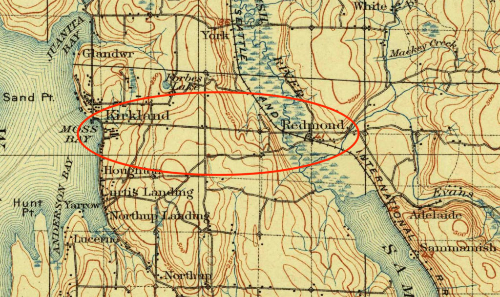

On the Eastside, the main road between Kirkland and Redmond is Northeast 85th Street. It’s a big, busy four-lane highway that connects to Interstate 405 through a big interchange, and both sides are lined with car dealerships and fast food restaurants for much of the way between the two bustling communities.
But NE 85th Street really only became the main road when it was widened and when a railroad overpass (over the old Belt Line) was added in the 1960s.
Before that, there were essentially two routes between Kirkland and Redmond in the modern era, not including trails first blazed by Native Americans thousands of years ago, and then by early settlers in the 1870s.
The earliest of the modern routes was called the F. A. Richardson Road. It was named for the settler who helped get it built in 1890, as part of the boom that accompanied Kirkland being founded as a steel-mill town.
All those metallic dreams for Kirkland went bust in the Panic of 1893 and the mill, as they say, never produced an ounce of steel. Fortunately, we can say with hindsight, Kirkland never fulfilled its promise to become the “Pittsburgh of the West.” In fact, as a proud native son of that lakeside community, I like to think of Pittsburgh aspiring to become the “Kirkland of the East.”
The Richardson Road wasn’t paved, and it generally followed the path of what’s now NE 80th Street. The current NE 80th Street, however, is no longer a through-road; it was cut off when Interstate 405 went through 50 years ago.
The 1890 road was criticized for being too steep in places as it went up and over Rose Hill. In 1908, the Seattle Times said it “climb[s] up one side of a steep ridge then plung[es] down the other side, apparently just for the fun of having to climb back up the next hill.”
In some ways, the Richardson Road is admirable for its time because it went straight from Kirkland to Redmond. The route was direct, east to west, and the roadway didn’t really meander like so many other rural roads of that era.
But because of this direct path, the Richardson Road had those criticized steep grades, and it also had multiple trestles to keep its route straight as it crossed over gullies. These structures added up to nearly a half-mile in total length, and required regular maintenance and upkeep.
Because of these problems, a new road was created by King County in 1908 that roughly paralleled the Richardson Road, but that was situated about a half mile to the south. This new route, which utilized parts of existing routes, was called the Steen Collins Road. The name came from Kirkland settlers Gustavus Steen and R.H. Collins, who each owned property along the route, and who had each helped build some of those earlier roads.
Praise for the Steen Collins Road in The Seattle Times was over the top.
On September 6, 1908, a Times’ writer called the new thoroughfare “[o]ne of the greatest, if not the greatest, and certainly the most appreciated, pieces of road building in King County within a decade.”
The effusive praised continued:
“The new road proceeds by a series of curves following the most favorable ground and taking every advantage of the topography to obtain the lightest grades, maintaining every foot of elevation once gained.”
Chief Assistant King County Engineer J.R. Morrison was proud of his work and the positive impact it would have on drivers who, in those days, used teams of horses to haul freight between the two towns.
Morrison told the Times that the maximum grade was reduced from 13 percent on the Richardson Road to just 6 percent on the Steen Collins Road. For comparison sake, he told the Times this would translate to needing only five horses — instead of nine — to haul a load of 6,000 pounds from the shores of Lake Washington to the shores of Lake Sammamish.
“The result,” Engineer Morrison said of the new route, “is a well-located road through a beautiful country which will make the drive a pleasure to both horse and owner.”
Nowadays, there’s no evidence or commemoration of either the Richardson Road or the Steen Collins Road, but you can still experience the “pleasure” of those long-ago equine commuters.
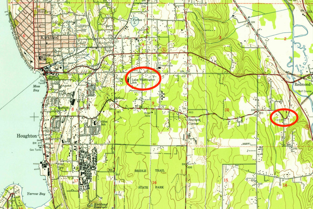
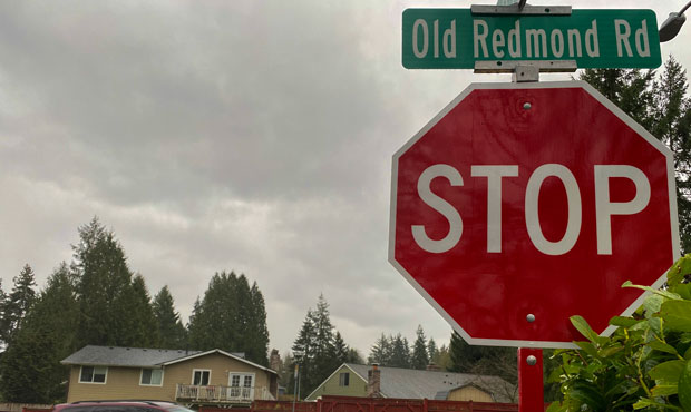
The road that closely follows significant portions of the route of the old Steen Collins Road — which was “new” back in 1908, of course — is the two-lane Old Redmond Road.
That name – Old Redmond Road – was used by locals at least as early as the 1960s, but wasn’t made official until 1971. At some point, the Steen name had been dropped entirely; newspaper articles from the Sammamish Valley News from the late 1960s call it simply “Collins Road.” Other names associated with the route were Kirkland-Redmond Road and Redmond-Kirkland Road.
As modern drivers head eastbound on NE 70th Street from Interstate 405, the “Old Redmond Road” name kicks in officially at 132nd Avenue NE at the Bridle Trails Shopping Center. The route continues east and mostly downhill all the way to West Lake Sammamish Parkway in Redmond.
Near its eastern terminus, the Old Redmond Road retains one very sharp curve, which we used to call “Dead Man’s Curve” (after the 1963 Jan & Dean song) when I was a kid in the 1970s. A circa 1911 photo of this curve, or perhaps of a curve a bit farther east that may have been eliminated when the road was realigned, is captioned “Dead Man’s Turn.”
A search of newspaper archives reveals multiple spots along old local roadways with one or the other of these morbid monikers, including one spot on the Redmond-Fall City Road where at least one fatality actually took place in the 1920s.
Whatever it’s called, the Old Redmond Road is a great alternative to NE 85th Street. It’s still pretty curvy, and the feel of driving it is very different from most of the rectilinear roads that connect Eastside communities these days.
Even if you have no reason to travel between Kirkland and Redmond, why not go out your way to experience what was once only a “pleasure to horse and driver”?
Special thanks to the Redmond Historical Society and to Eastside historian and author Matt McCauley for their invaluable assistance with this story.


