
All Over The Map: Confusing signs and too many names at Cedar Falls
Sep 11, 2020, 10:15 AM | Updated: 10:55 am

The old railroad town of Cedar Falls is just one of many names – perhaps too many – for a popular recreation hub on the way to Snoqualmie Pass. And it might be time to come up with some better way of identifying the popular spot.
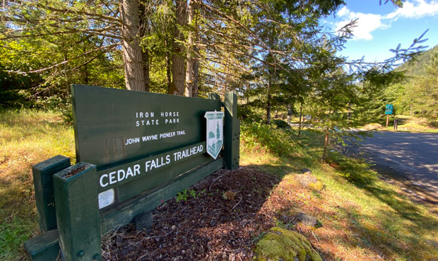
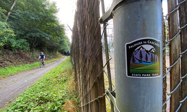
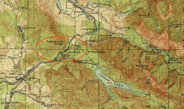
It’s likely that many KIRO listeners have been to the Cedar Falls Trailhead, which is located off I-90 at exit 32. There’s a lot of history there, along with some distinctive recreational opportunities, including the Palouse to Cascades Trail that goes east, up and over Snoqualmie Pass, along the edge of the City of Seattle watershed.
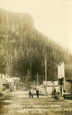
Also accessible from that spot is Rattlesnake Lake, Rattlesnake Mountain, and the Rattlesnake Ledge Trail (which remains closed because of the pandemic), all of which are co-managed by the City of Seattle, the Washington State Department of Natural Resources, and King County.
Incidentally, the “Rattlesnake” name, according to place-name expert and author Robert Hitchman, comes from pioneer Arthur Denny. During a 19th century survey, the sound of what turned out to be not a deadly snake but dried seed pods, apparently frightened a member of Denny’s survey party.
In the same spot, the City of Seattle operates a hydroelectric plant nearby on the Cedar River – that’s where the Cedar Falls name comes from – as well as an environmental education center. If all this weren’t enough for one recreation complex, the Snoqualmie Valley Trail, run by King County Parks, also begins there and goes all the way to Duvall.
These multiple recreation opportunities – and all those named resources owned by all those different agencies – make for a sometimes confusing hodgepodge of directional and other signage. Adding to this confusion is at least one major name-change in the past few years that signage hasn’t quite caught up with.
The Palouse to Cascades Trail follows the route of the old Chicago, Milwaukee & St. Paul Railway across the Evergreen State. Better remembered by its “Milwaukee Road” nickname, this is the same railroad that made the Whitman County town of Malden – recently devastated by a wildfire – go boom and then go bust a century ago.
From Cedar Falls, you can walk, bike, or ride your horse. If you can make it 18 miles up to Hyak, you can travel through the spooky two-mile long tunnel. Beyond there, the trail continues, with a few gaps, all the way to Idaho.
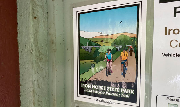
Until 2018, the trail was known both as Iron Horse State Park and the John Wayne Pioneer Trail, in honor of the Hollywood actor and iconic star of Westerns and war movies. Wayne died in 1979, which was around the time the Milwaukee Road went out of business, and when the state was first thinking about purchasing the old right-of-way to create a trail.
Paul Hart was the Ellensburg rancher who wanted that John Wayne name for the trail. In 1981, Hart told The Seattle Times that Wayne was a hero, and that the actor spent a lot of time at his home in Sequim. Hart also said people looked up to Wayne, and that Wayne was a friend of then-President Ronald Reagan. Hart did not mention that “Duke” Wayne also starred in the Dirty Harry-style film “McQ,” which was filmed in Seattle in 1974.
In May 2018, the Washington State Parks Commission decided to change the name because “the trail’s previous name did not comply with State Parks policy for naming trails, which gives preference to names that highlight geographic location, geology, archaeology or history.”
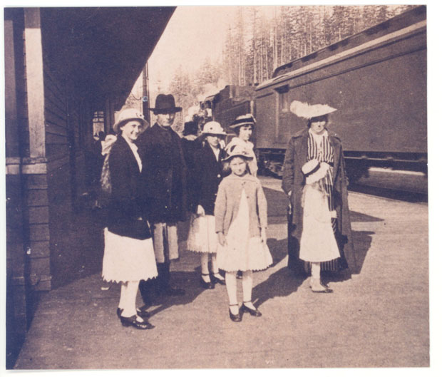
Name changes are nothing new around Cedar Falls. In fact, the long-gone Cedar Falls post office – which shut down in 1960 — was first called “Moncton” from 1910 to 1912. Moncton was the name of an adjacent community that was flooded by the inadvertent creation of Rattlesnake Lake around 1915; the flooding of the town was the unintended consequence of the nearby hydroelectric project on the Cedar River.
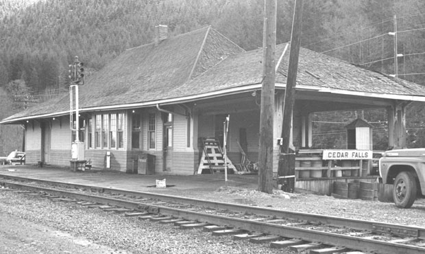
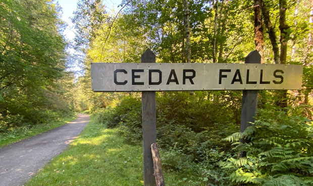
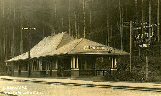
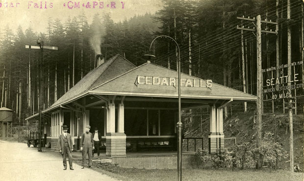
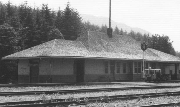
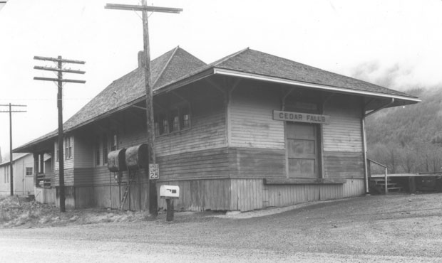
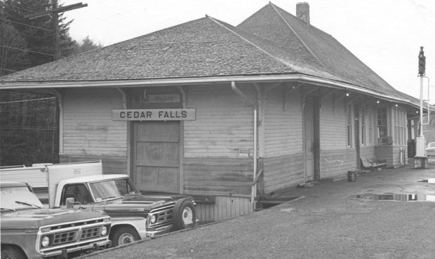
The Cedar Falls depot was built in 1910 and served passengers until around 1960. It then served as a freight office for the Milwaukee Road for 20 years after that. The depot building is long gone, but the “Cedar Falls” sign was saved and is now mounted on two posts alongside the Palouse to Cascades Trail.
In communities along rail corridors throughout Washington, depots were once a common sight, but most have been torn down, especially in the wake of big shifts in rail travel after World War II, and consolidation of big railroads in the 1970s.
The absence of the Cedar Falls depot would easily lead the casual hiker to believe that it, too, had been torn down. But, as it turns out, a very determined depot enthusiast bought it from Burlington Northern back in 1988 and took it apart — piece by piece – and then moved it, and carefully reassembled it, converting it to his family home in South King County.
Word is that the family does not like to publicize the old depot’s location, but photos show that it appears to be well-maintained and only slightly modified from its original appearance. In its current setting, perhaps only the most knowledgeable railroad history buff would be able to guess as to the building’s peripatetic history.
Finally, given all the names at Cedar Falls – Palouse to Cascades, Iron Horse, John Wayne, Snoqualmie Valley, Rattlesnake (Lake, Ledge and Mountain) – and the proliferation of signs from various jurisdictions, it sure would be nice to see everyone involved – the City of Seattle, King County, State DNR, State Parks – come up with a single appropriate and cool name for that recreation complex that makes it easy to understand for newcomers, visitors, and even long-time locals.
Perhaps there’s a name from local indigenous/tribal history that would work as a single title for one of the most interesting recreation and history-filled areas in western Washington.
Got a good idea? Please send your suggestions to me via my contact information below.
You can hear Feliks every Wednesday and Friday morning on Seattle’s Morning News and read more from him here. If you have a story idea, please email Feliks here.


