‘Band of snow showers’ moves through King, Pierce counties
Apr 14, 2022, 9:30 AM
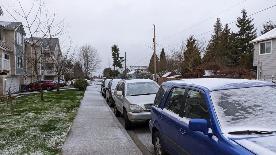
Snow in South King County. (MyNorthwest photo)
(MyNorthwest photo)
Parts of King and Pierce counties woke up to snow showers on Thursday morning, in the wake of record low temperatures earlier this week.
Snow today has been most prevalent in the Kent and Auburn area, limiting visibility along freeways. According to the National Weather Service, that “band of snow showers” is expected to taper off by the end of the morning, but could return again on Friday. In the meantime, drivers are advised to reduce speeds below the speed limit, leave extra following space between vehicles, plan for longer trips, and avoid using cruise control.
No, you're not seeing things.
It is 🌨️snowing🌨️a lot along SR 167 in #Auburn !
Remember when it snows, the road conditions worsen.
🐢Slow down, go below speed limit
↔️ Leave extra space between you and car ahead
❌Don't use cruise control
⏰Plan for longer drive@NWSSeattle pic.twitter.com/YVWlwpq5Hi— WSDOT Traffic (@wsdot_traffic) April 14, 2022
This comes after Seattle tied the mark for its coldest ever April day on record, averaging 38 degrees on Wednesday after bottoming out at 32 degrees. The last time the city experienced a day in April with an average temperature that low was April 4, 1975.
Olympia broke the record for the city’s coldest ever April day, averaging 35 degrees. The previous mark was set on April 19, 2008, when it averaged 36 degrees for the day.
Follow @http://twitter.com/Mynorthwest