Destination HISTORY: Skagit Bay Estuary and Craft Island
Jul 25, 2022, 3:08 PM | Updated: 3:32 pm


Just over 60 miles from Seattle, the Washington State Department of Fish & Wildlife manages a series of tracts of public land where the Skagit River meets the saltwater of Puget Sound.
The lands are known as the Skagit Bay Estuary Wildlife Area, and they’re a popular yet low-profile destination for birdwatchers, hunters, hikers, dog walkers, and weekend explorers.
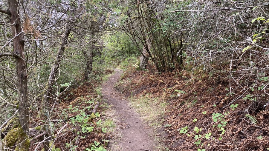
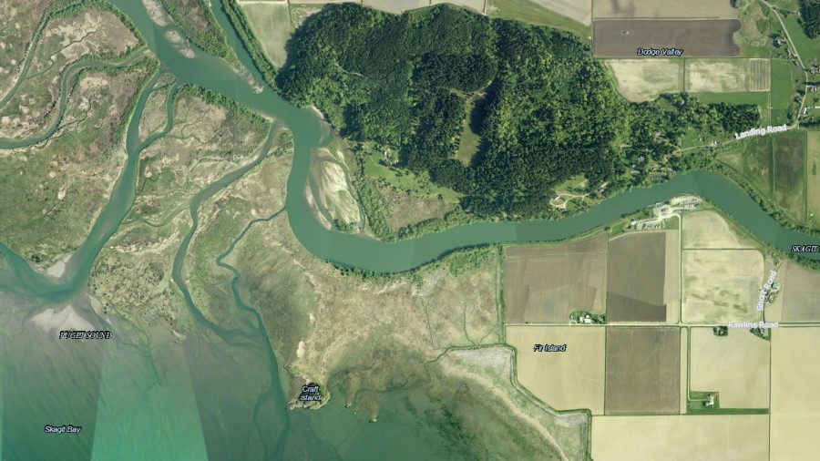
One section in particular lies just south of the North Fork of the Skagit River on Fir Island a few miles south of LaConner. For those willing to deal with some serious mud and to undertake some strenuous flat-terrain hiking, the estuary offers sights and sounds of the river, and access to a rare sandy beach on Puget Sound. But be warned, this is different from typical hiking experiences in the foothills of the Cascades, and a visit will likely require travel through sometimes treacherous tidal areas and wetlands.
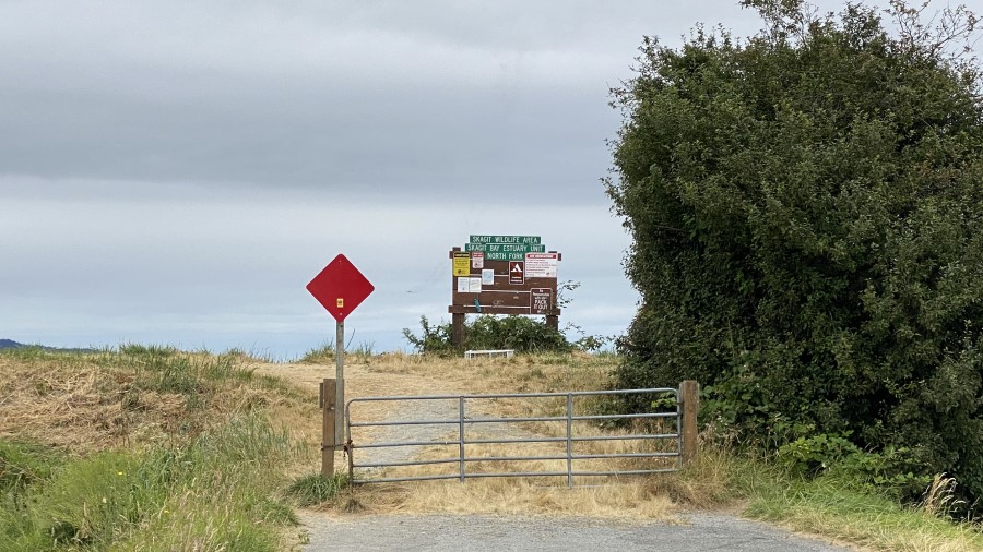
Entry to the estuary is from a simple trailhead at the west end of Rawlins Road, which is accessible via Fir Island Road, just north of ice cream and other delights at Snow Goose Produce. Fir Island Road is most easily reached from the Conway/LaConner exit (Exit 221) from Interstate 5, or from the old Pioneer Highway which roughly parallels I-5 and which can be easily accessed from the Arlington exit (Exit 208) by heading west toward Silvana (it takes longer, but is certainly more scenic).
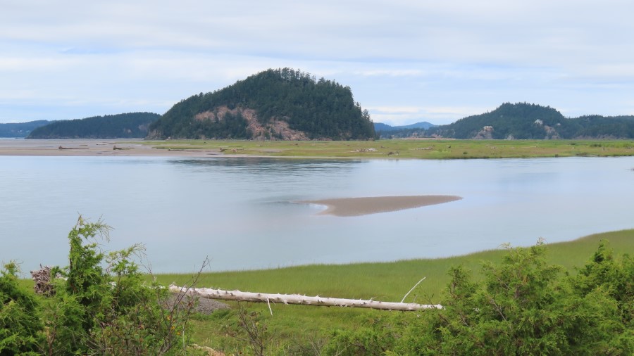
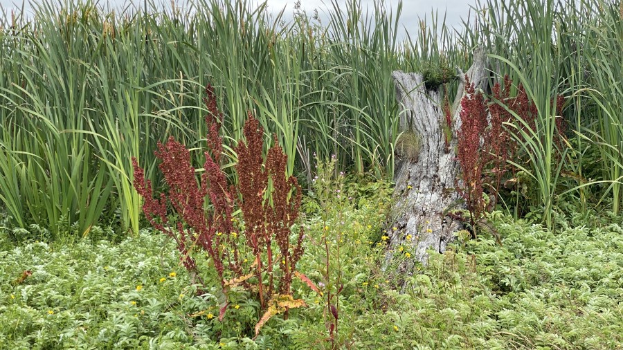
There are numerous trails through the estuary, but most are unmarked, and virtually all trails include spots where a jump or a big step over a ditch is required, or the occasional walking across a narrow plank. Following high tides, such as earlier this summer, and in the rainy months, traveling over and often through mud will be required to reach open saltwater, or to access the relatively dry trails on Craft Island, a small and non-swampy piece of land which rises above the tidal flats and which is visible from the trailhead. On a visit in July, the least muddy trail to the island appeared to be along the north edge of the muddy tideflats.
Birds are plentiful in the estuary, and their songs are interrupted only occasionally by a distant powerboat, or by a US Navy aircraft on approach to the NAS Whidbey, which lies immediately west of the mouth of the river on Whidbey Island. The outline of the famous “Whidbey Island Man” is nearby, but does not touch on the mouth of the North Fork of the Skagit.
From tides and river flow, an estuary is often an ever-changing place, and that’s certainly true at the mouth of the Skagit. A major shift of the river took place sometime around 2009, according to Belinda Rotton, land agent for the Washington State Department of Fish & Wildlife.
“The river channel took a turn,” Rotton said. “Before, the majority of the river flow used to go towards the McGlinn Jetty and came out more towards La Conner and Goat Island. The main channel flow now goes out by Craft Island.”
“Before that, it was just an island out to the marsh, but now it’s become an island out to the riverbank,” and thus has become a more popular destination for estuary visitors, Rotton said.
The origins of the name of Craft Island, according to Maritime Place Names: Inland Washington Waters by Richard Blumenthal, are unknown. “In 1962,” Blumenthal writes, “the U.S. Board on Geographic Names chose the name ‘Craft Island’ over the variant ‘Delta Rocks,’ as Craft was in ‘undisputed local usage.’”
Skagit Estuary is just south of the Swinomish Indian Reservation, and the Lower Skagit River has been home to Indigenous people since time immemorial.
A certain “Miss Linda Jennings” is quoted in an old 1906 book called “History of Skagit and Snohomish Counties.” Jennings was writing about the Swinomish Flats several miles north of the North Fork of the Skagit River, but her 19th-century description likely applies, at least somewhat, to what’s now the estuary around Craft Island.
“At high tide, the Indians paddled their canoes wherever they wished over what are now the finest farms in Washington,” Jennings writes. “The marsh was ramified” – or spread out – “by countless sloughs, big and little, many of them long since filled and cultivated over. In the summer, tule, cattail, and coarse salt grass flourished and it was the home of many thousands of wild fowl and muskrats—an ideal hunting ground for Indians.”
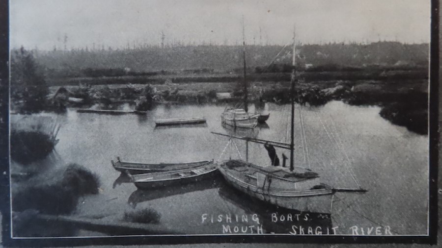
That same 1906 book mentions a man named Rollins from New Brunswick who settled briefly near the North Fork of the Skagit River, as well as a man named Rawlins who also homesteaded on Fir Island. It’s unclear, but it appears that these were two different and distinct men. Along with homesteaders pursuing farming, the largest settlement on Fir Island in the late 19th century was Skagit City, along the banks of the South Fork of the Skagit not far from where the river splits in two.
Belinda Rotton says the Washington State Department of Game, the predecessor to the Washington State Department of Fish & Wildlife, began acquiring land in the Skagit Estuary in 1944. Prior to that, Rotton says, the federal government’s US Fish and Wildlife Service had been acquiring land, perhaps with the intent to designate a National Wildlife Refuge. Those plans were scrapped at some point, and the publicly owned Skagit Estuary lands have been managed by the state ever since.
There are no restroom facilities at the trailhead, and the only vehicle parking on-site is along the shoulder of Rawlins Road. If you go, be courteous and park as far off the road as possible to maintain access for the nearby private landowners; on a few separate visits lately, cars were only parked on the north side of Rawlins Road.
Destination HISTORY is a regular feature written and produced for MyNorthwest by KIRO Newsradio Resident Historian Feliks Banel highlighting interesting places within an hour or two by car from Seattle. You can read more from Feliks here, or if you have an idea for Destination HISTORY or a question, you can email him here.