Relief on the way as smoky skies linger across WA
Oct 19, 2022, 3:43 PM | Updated: 3:56 pm
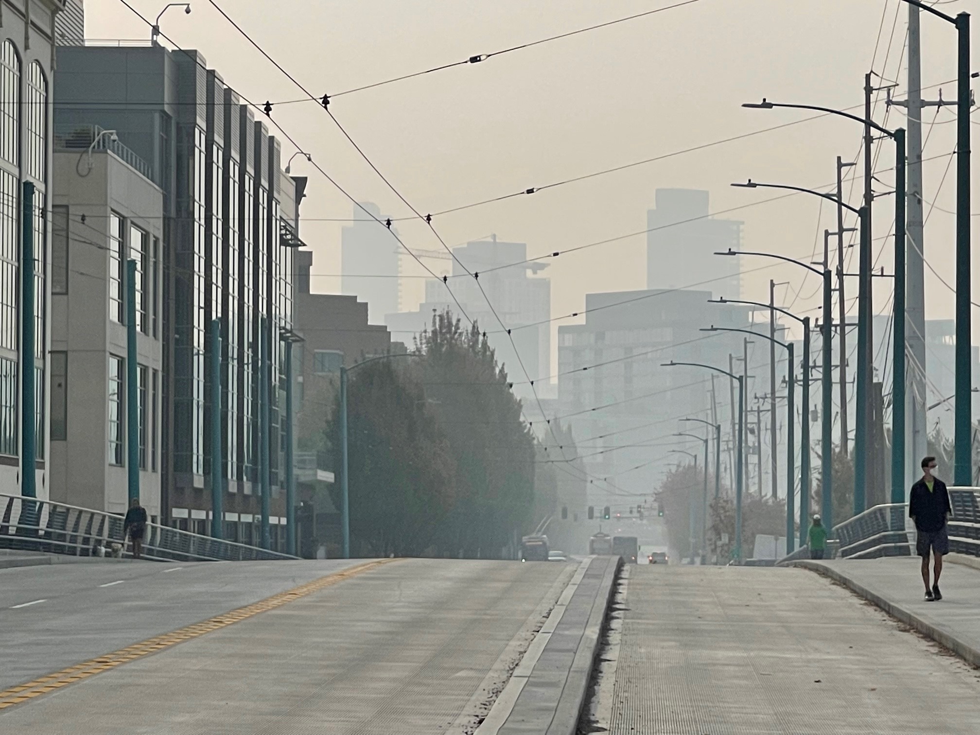
Smoke shrouds the Seattle skyline as seen from South Lake Union. (Photo by Bill Kaczaraba)
(Photo by Bill Kaczaraba)
Some people in western Washington like the glorious heat of summer. Others like the coziness the rain provides. Some even like the snow so they can head to the mountains and snowboard or ski. But one thing we can all agree on: ‘Go away, smoke!’
And we’re close.
Unhealthy air continues into Thursday
“We are seeing a lot of unhealthy air Wednesday across the Puget Sound region. We still expect this to continue unfortunately, well into Thursday,” Eric Saganic, Air Quality forecaster at Puget Sound Air Quality, said. “Thankfully, we only expect this to last a couple more days.”
“A large portion of the area from Bellingham to Olympia has ‘Unhealthy Air Quality’ readings, and the farther east you are, there are some ‘Very Unhealthy’ to ‘Hazardous’ readings,” Nick Allard, KIRO 7 TV’s meteorologist, said. “If the smoke has been bothering you, it will absolutely be an issue again today.”
Wildfire smoke again pollutes Pacific Northwest air
Most of the region was in the ‘Unhealthy’ 170 air quality range
Allard said Seattle has hovered in the 170 AQI range most of the day. That’s on a scale of 0-500. It’s also consistent with what AccuWeather and other weather agencies reported.
However, Snohomish, Gold Bar, and spots near Bellingham are well above 300 and a couple of those areas are at 329. That’s unhealthy even if you are not sensitive.
Some of the worst air quality in the world
“We’re experiencing some of the highest air pollution levels in the world at this point. There’s a lot of smoke out there,” Saganic told KIRO Newsradio’s Nicole Jennings.
In fact, Seattle’s air quality was the worst Wednesday ahead of Lahore (Pakistan), Delhi (India), and Chengdu (China).
“We’ve never really seen fires this close to such high population densities,” Saganic claimed. “It’s something to really keep a close eye on. It’s been very challenging to forecast because it’s just so close and the smoke impact is really significant when you’re adjacent to these fires.”
Fire officials tell us that even in the last couple of days, new fires have cropped up, including one just 10 miles outside of the Duvall area.
“A lot of that smoke is heading to areas like Bothell and even Shoreline,” Saganic said. “We’re seeing a lot higher levels of smoke because this fire is even closer than the old Bolt Creek Fire and we’re still seeing smoke impacts from the fire near Mount Rainier.”
Relief coming on Friday and Saturday
“There is a weak cold front offshore this morning that will move across the area Thursday,” Allard outlined. “I mostly just see increasing clouds and not much, if any, rain, but a few sprinkles are possible. However, onshore wind will increase and that should mean improving air quality throughout the day, but it will not scour all of the smoke out.”
In the short term, expect relief on Friday and Saturday.
“Friday morning could be mainly dry around Puget Sound, but by noon into Friday evening, rain will spread across the area,” Allard said. “In addition, gusty winds are possible, especially along the coast. However, it will likely be a bit breezy throughout the area Friday evening into Saturday morning.”
Seattle is expecting to see some significant rain this weekend for the first time since the summer began. That will help with smoke in the air as well as assist in dousing the wildfires.
The cost of nice summer weather
“With such an unprecedentedly dry October, I expect this is the highest level ever seen in October in terms of air pollution,” Saganic said. “This could be the result of a changing climate over time and we could see this more frequently. If we see a drier fall, this could be a typical event to have a lagging drier fall and see more smoke in these months.”
KIRO Newsradio’s Nicole Jennings contributed to this story