Puget Sound area hit by ‘significant flooding,’ power outages continue
Dec 27, 2022, 7:22 PM | Updated: Dec 28, 2022, 9:17 am
In Everett, tides went over the top of a levy, prompting concerns of a breach. (Photo from Everett PD)
(Photo from Everett PD)
The National Weather Service in Seattle reports “significant flooding” in Puget Sound will continue today.
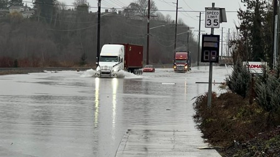
King Tides combined with heavy rain have led to homes being flooded in the lowlands. Some people say they have lost “everything.”
With 0.27″ at @flySEA Tuesday the yearly rainfall total is 39.52″ surpassing the yearly normal rainfall for Seattle which is 39.34″. More flooding around Puget Sound this morning around the time of high tide but not nearly as bad as Tuesday. Calmer weather for the next week.#wawx
— NWS Seattle (@NWSSeattle) December 28, 2022
Meanwhile, energy companies across the region are working to get power back on to thousands of people left in the dark. Companies in King, Snohomish, and Pierce counties say they expect to make significant progress today.
Seattle Police and other law enforcement agencies are responding to many flood-related emergencies. Many involve people who attempted to drive through water hazards.
Police and other emergency personnel are responding to a water hazard near 5th Ave S and S Holden St. Occupants of a vehicle rescued from possible sinkhole/flooding. Please avoid the area, more information when available.
— Seattle Police Dept. (@SeattlePD) December 27, 2022
All this is the culmination of a night of wild weather around the Sound. Sea-Tac Airport saw winds peak at 55 MPH.
While many saw strong winds of 45-55 MPH this evening, other saw almost no wind just a few miles away! Many small scale microclimates out there. Here’s a list of all the wind reports of 35 MPH or higher https://t.co/lh4zSRd7tb. About 40K out of power statewide presently. #wawx
— NWS Seattle (@NWSSeattle) December 28, 2022
The KIRO 7 weatherblog reports the weather is still unstable across the region.
Watches, Warnings, Advisories:
- Coastal Flood Warning
- Coastal Flood Advisory
- Winter Weather Advisory
- Special Weather Statement: Landslides
Mostly cloudy skies and some scattered drizzle over the northwest Interior Wednesday morning. Across the Puget Sound cloud breaks and slightly cooler temperatures than yesterday although temperatures today (and this week) are trending on the more “normal” side of things.
Overall, today is shaping up to be a fairly mild day as a weaker surface high is building and ridge of high pressure moves in later this evening. As lingering showers dwindle, a few will remain in place favoring mountain locations.
Snoqualmie and Stevens Passes are both open but got hit with a significant amount of snow overnight. Chains are required and it’s a good idea to check their status before heading out.
KIRO 7 Pinpoint Weather team contributed to this report