Parts of Western Washington see slush and snow, most schools delayed or closed
Feb 15, 2024, 7:30 AM | Updated: 7:49 am

Snow and slush early Thursday morning (Photo: Sam Campbell, KIRO Newsradio)
(Photo: Sam Campbell, KIRO Newsradio)

UPDATE (Thursday, 5:10 a.m.): Snow fell across parts of Western Washington overnight into Thursday morning, causing both school delays and power outages.
While Seattle saw merely a dusting of snow throughout Wednesday night, other areas, like Western Kitsap and the Hood Canal region, received the most snow. A Winter Storm Warning was issued for the Hood Canal area.
For the remainder of Puget Sound, it will be mostly wet roads, according to KIRO 7 Chief Meteorologist Morgan Palmer, with some wet snow mixing in with rain at times. There will be some spotty areas of slush on car roofs and grassy surfaces.
More on snow in WA: With freezing temperatures comes drivers’ biggest worry, black ice
Most school districts had delayed starts, but some school districts — including Bremerton, Central Kitsap, Hood Canal and Griffin — were forced to close for the day. Track all school delays and closings here. Additionally, the Kitsap County Courthouse and all county offices are on a two-hour delay, according to KIRO 7.
“We have a mix of everything this morning with snow/wet snow and rain showers all over,” KIRO 7’s Meteorologist Nick Allard said. “Just like we forecasted, the snow has been heaviest west and south of Puget Sound. We still have Winter Weather Advisories for Tacoma south and from the eastern Kitsap Peninsula south until later this morning.”
The weather even caused power outages across Western Washington. Approximately 49,000 customers were without power Thursday morning, according to a power outage tracker, with the majority in Kitsap, Pierce and Thurston Counties.
We’re not quite done with winter yet — no matter what that (allegedly) prophetic groundhog says in Pennsylvania.
This is a park in Shoreline where SOME neighbors woke up to snow — others just a couple blocks away lucked out and didn’t have to scrape off their cars. pic.twitter.com/ir3tVLPwli
— Sam Campbell (@HeySamCampbell) February 15, 2024
Previous story:
Up to three inches of snow — or freezing rain depending on conditions — is expected to land in Western Washington throughout Wednesday night into the morning.
According to KIRO 7 Meteorologist Nick Allard, the snow is not expected to last long with Thursday temperatures not dipping into the 30s.
More on snow in WA: Want to eliminate noise pollution? Let it snow
“Precipitation will move north Wednesday evening, and while temperatures will be warm enough for mainly rain in some spots, there will be areas where some snow mixes with rain or wet snow falls for a time,” Allard said. “The best opportunity for this will be around western Hood Canal and south/west of Olympia tonight into early Thursday morning. There is a Winter Weather Advisory in effect for part of the Kitsap Peninsula and south to Chehalis, where one to three inches of slushy snow could fall.”
Snow falling and sticking in lowland regions requires a lot of factors, according to the National Weather Service. This week’s weather is providing dry air, low levels of moisture and temperatures in the 40s — a concoction of elements preventing Seattle and the surrounding areas from having bountiful levels of snow. Local meteorologists believe snow is unlikely to stick anywhere under 1,000 feet above sea level.
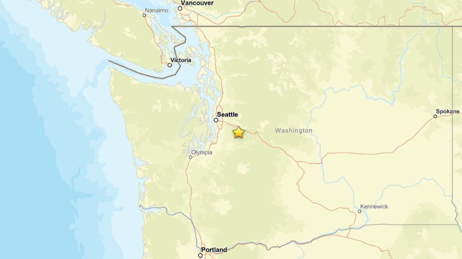
An additional Winter Weather Advisory will be in effect from Wednesday night to Thursday morning for the South Cascades as more than a foot and a half of snow could fall around Paradise and Crystal Mountain. Through Stevens and Snoqualmie passes, four to eight inches of snow could occur.
More on snow in a mountain pass: Drivers need to get the message about mountain pass driving
There are chances of rain throughout the rest of the week, no official wind alerts have been activated, as of this reporting.
February is the second-most common month for snow in Seattle, averaging 0.9 inches of snow, according to Best Places. For the year, Seattle averages 4.6 inches of snow, with almost half coming in December.
The latest recorded snowfall in Seattle was April 19, but that occurred 97 years ago.
Contributing: KIRO 7
Frank Sumrall is a content editor at MyNorthwest. You can read his stories here and you can email him here.