Light snow falls overnight across Seattle area as cold snap winds to a close
Feb 24, 2022, 6:47 AM | Updated: 12:29 pm
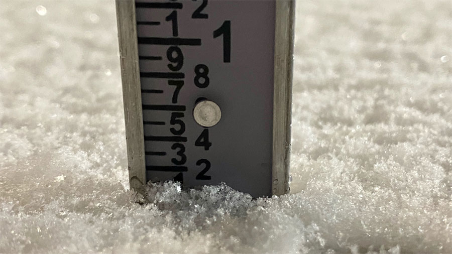
Snow measured at the National Weather Service's Seattle office. (NWS Seattle, Twitter)
(NWS Seattle, Twitter)
More snow fell across the greater Seattle area overnight between Wednesday and Thursday, with warmer weather on the horizon.
Check your local weather forecast
Pockets of light snow showers tapered off for most areas by the early morning with light accumulations. The NWS recorded a tenth of an inch of snow at its Seattle office along Sand Point Way just before 5 a.m. Between Port Angeles and Bellingham, accumulations ranged between 1 and 2 inches.
Not much to write home about snowfall wise, but we did record 0.1 inch here at the office. Stay safe on the roads this morning! #wawx pic.twitter.com/PDQfeJcTBB
— NWS Seattle (@NWSSeattle) February 24, 2022
The larger concern is that even without much snow sticking to the ground in Seattle, below-freezing temperatures will likely lead to slippery road conditions for morning commuters. As temperatures begin to warm into the low 40s by the afternoon, ice along roads and sidewalks will begin to melt.
On Friday, weather across the region will continue to get warmer, with a chance of rising into the low 50s. That said, “morning lows will still be on the cold side, generally in the upper 20s,” according to the latest forecast. The NWS is cautioning residents to make sure the “4 Ps are still taken care of: People, plants, pets, and pipes.”
Longer term, Seattle-area residents can expect a lengthy period of rainy weather spanning Saturday through next Tuesday.
This comes in the wake of record cold temperatures recorded across the Seattle area, after dipping to 23 degrees on Wednesday. That beat the previous record for Feb. 23 by one degree, while temperatures plummeted to 16 degrees in Tacoma, 15 degrees in Shelton, and 17 degrees in Olympia. In Sumas, it got as cold as 10 degrees.
Follow @http://twitter.com/Mynorthwest