No maps, no insurance: Michigan floods expose lack of information, preparation in many rural areas
Jun 22, 2026, 6:00 AM
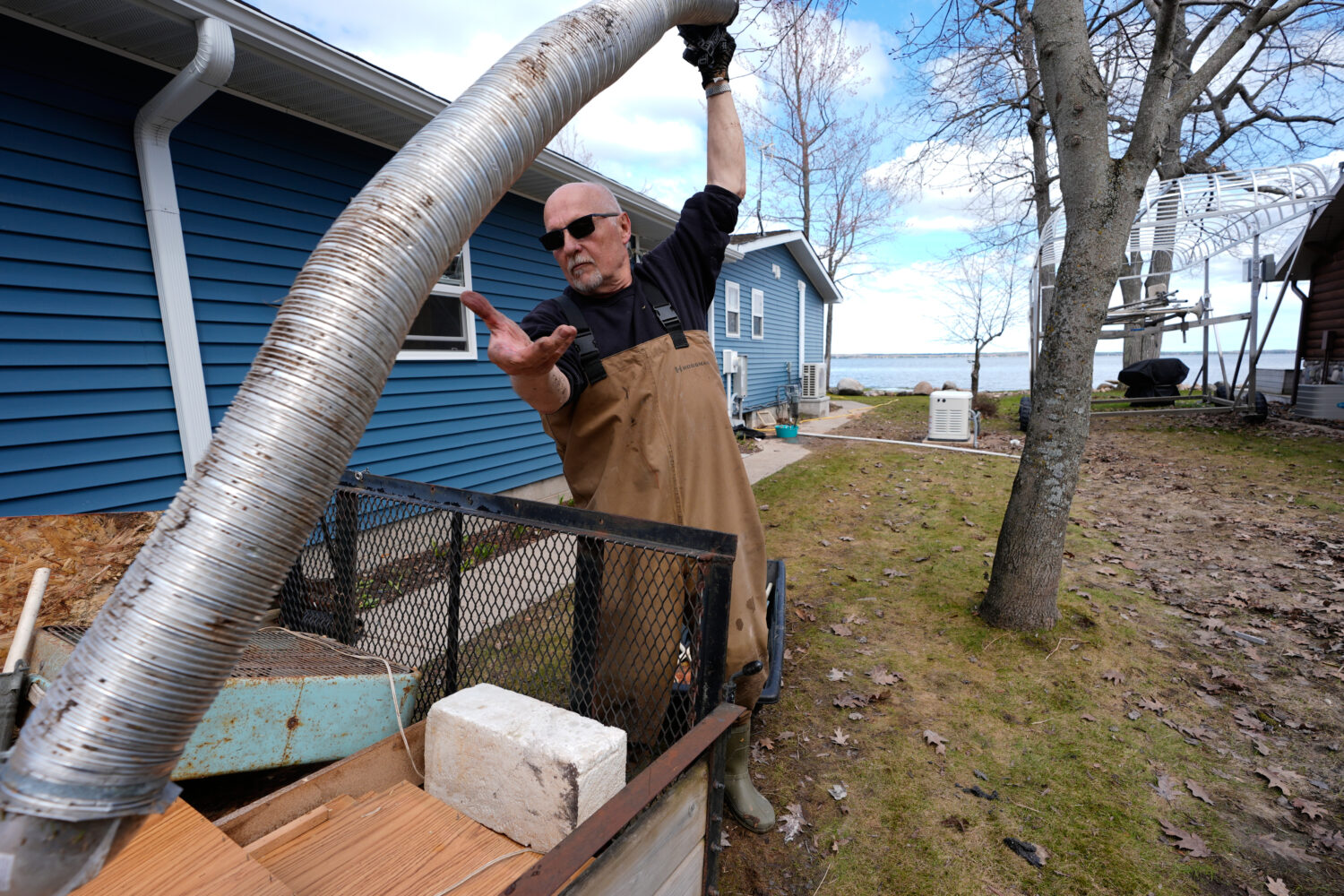
Tom Peterman cleans up outside his home from recent floods at Black Lake on Wednesday, April 29, 2026, in Grant Township, Mich. (AP Photo/Paul Sancya)
Credit: AP Photo/Paul Sancya
(AP Photo/Paul Sancya)

ONAWAY, Mich. (AP) — Tom and Diane Peterman tried to buy flood insurance when they moved to their retirement home on the shores of Black Lake 14 years ago but were told it wasn’t available. John Solum was told he wasn’t in a flood zone when his family bought a 1940s-era cabin there.
Then came this spring’s historic and devastating floods across northern Michigan — in some areas, for the first time anyone can remember — swamping homes, pushing dams to the brink of failure and washing out roadways. Dozens of counties were under a state of emergency.
Black Lake was so high that floating ice broke apart decks and crashed through windows.
“We’ve never seen anything like that. Never,” said Solum, who experienced flooding often when he lived in Houston. Knee-high floodwater forced them to tear out flooring, drywall, furniture, bedding and appliances.
Across Michigan, thousands were left without financial protection after record April rains fell on top of record March snowfall. Worse, many had no idea they were at risk despite years of increasingly heavy precipitation.
Their experience exposes vulnerabilities across the country, experts say, because flood plain maps don’t cover all areas. What’s more, the federal government’s mapping method is arguably outdated and does not account for actual risks as climate change increases the odds of more extreme weather.
The Federal Emergency Management Agency develops and updates maps that determine who’s in a flood plain and must buy insurance, and to help communities plan. But it hasn’t developed maps in many less-populated areas, including some Michigan counties that experienced unprecedented flooding.
Black Lake, for example, straddles two counties — Cheboygan, which has a 2012 FEMA flood plain map, and Presque Isle, where most areas have never been mapped. The longtime summer and retiree destination is ringed by small cabins and some larger homes.
Another issue: FEMA’s maps are based on risks of rivers, streams and other waterways overflowing their banks. But they don’t account for flooding caused strictly from increasingly heavy rainfall that overwhelms stormwater infrastructure in urban areas and inundates rural towns where there’s nowhere for the water to go.
First Street, a company that researches the financial implications of climate change, found more than twice the number of properties at significant flood risk nationwide after incorporating that rainfall data into its own models and by mapping the whole country, including smaller streams that FEMA does not.
That includes four times more properties in Michigan.
“I couldn’t believe it when we first started building our model how different we were from FEMA,” said Jeremy Porter, chief economist at First Street, who says federal maps are “missing a whole source of flooding.”
FEMA uses that extra rainfall data to help set insurance rates, experts said. But it’s unclear whether it’s proceeding with an effort to incorporate it into flood plain mapping.
The General Accounting Office, a federal watchdog agency, raised concerns five years ago that FEMA’s flood hazard maps didn’t reflect the best available climate science or heavy rainfall.
FEMA declined an interview request, but said in a statement that 95% of the U.S. population lives in areas with maps, which are “snapshots in time.” It did not respond to questions about whether this year’s flooding adds urgency to mapping less-populated areas or whether it’s updating its mapping methods.
Michigan experienced “truly a monumental flood” that in many areas exceeded what is known as a 100-year flood, meaning it has a 1% chance of occurring in any given year, said Matthew Occhipinti, the state’s National Flood Insurance Program coordinator.
But it wasn’t a fluke, experts said.
A warmer atmosphere holds more moisture for longer periods, which can lead to heavy rain or snow when enough builds up. And this spring, an “extraordinarily warm” Gulf of Mexico set the stage for both snow and rain in the upper Midwest, said Richard Rood, a University of Michigan climate scientist.
A massive March snowstorm dumped up to 2-4 feet (61-122 centimeters) across northern Michigan. Then April’s record rainfall created more runoff than waterways, dams and culverts could handle.
“We call these storms historic; that is only true compared to the past,” said Rood, adding that Michigan and neighboring Wisconsin experienced their wettest March 1-April 15 period on record. “I think it is more appropriate to consider it typical of the climate of the future.”
That’s why it’s important to update flood maps and for communities to be prepared, experts said.
“You should never be lulled into complacency that, ‘Oh geez we just had the big flood so we’re good for another 100 years or another 500 years,’” said Chad Berginnis, executive director of the Association of State Floodplain Managers. “Mother Nature does not obey statistical averages.”
FEMA has been working to update existing flood plain maps — some that were decades old — but has made little progress creating new ones in rural areas where development could occur, despite a 2012 congressional mandate, Berginnis said.
The agency has historically prioritized places with the greatest population and risk, which makes sense due to budget constraints, Berginnis said, but also leaves about two-thirds of the country’s streams, rivers and coastlines unmapped. Some of those areas are unpopulated federal land that likely won’t be mapped.
His organization estimates it would cost $4 billion to $12 billion to fully map the country, but FEMA has never had the funding to do so, he said.
Flood plain managers worry the agency could fall even further behind due to significant staffing losses under the Trump administration.
FEMA lost close to 20% of its total workforce in 2025, according to a General Accounting Office report. That includes about 25% of its permanent and most senior staff, said Christopher Currie, who audits FEMA for the GAO.
“We’re very concerned,” said Currie, adding that FEMA was chronically understaffed even before Trump’s second term. Now it would have to divert resources from many programs, including mapping, to respond to multiple disasters.
Getting accurate flood-risk information to communities is a challenge even beyond flood plain mapping.
Communities must participate in the National Flood Insurance Program before homeowners can buy policies underwritten by FEMA and sold by private companies. But many — including several hundred in Michigan, Occhipinti said — have never joined.
Communities can participate without a map. But experts say those that haven’t might never have experienced damaging floods or don’t understand the insurance program.
They also might not realize they have an elevated risk if they rely on FEMA’s National Risk Index, a separate tool from mapping. The index gives one score for a community’s overall risk of any type of natural disaster, and assumes there are no flood risks if the community doesn’t have a flood plain map, said Berginnis.
That means a community with a low score might actually have elevated flood risks, he said, which “gives people the absolute wrong sense of security.”
But even program participation doesn’t guarantee homeowners get accurate information.
Diane Peterman, who evacuated as her crawlspace filled with floodwater, said she tried buying insurance three times but was told she couldn’t, even though her township participates in the National Flood Insurance Program.
“They said, ‘You’re not in a flood zone’ and I said, ‘But I live on a lake,’” said Peterman, who later learned that her neighbor had insurance.
In Michigan, an average policy costs about $1,000 for $250,000 in coverage, though that rate can vary widely based on factors such as home value and location, Occhipinti said. Some companies will sell private flood insurance, though it’s rare, he said.
Berginnis said homeowners and communities should seek information beyond what FEMA provides.
“FEMA flood maps should always be the beginning of the journey and not the end,” he said. “Maybe states and communities need to step up and lead a little bit more.”
___
The Associated Press’ climate and environmental coverage receives financial support from multiple private foundations. AP is solely responsible for all content. Find AP’s standards for working with philanthropies, a list of supporters and funded coverage areas at AP.org.