First strong winds, now chance of snow in forecast
Dec 17, 2012, 5:24 AM | Updated: 4:51 pm

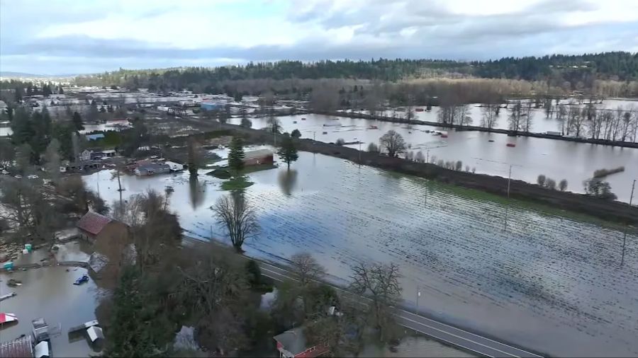
A powerful winter storm knocked out power to thousands of Puget Sound area residents. (Image courtesy Puget Sound Energy)
(Image courtesy Puget Sound Energy)
Forecasters say snow is possible across Western Washington behind a powerful winter storm that blasted the region Monday with strong winds and rain in some places and heavy snowfall and whiteout conditions in others.
KING 5 Meteorologist Jeff Renner says cold air moving in could drop the snow level to near sea level across Western Washington Tuesday during the day, with a possible rain and snow mix or snow showers. And he says we could get a Puget Sound convergence zone forming that could cause accumulations north of Seattle.
Renner says another 4-to-8 inches of snow could fall by Tuesday night along the west slopes of the Cascades and in the Olympics.
Wind gusts early Monday hit 60 mph on the coast and 55 mph in the south Puget Sound area, the National Weather Service reported.
High winds early Monday knocked out power for about 17,000 Puget Sound Energy customers in south King County and Thurston County.
Spokeswoman Julia Hughes says there were 60 outages in the area including Auburn, Federal Way and Olympia.
The Bellevue-based utility has dispatched 100 crews and hopes to have most customers back on line by late Monday, depending on the extent of the damage.
Seattle City Light reports virtually all of the 11,000 customers without power were back on line by late Monday afternoon.
High tides and heavy winds pushed Puget Sound into the parking lot of the Whaler’s Village condos in Des Moines this morning.
More than 100 cars were in the parking lot when the water flowed over the wall, swamping them. Homeowners were able to move all but two of the cars. The water did not get into the units.
A mudslide derailed a Burlington Northern Santa Fe freight train just south of Everett and forced the cancellation of Sound Transit and Amtrak passenger rail service.
BNSF spokesman Gus Melonas says the slide came off a 100-foot slope and struck the train at about 1:30 p.m. Monday, in the same area where a slide covered the tracks earlier in the day. Seven cars were derailed. They were carrying various types of freight, including small packages of disinfectant and chemicals used in cleaning supplies and fertilizer.
Melonas says a hazardous materials team did respond, but there is no threat to the environment or public health.
The tracks are expected to remain closed for freight trains at least until Tuesday, and Amtrak and Sound Transit Sounder passenger trains must observe a 48-hour safety moratorium before then can resume travel.
At least two schools were impacted by the weather. Power outages closed one elementary school in the Olympia School District, and classes started late for some schools in Tukwila.
View all school closures and alerts.
Some ferry crossings were also canceled.
Check latest Washington State Ferry alerts.
Accumulations from the storm that started Sunday are likely to total 2 to 3 feet by Tuesday morning in the mountains.
Check the mountain pass cameras
Because of the dangerous conditions, the Weather Service recommends no travel in the Cascades unless absolutely necessary. It says motorists who do need to travel should pack winter survival kits with flashlights, food, water and blankets.
Many people throughout Western Washington have received blizzard warnings on their cell phones and computers.
The National Weather Service told KING 5 the warnings are only for those that live or are traveling in the mountains.
The cell phone providers that sent out those messages are reportedly still trying to fine tune who gets the alerts and tailor them to the specific warning areas.
The Associated Press contributed to this report.