New network aims to give early warning of flooding in Snoqualmie Valley
Oct 22, 2020, 5:41 AM
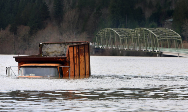
Snoqualmie River flooding in 2015. (Genna Martin/seattlepi.com via AP)
(Genna Martin/seattlepi.com via AP)
The year 2020 may be full of disasters, but a Snoqualmie Valley group is making sure flooding won’t be one of them — or at least that it won’t catch residents off-guard.
Just ahead of flood season, the nonprofit Snoqualmie Valley Preservation Alliance launched the new Floodzilla Gage Network to give residents a heads-up when a flood is headed toward their property so they can prepare.
The system includes 10 new flood gauges throughout the Snoqualmie Valley, from North Bend to Monroe. These gauges are meant to fill in the gaps with USGS gauges, so homeowners and farmers can be notified quickly when a flood is coming and receive more detailed information about how high the water will get at their home.
Cynthia Krass, director of the SVPA, said it can be very difficult to predict how much water a particular piece of property will get during an episode of flooding because the speed of the river has a very wide range across the valley.
Landslides, flooding persist across Puget Sound region
“You could be several miles downstream of a USGS gauge and you don’t know if the peak of the flood has passed you or not — for example, you don’t know if the water is going to continue to rise for six more hours, or if the water is as high as it’s going to get and start to recede — because there just aren’t enough gauges to cover this large, flat valley,” Krass said.
The information is connected to the Floodzilla website so residents can check out a map of water levels in real time.
“It all is integrated into one easy-to-use interface so that people can figure out what is happening while floods are unfolding — whether they’re worse or whether they’re better, whether the road has gone under or whether it hasn’t gone under,” Krass said. “It’s very, very detailed information about the level of flooding while it’s happening.”
The map includes data from both Floodzilla and USGS gauges so that as much territory as possible is covered.
Krass said the Floodzilla gauges are strategically placed in spots that tend to be predictors of what is to come. She used the example of a gauge in a Carnation field near a group of farms.
“There are about half a dozen farmers downstream, and they know that when the water comes over the river, jumps its banks, and spills into this farm field, they are between three and six hours before they will have the same thing happen to them,” she said. “They can’t get that information just from the USGS gauges, so we’ve supplemented that system.”
The gauges can also help people plan their commute home so they don’t end up getting stuck in standing water.
“On West Snoqualmie River Road, there’s one spot that becomes impassable before the entire road goes under, and it’s the last spot that tells you whether or not you can get through on your commute home, for example,” Krass said. “So we have a gauge at that particular spot on the road, and it measures the water level as it’s coming up, and tells you approximately how long until that road will be impassable.”
Krass said they hope to expand the system to more hotspots this season and in the coming years, such as the spot where the Snoqualmie and Skykomish Rivers join to become the Snohomish River.
Floodzilla is funded by donors, as well as the King County Flood Control District.
The Snoqualmie Valley’s tendency to flood is not always a curse — for farmers, floodplains are some of the most fertile, lush places to grow crops. The SVPA’s mission is to preserve that farmland and help local farmers protect their farms from flood damage.
“We want to support our farmers so we can have local farming, so this is one of the ways we support farmers so we can have a viable, sustainable agricultural economy in King County,” Krass said.