‘Unusually strong storm’ off Pacific Northwest coast, wind warnings in effect Sunday
Oct 20, 2021, 9:59 AM | Updated: Oct 24, 2021, 4:39 pm
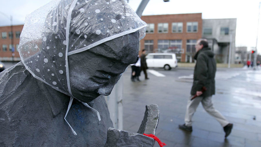
A pedestrian walks past a statue with a rain bonnet on its head in the Fremont neighborhood of Seattle, Washington. (Photo by Robert Sumner/Getty Images)
(Photo by Robert Sumner/Getty Images)
The weekend ahead is expected to be wet and windy as an offshore storm is approaching the Pacific Northwest coast. Meteorologists are warning of strong wind gusts and heavy rain into the weekend, mostly Sunday into Monday.
Everyone has likely heard a lot about how the storm offshore is expected to become unusually strong. Here's a great thread from our friends at @NWSWPC which helps to tie together what makes this storm so noteworthy. #wawx https://t.co/a9CZzdqpnl
— NWS Seattle (@NWSSeattle) October 24, 2021
First labeled a “bomb cyclone” by some meteorologists, the storm downed trees and power lines Thursday.
Even though we’re not predicting a “major" windstorm for Western Washington at this time, a prolonged period of wind gusts that could hit or exceed 40mph will “prune” leaves, twigs, branches. Early season storms have outsized impacts, like blocked roads, power outages. #wawx https://t.co/EcgMTYkOtk
— Morgan Palmer (@MorganKIRO7) October 22, 2021
Puget Sound Energy outage map
Seattle City Light
Snohomish County PUD
Tacoma Power
Brent Bower with the National Weather Service (NWS) said the brunt of the storm may miss the Seattle area entirely.
“The storm system off the coast is going to stay off the coast. It’s not going to come into our area, or the Seattle area,” Bower told KIRO Radio.
“The timing will be starting Sunday and lasting through Monday, so we could have some significant wind. Certainly not going to be the biggest thing we’ve ever had,” he added.
The coastal areas are expected to get hit the hardest by the storm, he says, but it will still likely be rainy across Western Washington this weekend.
“In case you were not aware, it is still raining, and more rain is coming,” the NWS said late Thursday.
Like Bower noted, those rainy and windy conditions are expected to persist through the weekend across the region. Saturday was expected to see “the weakest in the series of systems we have been having,” according to the NWS.
“More widespread rain is expected with some breezy winds immediately by the waters,” the NWS’s weekend forecast reads. “But other than that not much in the way of impacts from this system. A much stronger system will be making its approach late Saturday night.”
For Sunday, the region could see the strongest run of weather in recent weeks, possibly bringing “multiple weather hazards,” including wind, rain, and possible thunderstorms.
If tomorrow wasn't busy enough weather-wise, #thunderstorms are possible Sunday afternoon & evening, but looks to be confined to Coast & SW Interior. Damaging winds, hail & #waterspouts (tornadoes over water) possible in dark green area over SW Grays Harbor county. #wawx pic.twitter.com/FuN63pfBz4
— NWS Seattle (@NWSSeattle) October 24, 2021
Region’s year of record-breaking weather continues with coldest early-October day in 125 years
A high wind warning has been issued for portions of the Coast and Northern Interior, set to begin Sunday morning, while a wind advisory has been issued for some locations in the Puget Sound and Cascade foothills. That could extend into Monday, possibly through Monday night.
With the gusty conditions expected for much of the region the next 2 days, now is the time to prepare! Secure loose objects, prepare for power outages, & make sure to stay clear of trees & downed power lines! #wawx pic.twitter.com/XMwmUBSk55
— NWS Seattle (@NWSSeattle) October 23, 2021
Temperatures were record warm on Thursday. At the National Weather Service in Seattle (at Sandpoint), the record high for today was tied at 69 degrees, a 2005 record. Bellingham also got up to 69 degrees, breaking a record of 68 degrees set in 1965. However, the NWS reports that the temperature at Sea-Tac fell from 68 to 59 degrees in one hour as easterly winds stopped.
Follow @http://twitter.com/Mynorthwest