Prepare for a ‘parade of frontal systems’ in Washington
Jan 23, 2018, 8:33 AM | Updated: 10:31 pm
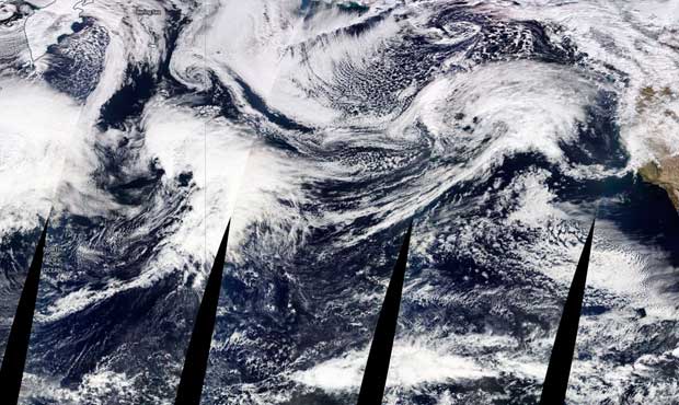
This composite image shows a series of weather systems heading for the West Coast. (National Weather Service)
(National Weather Service)
Several weather systems are en route to the West Coast in what the National Weather Service is calling a “parade of frontal systems.”
Meteorologist Dustin Guy says a strong system is approaching the Puget Sound region, which will result in heavy rain in the lowlands and snow in the mountains.
A Flood Watch is in effect for portions of Northwest Washington, including Mason County.
A Winter Storm Warning for the Cascades is in effect until 6 a.m. Wednesday about 2,000 feet.
A Wind Advisory for the north interior and San Juan Islands is in effect until 6 p.m. Tuesday. Sustained winds of up to 35 mph and gusts up to 45 mph are possible.
KIRO 7 Meteorologist Nick Allard says we will get a short break on Wednesday with a few showers. The next system is expected to move in Thursday, with rain continuing through the weekend.
OK, resting heart rate almost back to normal. Here’s a look at Pacific over the last day. At right is system impacting us over the next 36 hours with heavy snow in the Cascades. Near center of image, developing system w/ possible warmer & very wet conditions this weekend. #wawx pic.twitter.com/iuWXBhXkD9
— NWS Seattle (@NWSSeattle) January 23, 2018
Follow @http://twitter.com/Mynorthwest