The beauty of Seattle weather emerges from the cloudy skies
Dec 6, 2022, 3:17 PM
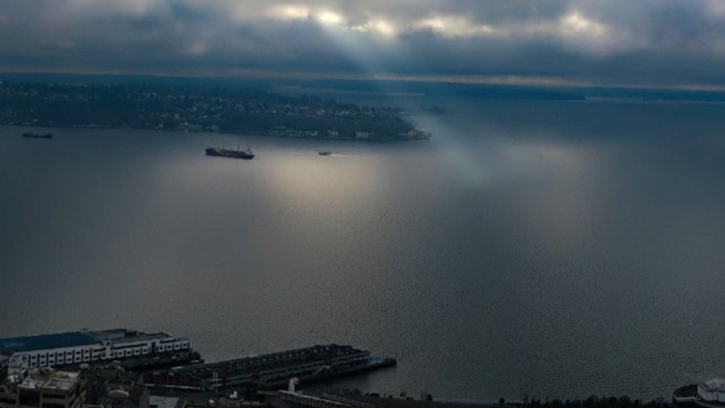
A lone ray of light shines on Elliot Bay just north of West Seattle. View courtesy of the Space Needle webcam. (Photo courtesy of NWS Seattle)
(Photo courtesy of NWS Seattle)
More than anything, we’re using this weather story as an excuse to use a really cool picture above Elliot Bay.
A lone ray of light on Elliott Bay just north of West Seattle. View courtesy of the Space Needle webcam.#wawx pic.twitter.com/KDbAaAvVlv
— NWS Seattle (@NWSSeattle) December 6, 2022
We’re finally getting a break from all this wintry weather, even though winter itself is a couple of weeks away.
The National Weather Service in Seattle tweets: ‘How cold was it the last week? Using the current high of 41° and low of 34° for Seattle today this is the coldest November 29th thru December 5th in 78 years of records for Seattle. The average temp. for the week of 35.1° just beat out the previous coldest, 1985 with 35.2°.”
midday satellite imagery for the Pacific Northwest pic.twitter.com/CbeZ8bib3e
— NWS Seattle (@NWSSeattle) December 6, 2022
This afternoon and evening, it will be mostly cloudy and dry.
KIRO 7 meteorologist Frankie Kittafias reports, “Looking ahead on Tuesday and Wednesday, some patchy lowland rain looks favorable as slightly warmer air, weak transitory upper ridging, and weak low-level warm front move through the area.”
In the mountains, there could be more snow coming. Several inches may fall across the passes.
According to WeatherUnderground there is only a 15% chance of participation tomorrow. A high of 44 degrees.
KIRO 7 contributed to this story.