
Days of rain could bring flooding as atmospheric river targets western WA
Dec 4, 2025, 5:00 AM | Updated: 2:55 pm

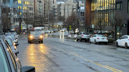
Some commuters carry umbrellas as they wait for buses in Rainier Square on 4th Avenue during evening rush hour. (Photo: Robert Sumner, Getty Images)
(Photo: Robert Sumner, Getty Images)
A significant change in the relatively cool, quiet start to December weather is expected to get underway Thursday through the weekend.
Higher pressure aloft just off the coast has been steering Pacific weather systems primarily into British Columbia and Southeast Alaska so far this week. That higher pressure aloft is anticipated to sag south, permitting a parade of weather systems to march through western Washington.
Mild wet conditions into this weekend
The first is forecast to arrive Thursday with rain spreading onshore and inland through the day. The next system follows on Friday into Saturday morning. Another tracks onshore Sunday. Rain amounts during this time period range from 1/2 inch to 1 1/2 inches of rain for the lowlands, while the mountains get 2 to 4 inches of rain.
These weather systems will bring milder air. Snow levels are expected to rise into the range of 4,500 to 6,000 feet. The Washington State Department of Transportation has reported it plans to close the North Cascades Highway for the season at 6 p.m. Thursday, thanks to rising avalanche conditions from this change to the weather pattern.
In the western Washington lowlands, high temperatures will rise into the lower to mid-50s, about 5 degrees warmer than usual for early December.
More rain early next week
But wait — there’s more! Monday and Tuesday will see more rain, this time with an atmospheric river juiced with some subtropical moisture. Lowland rain amounts should range from 1 to 3 inches, while the mountains are anticipated to get 3 to 6 inches of rain. Snow levels will remain elevated, in the 5,000 to 6,000 foot range – not good news for snow enthusiasts.
Impacts
Given how area rivers are running lower than usual, there is room for the rain runoff. Yet over time, the rivers will respond and rise ever closer to bank full early next week.
Depending on rain amounts, a few rivers could exceed flood stage, such as the Skykomish, Snoqualmie, Skagit, Stillaguamish, and Skokomish rivers. This situation bears watching heading into next week.
Despite ongoing drought conditions across western Wafshington, this surge of rainfall could lead to saturated soil conditions and a rising threat of landslides — also another issue to monitor.
King Tide period
December 5 through 9 is a King Tide period with tides rising above 12.5 feet. For the Seattle area, tidal overflow coastal flooding usually starts at around 13.5 feet.
With these passing Pacific weather systems, associated lower atmospheric pressure and winds in the 15 to 25 mph range at times, means the actual high tides may rise another foot or so, resulting in another concern to watch.
Stronger winds of 20 to 30 mph at times in the North Sound from about Whidbey Island northward can exacerbate high tide conditions as well.
RELATED STORIES

Weather outlook for December
If longer-range weather guidance is on track, this period of mild wet weather will give way to much cooler weather starting around Thursday, December 11, and extend into the weekend. As a cool area of lower pressure sets up off the coast during this time period, snow levels should fall below the passes, permitting some accumulating snow in the mountains. High temperatures in the lowlands of western Washington should fall into the 40s with lows down into the 30s.
Yet, this period of cooler weather may be short-lived.
La Niña, the global weather pattern when sea surface temperatures in the tropical waters well west of Peru are cooler than average, remains in play. La Niña conditions usually result in a cooler and wetter than average winter season in the Pacific Northwest.
It is not unusual for La Niña weather impacts to develop until at least the holidays. Those impacts include more significant snows in the mountains and a greater threat of at least one lowland snow event.
Until then, skiers, snow enthusiasts, and water managers continue to wait for mountain snows to pile up.
Ted Buehner is the KIRO Newsradio meteorologist. Follow him on X and Bluesky. Read more of his stories here.













