
‘One-two punch’: Second wave of atmospheric river to dump up to 15 inches on Cascades
Dec 9, 2025, 1:48 PM | Updated: 4:13 pm

A mural painted on a wall is seen through rain drops. (Photo: Christopher Furlong, Getty Images)
(Photo: Christopher Furlong, Getty Images)
A massive atmospheric river that hit the Puget Sound region on Monday shifted further south on Tuesday but is heading back.
Kirby Cook, a meteorologist with the National Weather Service in Seattle, explained that this time, it could dump eight to 15 inches of rain in the central Cascades.
“One of the unique things about this storm system is that it’s kind of like a one-two punch,” Cook said. “It’s sort of like two waves coming down the rivers from the mountains. It’s that second crest that’s going to be on top of whatever water was there before.”
RELATED STORIES

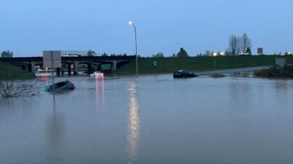

Several WA rivers flood after initial rainstorm hits
This comes on top of the storm’s initial hit, which pushed 24 Washington rivers over their banks.
“This round of precipitation is actually looking wetter than previously forecast, so it’s going to be at least, if not wetter than what we saw yesterday,” Cook said. “The Seattle metro area northward, then Whidbey Island and Everett, we’re looking at anywhere from half an inch to an inch, that’s typically not the biggest concern, it’s how much rain is falling in the mountains.”
Cook believed that this would affect every river coming off the mountains, but would likely have the biggest impact in Snohomish and King Counties.
“We’re looking at rain amounts in the mountains of anywhere from eight inches to as much as 10 to 15 inches of rain in some places in the central Cascades through Thursday morning,” Cook said. “More or less all of the rivers running off the Cascades, so Lewis, Pierce, King, Snohomish, Skagit, and Whatcom County.”
Read more of Heather Bosch’s stories here.












