Atmospheric river returns to Western Washington, bringing heavy rains
Dec 4, 2023, 7:12 AM | Updated: 7:13 am

(Photo from KIRO 7)
(Photo from KIRO 7)
What a change from the dry, cool, frosty, foggy, and sunny weather in the latter part of November! The calendar turned to December Friday and so did a big change to the weather.
Over the weekend, a series of Pacific weather systems resumed fall season rainfall and snow in the mountains. Snow totals in the Cascades ranged from one to three feet.
More from Ted Buehner: Snow on the way to Washington mountains
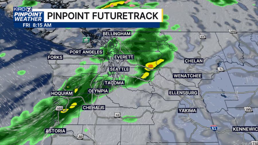
And now an atmospheric river will impact Western Washington through Tuesday, bringing more rain with mountain snow levels climbing well above the highway passes and rain falling into that fresh snow. An atmospheric river is a plume of warm, moist sub-tropical moisture that can produce copious amounts of precipitation in just a few days. High temperatures during the first half of this week will feel mild, well into the 50s.
Precipitation amounts anticipated to fall in the mountains through Tuesday ranges from 5 to 10 inches. Along the coast, 2 to 4 inches of rain is expected, while the western interior will range from a half inch falling in the Olympic Mountains rain shadow to 3 and a half inches.
Of note – all that fresh mountain snow will not melt. In fact, the snow will act as a sponge and soak up much of the rain. Yet, lower-elevation snow will tend to melt off and contribute to runoff in area rivers. The remaining rain-soaked heavier snow on steeper slopes will generate elevated avalanche conditions. Washington State Department of Transportation (WSDOT) mountain road crews may need to conduct avalanche control, temporarily closing highways to clear the snow.
Heavy rainfall is the main culprit to rising rivers and that will be the case during this event. Fortunately, the dry latter part of November resulted in rivers running at lower levels, leaving room to handle this period of heavy rainfall and runoff. Yet, a number of rivers are expected to jump above flood stage and create floodwater inundation through Wednesday. These rivers will likely include the Skagit, Snoqualmie, Tolt, Skykomish, Snohomish, Skokomish, Newaukum, and the lower reaches of the Chehalis. Monitor National Weather Service Seattle for the latest river flood information.
In addition, periods of heavy rainfall could produce some local urban flooding and ponding of water on roadways, creating slick and hazardous driving conditions.
Relief from the heavy rainfall and high river levels is expected later this week. The weather pattern is anticipated to shift and bring cooler air from the northeast Pacific, turning the weather to more showery conditions and dropping mountain snow levels back down to the passes. High temperatures in the lowlands of western Washington will cool back into the 40s, with lows dropping into the 30s.
Despite the soggy start to November, rainfall totals for much of western Washington were once again below average for the month. SeaTac Airport finished the month with just over four and three-quarters of an inch of rain, about 1 inch below average. Olympia and Bellingham were also both about one to two inches below average. The cool latter part of the month also resulted in average monthly temperatures being about one or two degrees below normal.
This month is starting off much like November did, with plenty of rainfall. The outlook for the middle part of the month reflects cooler-than-average temperatures with near-normal rainfall. Then, the latter part of the month offers warmer-than-average temperatures with near-normal rainfall, meaning the odds of a white Christmas look dismal. Sorry kids
Follow Ted Buehner, the KIRO FM news meteorologist, on Twitter