Destination HISTORY: Centuries of stories along Baker Lake Trail
Aug 8, 2022, 9:34 AM | Updated: 12:20 pm

Mount Baker is visible from Baker Lake Road, not far from Koma Kulshan Guard Station, on the way to the Baker Lake Trail. (Feliks Banel/KIRO Newsradio)
(Feliks Banel/KIRO Newsradio)


In an earlier era, hydroelectric dams were often seen as a win-win: producing electricity without burning fossil fuel, and creating reservoirs where the growing local population could boat and fish – plus they also made adjacent lands attractive for picnicking, camping and for hiking. One of the best examples within a short drive from the Seattle area is Baker Lake, and the Baker Lake Trail.
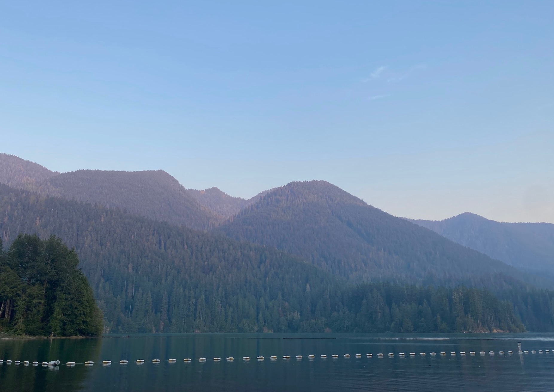
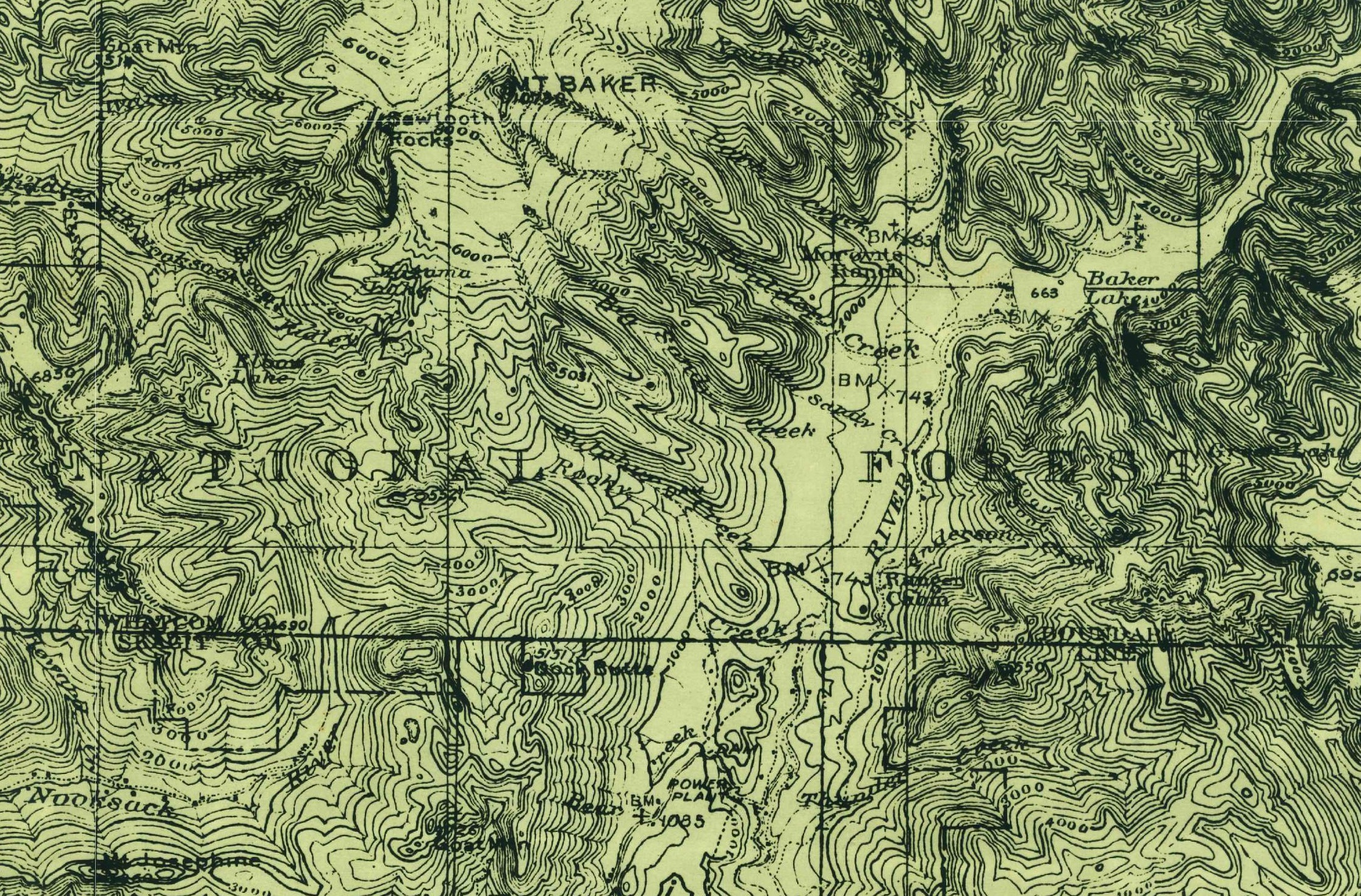
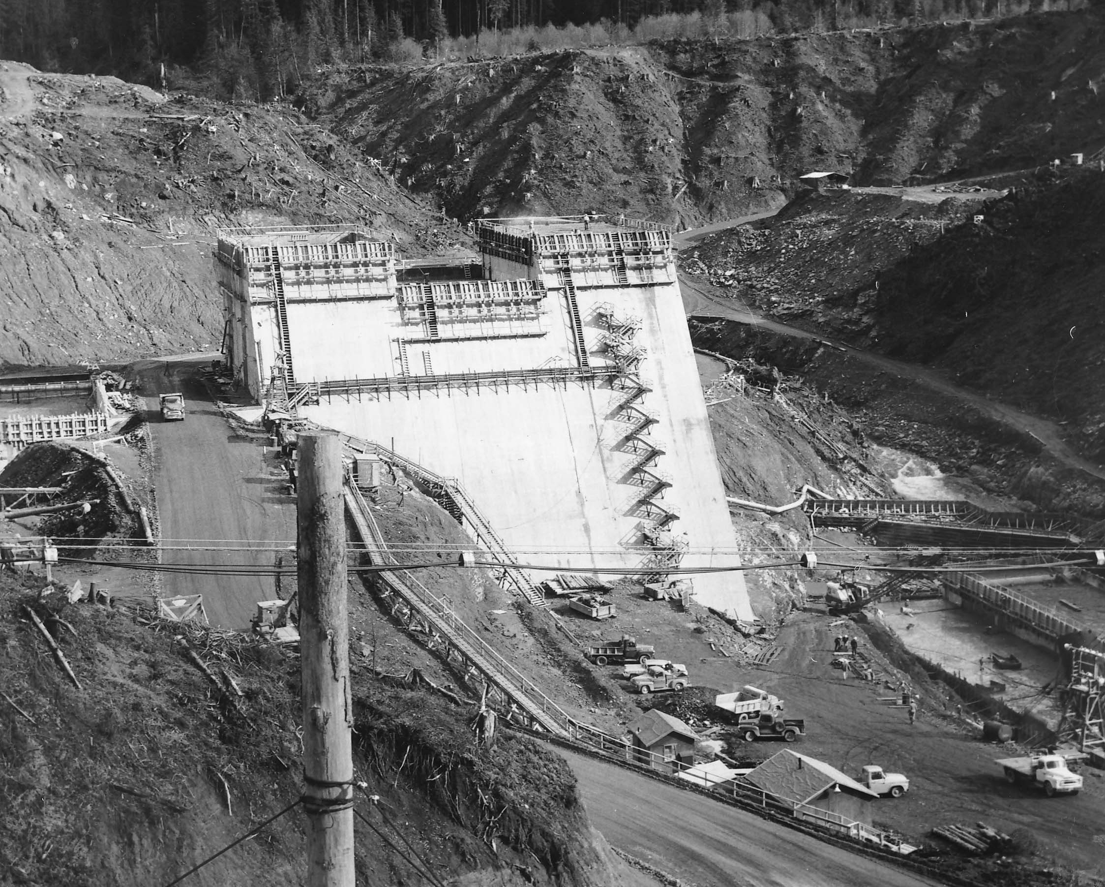
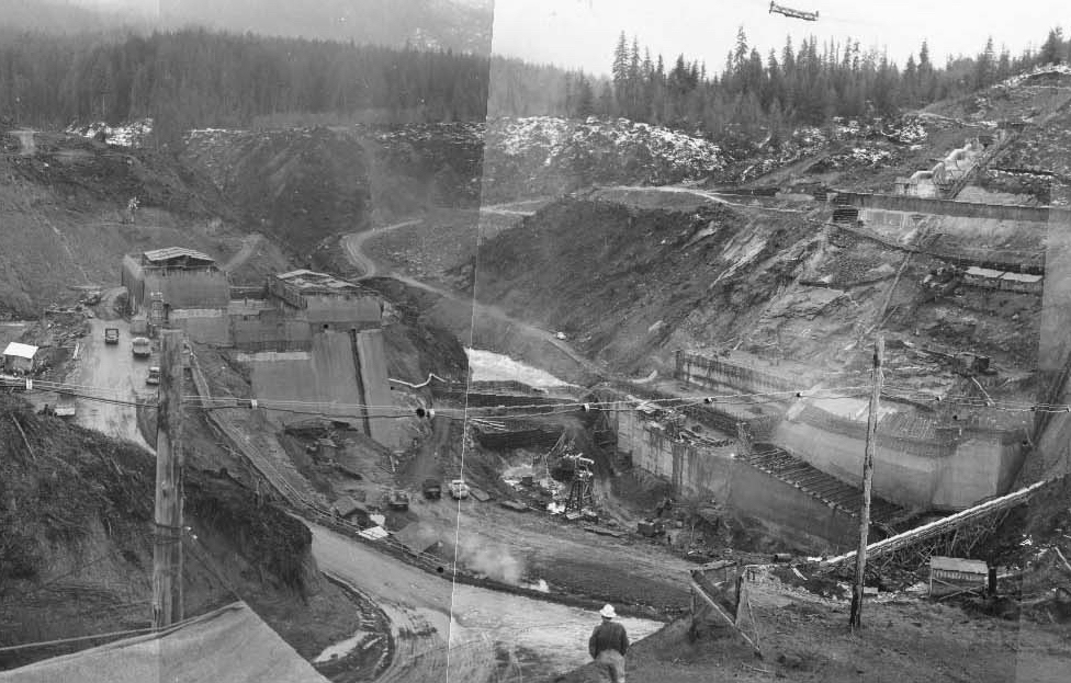
The Upper Baker Dam, located in Whatcom County and within the Mount Baker-Snoqualmie National Forest, is from that earlier era. The dam was built by what’s now Puget Sound Energy (PSE) in the late 1950s on the Baker River southeast of the eponymous Cascade volcano. Though there was a body of water called Baker Lake some miles upriver from the dam, once construction was completed in 1959, a much bigger lake, roughly nine miles long, was created – in what had been known as Angle Trout Canyon – by sometime in early 1960.
U.S. Forest Service campgrounds and picnic areas line the west side of Baker Lake and are easily accessible by vehicle from the Baker Lake Road, with lakeside campsites often booked up for the summer months well in advance, particularly on weekends.
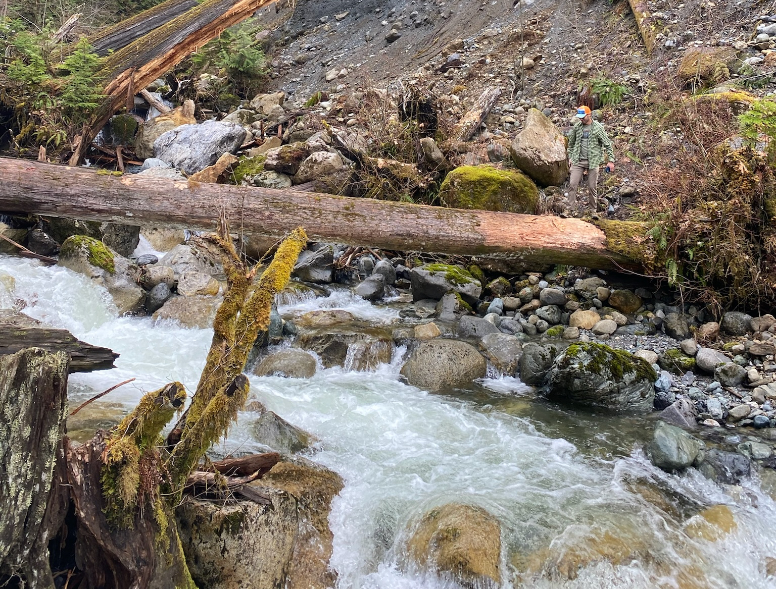
The Baker Lake Trail is also accessible by vehicle, from a trailhead along a U.S. Forest Service road – NF-1106, which becomes NF-1107 – that goes east/northeast from the east side of the Upper Baker Dam, which also functions as a bridge and which accommodates most vehicles. A Northwest Forest Pass is required to park at the trailhead. Total length of the Baker Lake Trail from end-to-end is 14 miles, with a trailhead at the north end of the lake as well.
From the trailhead near the dam, the Baker Lake Trail heads mostly north, through dense woods with the occasional sun-dappled meadow, and eventually reaches the shore, or near the shore, of the lake. Several spots along the trail offer spectacular views of the water, glimpsed through the tall firs, and then – if skies are clear – postcard-perfect views of Mount Baker. Steam is often visible emitting from the crater of the long-dormant volcano, which last teased serious activity in 1975.
“Generally, when you see it venting, it’s going to be on an exceptionally clear day in in the winter or other otherwise cooler weather,” said Richard Chrappa, information assistant for the Mount Baker Ranger District and Mount Baker-Snoqualmie National Forest. “It’s steaming all the time, but you don’t see it until it’s condensing in the cold air.”
Chrappa also says some of the older trees along the trail may have been witness to an earlier volcanic event, and still bear evidence.
“It’s my understanding that some of the burn marks that you see on the big trees on that trail happened from a fire that occurred at a time when Mount Baker was active and blew up and set the forest on fire,” Chrappa said. That eruption and fire are believed to have taken place in 1843, according to Chrappa.
Along the way, the trail dips down to lake level for crossings at places like the tumbling waters of Anderson Creek. A mixture of rough-hewn bridges, along with the occasional wide log, are easily negotiated by most hikers.
For backpackers, campsites are available at multiple places, including Anderson Point and Maple Grove. Maple Grove is also a popular stop for boaters, and the drone of outboard motors or whine of personal watercraft can, on weekend afternoons in summer, be a near constant companion.
Elevation gain on the trail is minimal and the scenery begins almost immediately, so it’s ideally suited for short hikes in and out of the woods, or for those who want to backpack in and camp overnight. At 14 miles in length, the full trail is certainly do-able as a day hike, as long as a second vehicle can first be dropped off at the opposite end.
As far as the history of the Baker Lake Trail, the current route likely only dates to sometime in the 1960s, after the Upper Baker Dam was completed and the current lakeshore was established.
However, the area that was inundated to create the expanded Baker Lake has a long history stretching back millennia. The land is traditional home of the Upper Skagit Tribe, which archaeological research has revealed some evidence of, but the details of which remain unpublicized to reduce the risk of sites being disturbed.
Campgrounds, a private resort, a ranger station and fish hatchery were among the facilities on the valley floor where lake water now stands. Most of the structures, other than perhaps concrete foundations, were removed prior to completion of the dam and flooding of the valley.
One of the earliest non-Indigenous inhabitants of the area was a prospector and miner named Joe Morovits, who arrived in 1891 and who lived on a ranch on what’s now the lake floor. It was not long after that when the Washington Forest Reserve was created, a precursor to the Washington National Forest – which was renamed the Mount Baker National Forest in 1926.
“The main thing, really, that Baker Lake inundated was the cultural heritage of the ancestral people who live there, the Skagit’s ancestors,” said Elizabeth Dubreuil, a consulting cultural resource scientist for Puget Sound Energy. “We have 10,000-year-old archaeological sites in the Upper Baker area. There is a long, long history of people living there.”
In the early 20th century, one of the predecessors of PSE – a Boston firm called Stone & Webster who had purchased local utilities and trolley companies in the Seattle area – identified the Baker River as a potential site for a hydroelectric project as early as 1912. The Lower Baker Dam, on private land south of the National Forest, was built by Stone & Webster on the Baker River in the 1920s and created Lake Shannon.
“In our archives, we have reports on them looking at that site early on,” said Dubreuil. “Basically, what they were looking for is very narrow canyons where they didn’t have to build infrastructure [in order to create a reservoir], really narrow passage areas where they could very easily contain the water behind.”
“Those are traditional fishing areas for the Upper Skagit peoples and their ancestors, because those would have been pinch points for salmon to come up the rivers,” Dubreuil continued. “So those places were great for hydro and they were great for fishing.”
Presence of the two PSE dams on the Baker River created obstacles for returning salmon, which is something the company has been addressing for decades through various methods – including changes to dam construction and even tanker trucks to shuttle salmon around dams – to foster improved fish passage.
For more about the history of the area, Dubreuil recommends a visit to the Baker Visitor Center, located in the storied town of Concrete, and which just reopened after a renovation project.
“We just restored a 1914 concrete building, which was part of the Washington Portland Cement Company,” Dubreuil said. “There are a lot of informative panels about the ancestral people who lived there, our partnership with the tribes for our fisheries programs and other resources, as well as all the history of the Lower Baker Dam, of the Upper Baker Dam and of the cement industry itself.”
Destination HISTORY Travel Tip
The Baker Lake Road heads north from Highway 20 – the North Cascades Highway – just west of the community of Birdsview. For those interested in a slightly more adventurous route, keep going east on Highway 20 to the town of Concrete, where the old route to Baker Lake – Burpee Hill Road – heads up into the hills on the west edge of town. This road is curvy and bumpy, and feels like something out of the distant past. It connects with the more modern Baker Lake Road at Lake Tyee.
You can hear Feliks every Wednesday and Friday morning on Seattle’s Morning News with Dave Ross and Colleen O’Brien, read more from him here, and subscribe to The Resident Historian Podcast here. If you have a story idea or questions, please email Feliks here.