Whiplash weather turns cooler and drier this week
Nov 8, 2022, 8:25 AM

Photo from the National Weather Service
Feel like the weather of late has been whipping you around like the winds did Friday night? You are not alone. Fall arrived with a vengeance starting Oct. 21 and has offered not only refreshing rain to cleanse our air from wildfire smoke but also snow in the mountains making for treacherous driving at times, heavy rainfall for the season’s first flooding sequence, and of course, the strong winds which have knocked out power and trees.
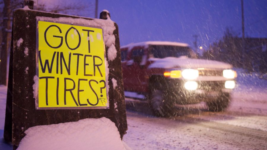
And now this week will be far cooler than average for the first half of November, with highs only in the 40s across much of western Washington and lows ranging from the mid-20s to 30s. The average highs are in the mid-50s, and lows are in the lower 40s.
Some northern WA schools delayed due to weather
After some additional showers Monday, the next chapter in this fall’s weather will involve dry weather the rest of the week as higher pressure builds over the region. For those concerned about snow falling in the lowlands of Western Washington today, the snow level will be around 1500 feet meaning a few more inches of snow along the Cascade highways, but local lowland showers could result in a burst of snowflakes with no accumulation.
It was just a few weeks ago when we were in the 80s, now a distant memory. Since then, Sea-Tac Airport has reported a bit over three inches of rain. During the heavy rain event late last week, the Seattle area got relatively little rain thanks to the Olympic rain shadow while the Olympics received up to 20 inches of rain, the coast got 5 to 8 inches, the Cascades got 15 to 20 inches, and the interior areas north and south of the Seattle area received only 3 to 10 inches of rain.
Snow levels temporarily popped up to around 6000 feet Friday, resulting in considerable rain runoff into area rivers. Over a half dozen rivers exceeded flood stage and have since fallen back within their banks.
Then the strong cold front came through late Friday and Friday night with a blast of wind. Areas along the Strait of Juan de Fuca and the North Sound got the brunt of the strong winds, the New Dungeness Lighthouse peaked at 68 mph, Naval Air Station Whidbey Island topped off at 60 mph, and Lake Stevens hit 50 mph. Most other Western Washington locations had wind gusts in the 40 to 50 mph range, though one site in the Tacoma area peaked at 69 mph.
The wind served as the first tree trimmer of the season, knocking down some trees but primarily ripping limbs off and sending them into power lines, onto roadways, and into homes. Dozens of transformers blew, lighting up the sky and mimicking lightning. Around 300,000 customers were without power at the peak. Power crews jumped into action, responding to all the outages, and by this morning, the total number of customers without power was down to 50,000.
Starting this coming weekend, the cool temperatures will begin to moderate and the threat of rain will return heading into next week. Given this fall and winter season involves a rare third La Nina event, more active weather is likely in store. Consider the past few weeks as a dress rehearsal and an opportunity to be better prepared for what may lie ahead.
Follow Ted Buehner, the KIRO FM news meteorologist on Twitter