Seattle hit a record low of 0 degrees in 1950; temps are closer to 60 now
Jan 30, 2024, 9:32 AM | Updated: 2:14 pm

Walkers find a sunbreak on Greenlake in Seattle. (Photo: Bill Kaczaraba)
(Photo: Bill Kaczaraba)
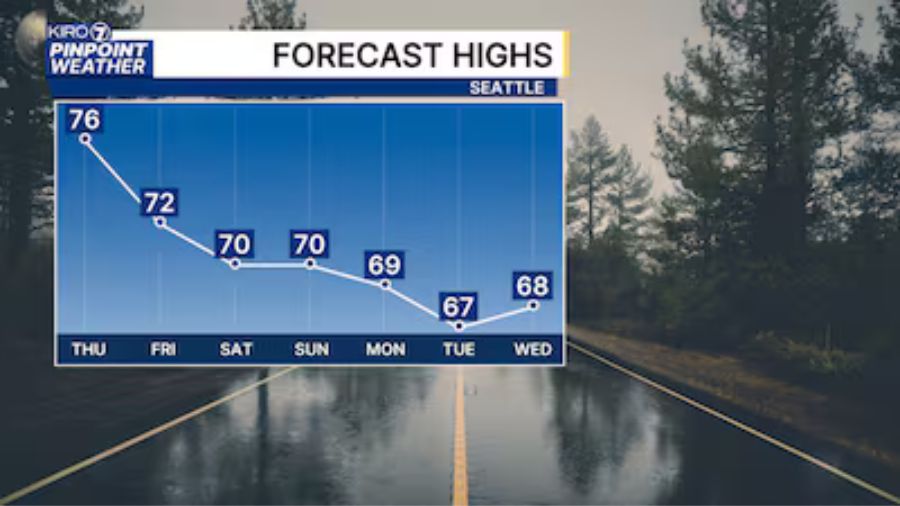
The unseasonably warm spring-like weather will continue Tuesday before temperatures begin to gradually cool Thursday through the weekend. More daily record high temperatures could be set again today across Western Washington for the third day in a row.
The current unseasonably warm temperatures are in sharp contrast to the sub-freezing cold earlier this month, or the long-winded frigid weather during the winter of 1949-50. On Monday, Bellingham soared to 69 degrees, crushing the previous daily record high of 62 established in 1992. Seattle-Tacoma International Airport, Olympia, Hoquiam and Forks all toppled their previous record highs for the day as well.
More from Ted Buehner: Will unseasonably warm weather continue?
Most record highs today range from the mid-50s to 60 degrees and those are the readings forecast for highs Tuesday. Snow levels remain quite high as well, hovering around 7,000 feet.
More rainfall is expected later Tuesday and will continue into Thursday, but nowhere close to the heavy amounts that fell this past weekend. Nevertheless, soils are now saturated with an ongoing threat of landslides at least into this weekend. Area rivers should slowly recede as well.
By Friday and the weekend, cooler more seasonable temperatures are expected with highs mainly ranging from 45 to 50 degrees, and snow levels tumbling to around Cascade pass levels. Spotty showers are anticipated mainly falling in the mountains.
Looking ahead for the rest of the winter – February into March, the latest seasonal weather outlook maintains heavy odds on warmer than average temperatures while nudging chances toward wetter than average conditions – all under the influence of the current El Niño winter pattern.
How cold it was on Jan. 31, 1950
The recent cold snap earlier this month was a mere shadow of what was the coldest and longest stretch of arctic-like weather in the 20th century during the winter of late 1949 and early 1950. An arctic blast plunged south into the Pacific Northwest in the final days of 1949, and surges of cold air continued into early February 1950. Periods of snow fell during those six weeks, but not as much as the 5 feet plus during the winter of 1968-69.
Given the current mild weather, it may be hard to fathom how cold it was on Jan. 31, 1950. Seattle set its all-time coldest on record at zero degrees. Many other Western Washington locations were even colder. For instance, Everett was two degrees below zero, Bothell was six below and Skykomish was 10 degrees below.
Clear nights and fresh fallen snow led to many single-digit low temperatures across the region in January 1950. The 31st was the coldest of them all in many Western Washington locations. Olympia dove to just 1 degree above zero, Bellingham sank to zero, and Darrington dipped to 9 below degrees zero.
It is hard to imagine Western Washington having temperatures near or below zero. But it happened during that historic winter and could happen again someday. In fact, earlier this month during the recent cold snap, Arlington fell to just seven degrees above zero for example.
Ted Buehner is the KIRO Newsradio meteorologist. You can read more of Ted’s stories here and follow him on X, formerly known as Twitter.