Seattle area continues march toward record dry streak despite thunderstorms
Aug 4, 2021, 7:27 AM | Updated: 9:56 am
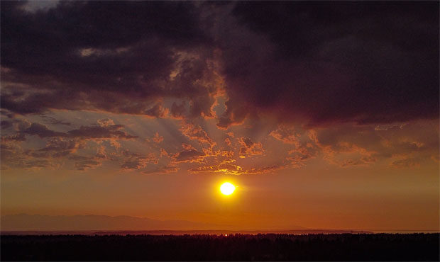
The sunset near the National Weather Service's Seattle headquarters. (NWS Seattle, Twitter)
(NWS Seattle, Twitter)
While parts of the Puget Sound region experienced thunderstorms late Tuesday, a record dry streak in the Seattle area continued.
State shatters records amid ‘early, alarming’ start to wildfire season
How can downpours hit parts of Seattle itself and still lead to a continuation of a dry streak, quickly approaching an all-time record? That’s due to the fact that the National Weather Service measures rainfall at Sea-Tac Airport, where wet weather hasn’t been seen in 50 days as of Tuesday.
Yes, some places did see some showers or thunderstorms last night. Sadly, SEA didn't have any measurable rain…the streak continues…for now. #NickKnows #wawx https://t.co/6LAm39aoFp
— Nick Allard (@NickAllardKIRO7) August 4, 2021
The region’s ever-shifting weather patterns were on full display Tuesday, with Boeing Field even seeing rain, despite neighboring Sea-Tac remaining virtually untouched by thunderstorms that eventually moved further north into White Center, West Seattle, and Seattle proper.
The record for dry days at Sea-Tac is 55 days, set in 2017. The current streak is expected to tick up to 51 days by the end of Wednesday. It could soon be threatened again on Thursday and Friday with a chance of showers. That said, recent forecasts indicate that chance may be dwindling.
“For Friday, what had looked like a promising wetting rain is beginning to look a bit more moisture starved,” the NWS said.
There’s also a possibility that rain could move in on Sunday or Monday. If conditions at Sea-Tac remain dry on Sunday, though, that will officially tie 2017’s 55-day record.
Follow @http://twitter.com/Mynorthwest