
WA snowpack remains far below normal as WSU unveils new AI water forecast tool
Feb 10, 2026, 6:26 AM

A photo of a snow monitoring station in operation. (Photo: Daniel Fisher, USDA)
(Photo: Daniel Fisher, USDA)
The amount of water in the region’s mountain snowpack is critical for water supplies heading into summer and early fall. Snowfall in the mountains has finally resumed after several interruptions this winter, when big ridges of high pressure steered Pacific weather systems away or warm atmospheric river events brought elevated snow levels.
The mountain snowpack is way behind where it should be at this point in the winter season. Early this month, the Northwest Avalanche Center reported snow depths in the Olympics and Cascades were averaging only about 30-50% of normal.
According to the Natural Resources Conservation Service, the amount of water in the snowpack was only about 35-45% of average, except in the North Cascades, where it was around 75% of average.
RELATED STORIES
WSU New Snow-Water Equivalent Forecast Tool
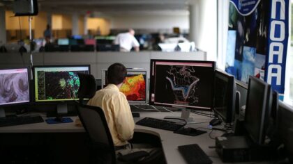
Washington State University (WSU) researchers have developed a new tool that can someday offer daily or weekly forecasts of mountain water availability. The researchers recently presented their snow-water equivalent forecast tool at the Association for the Advancement of Artificial Intelligence Conference in Singapore.
Their research found the tool is more accurate than current snow-water equivalent methods for about 90% of the more than 800 western U.S. snow measurement stations for daily forecasts, and roughly 75% for weekly forecasts.
The amount of water in the mountain snowpack is vital. In the western U.S., including the Cascades and the Olympics, about 75% of annual streamflow comes from melting winter snow. This melting snow runoff is what provides water for electric power generation, irrigation for agriculture, migrating fish, recreation, and drinking water.
“Snow-water equivalent is critical for decision making because it tells you how much water would be available from the melted snow, which would go through streamflow or watersheds,” said Krishu Thapa, first author on the research and a WSU School of Electrical Engineering and Computer Science graduate student.
Western U.S. mountain snow measurement stations are sparsely located – about one site for every 1,500 square miles. The use of AI in this tool helps account for snowpack differences across a region’s complex terrain and topography.
This new tool also accounts for uncertainty in daily and weekly snow-water equivalent forecasts, much like weather forecasts do today.
“The most important thing is how confident we are about those predictions because the decisions that water managers make are going to impact people,” Bhupinderjeet Singh, another research co-author who finished his WSU doctorate with this research, said.
Next Step
The next step is to provide an easy-to-use forecast data dashboard that delivers real-time information for water managers to make decisions that serve the public. No specific timeline for when this dashboard will be available was offered.
The funding that supported this WSU research came from the USDA National Institute of Food and Agriculture and the WSU-led AgAir Institute.
Time is limited to build this season’s snowpack
Washington has suffered three consecutive years of below-average precipitation and drought conditions. Unless this winter season’s snow totals make a big comeback in the remaining less than two months of the snow season, this summer and early fall may mark four consecutive years. Having this new snow-water equivalent tool in use may play a key role in managing the limited snowmelt water available.
Ted Buehner is the KIRO Newsradio meteorologist. Follow him on X and Bluesky. Read more of his stories here.













