Spring weather finally on the horizon after Tuesday morning snow
Mar 12, 2019, 5:49 AM | Updated: 1:29 pm
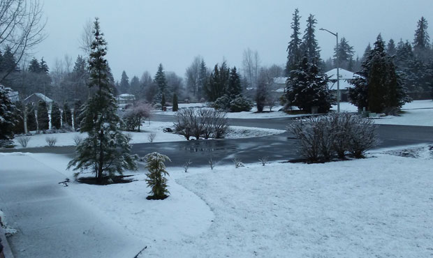
Granite Falls woke up to a snowy Tuesday morning. (MyNorthwest reader submitted)
(MyNorthwest reader submitted)
Light snow, or snow mixed with rain fell around Snohomish County Tuesday morning. Even so, it won’t be long before warmer weather rolls in.
Check for school delays and closures
According to both the National Weather Service and the European Center forecasts, temperatures next Monday in the Seattle area could move into the mid-to-upper 60s. The even better news: UW climate scientist Cliff Mass says that those warmer temperatures could be here to stay, thanks to a ridge of high pressure.
“By next weekend the ridge of high pressure aloft will be on top of us, a MUCH warmer situation, and the forecast models keep the shift in place out into the future,” he said in a recent blog post.
The Weather Channel’s 10-day forecast calls for a high of 67 degrees on Monday, bookended by a pair of 64-degree highs on Sunday and Tuesday.
More spring weather ahead
Dustin Guy with the National Weather Service says that Tuesday’s morning snow may be the last for at least the next few days around the Seattle area.
“You’ll see an early taste of spring this weekend,” he said. “I think we’ll start to see quite a few spots get into the 60s by Sunday. So if you can hold on for a few more days, I think we’re going to see some spring weather come our way.”
No, this isn’t an April Fools Joke because it’s only March 12th. So, don’t spill your coffee in shock. But it’s about to feel like spring. Perhaps we should thank the Irish? It’s either luck or overdue payback for the last 6 weeks. #wawx pic.twitter.com/P18xLKTATK
— NWS Seattle (@NWSSeattle) March 12, 2019
Tuesday morning snow
Temperatures Tuesday remained too warm for anything to stick to roadways, according to the National Weather Service. Rain is otherwise expected throughout the region, but some schools delayed classes — such as in Skykomish and Morton.
“Be careful on the roads out there,”said Guy. “There is some slush. But we’ll see some better conditions as we go through the morning.”
“Up around Lake Stevens there have been reports of between 3/4 of an inch to an inch of snow,” he said.
Guy says that the snowy, wet weather is expected to push east toward the mountains as the day continues. The snow will therefore taper off by the end of the morning around Puget Sound. But that snow will then affect mountain passes with significant snowfall.
— NWS Seattle (@NWSSeattle) March 12, 2019
Mountain snow
Heavy snowfall hit the mountains Tuesday morning. Chains are required for vehicles traveling over Snoqualmie Pass where as much as 20 inches is expected by Tuesday evening. Traction tires are advised over Stevens Pass.
More snow is in the forecast today with a winter storm warning in effect producing upwards of 20 inches by tonight. The heaviest snowfall this morning. Pls know before you go, be prepared to take it slow or consider changing your travel plans all together. pic.twitter.com/WOLPdQAX2Y
— I-90 Snoqualmie Pass (@SnoqualmiePass) March 12, 2019
Follow @http://twitter.com/Mynorthwest