New Washington geological maps can help residents escape tsunamis
Apr 6, 2019, 7:55 AM
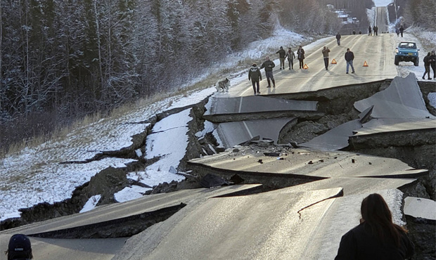
Anchorage, Alaska was hit by a 7.0 quake late last year. (AP Photo)
(AP Photo)
You know those hotel maps that tell you how to leave in case of a fire? The Washington State Department of Natural Resources (DNR) just released similar ones for tsunami evacuation routes. Except people are much more likely to look at these.
The maps lay out tsunami evacuation walking routes for those in coastal communities in case a tsunami occurs as a result of a Cascadia subduction zone earthquake. It lets residents know where to evacuate on foot from inundations zones and how long it might take to get to safe spots.
RELATED: How to camp in your house during the great Cascadia earthquake
Towns covered include Port Angeles, Bellingham, Anacortes, Aberdeen, Hoquiam, and Cosmopolis. Additional time maps are being created for other towns.
“A tsunami could be devastating to our communities. That’s why our geologists work every day to make sure people in coastal areas have the information they need to prepare and be ready,” said Commissioner of Public Lands Hilary Franz. “These maps put vital information in the hands of people who live, work, or play in these coastal communities so they know where to go, and how long it might take to get there, in the event of a tsunami.”
RELATED: Northwest region is currently in an ‘earthquake drought’
The maps were created using tools that track elevation changes and type of land cover to calculate walking speed along the evacuation route, and accounts for elements like steeper terrain and heavy vegetation.
It’s been 319 years since Cascasdia last quaked. The Cascadia subduction zone covers the offshore area where the Juan de Fuca tectonic plate pushes under the larger North American plate, and produces megathrust quakes every 300 to 600 years.
Tsunami experts will be hitting the road next week on the Washington coast to discuss vertical evacuation structures, potential earthquake early warning systems, and survival strategies. Check out the dates here.
Follow @http://twitter.com/Mynorthwest