Frigid cold, bad commute conditions, weekend snow ahead for Seattle
Feb 4, 2025, 9:58 AM
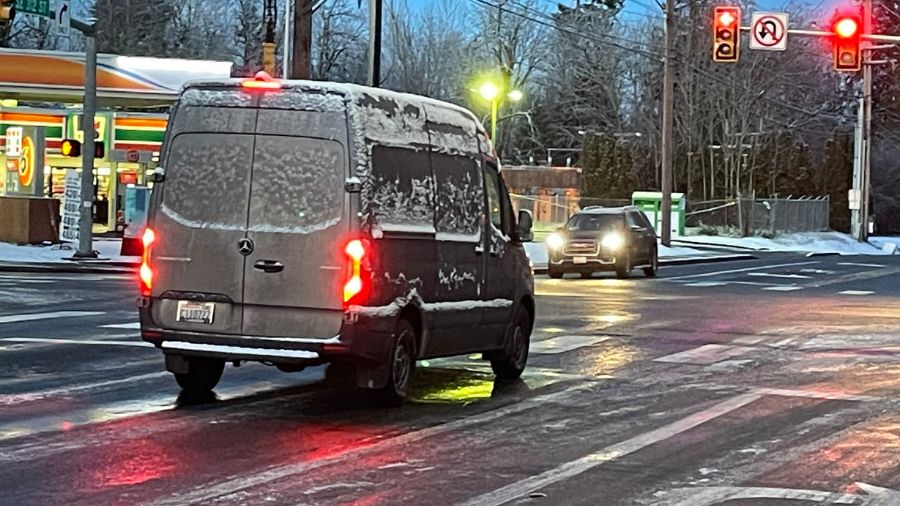
Icy driving conditions in Auburn. (Photo: Luke Duecy, KIRO Newsradio)
(Photo: Luke Duecy, KIRO Newsradio)
The Pacific Northwest is entering a deep freeze. That and predictions of a rain/snow mix will make moving about treacherous.

Seattle 7-day forecast provided by MyNorthwest.
“The stubborn cold low pressure aloft is forecast to remain just off the coast through Wednesday before finally moving onshore Thursday,” KIRO Newsradio meteorologist Ted Buehner told MyNorthwest. “Spotty rain or snow showers continue to circulate around this system, rotating through Western Washington. Showers will be more limited today with some sunshine but pick up Wednesday morning, and again Wednesday night and Thursday morning.”
Ice, cold challenging drivers
#Ice Ice Baby!!!!! Really bad in Auburn! Ice related #accident and a van spinning out of control! Sidewalks and parking lots are a mess… I have all your closures and advisories this morning on @KIRONewsradio pic.twitter.com/l4eCZJ5CoG
— Luke Duecy (@LukeKIRO) February 4, 2025
“There will be a little bit of moisture both in the sound and west of the Puget Sound,” said KIRO 7 Chief Meteorologist Nick Allard. “There will be some moisture overnight, especially early. Some snow and freezing rain will start the day on Wednesday. There’s also a potential for moisture overnight Wednesday into Thursday that could produce pockets of accumulating snow.”
#Ice on roads!!!! It’s worst in #Auburn Spinning tires at every intersection – #sidewalks and #parkinglots are ice rinks! I’ll have closures and advisories on @KIRONewsradio pic.twitter.com/sQUiIo6YL0
— Luke Duecy (@LukeKIRO) February 4, 2025
Flying after May? You’ll need more than a WA driver’s license
There won’t be much temperature change throughout the week, with highs around 40 and lows about 30, colder in the northern suburbs. Freezing rain and some wet snow are expected on Saturday.
“Daytime temperatures will continue to warm only into the mid and upper 30s, permitting any overnight and morning snowfall to melt,” Buehner said. “Nighttime temperatures are again expected to dip down into the 20s. So any wet roadways will freeze, resulting in icy conditions.”
“These showers will remain hit and miss. Any new snow accumulations Wednesday and Thursday will likely be no more than a couple of inches in the lowlands,” Buehner explained. “Friday is looking like a break in the shower action with some sunshine yet still cool temperatures, about 10 degrees cooler than early February averages.”
Let it snow, let it snow! Laps on the new Wildside Quad were a real treat today. ❄️
So far this storm cycle has dumped 16″ at base elevation and 30″ at the top of Alpental.#wawx pic.twitter.com/rYZxhVDJni
— Summit at Snoqualmie (@SummitSnow411) February 2, 2025
There is good news in all this. Feet of snow dumped in the mountains, creating optimal skiing conditions.
Contributing: KIRO 7 Pinpoint Weather
Bill Kaczaraba is a content editor at MyNorthwest. You can read his stories here. Follow Bill on X, formerly known as Twitter, here and email him here.