
‘Hurricane Hunter’ plane deploys to Pacific Northwest as major atmospheric river takes aim at Seattle
Dec 8, 2025, 9:08 AM | Updated: 5:54 pm
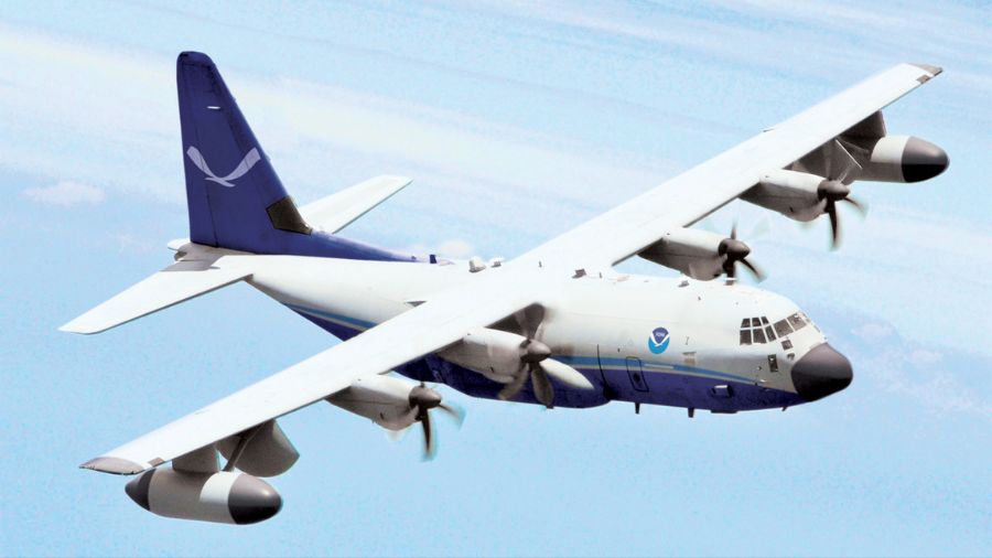
An artist's rendering of a NOAA C-130J Hercules hurricane hunter aircraft. (Photo courtesy of NOAA)
(Photo courtesy of NOAA)
The National Oceanic and Atmospheric Administration (NOAA) is sending its famed reconnaissance aircraft into a powerful storm system that threatens widespread flooding and damaging winds for Western Washington from Monday through Wednesday.
The approaching atmospheric river barreling toward Western Washington is powerful enough to warrant a rare deployment: NOAA is sending its hurricane hunter aircraft to fly directly into the storm system Monday, a dramatic step that underscores the impact of the incoming weather event.
During hurricane season, the aircraft flies into hurricanes over the East Coast and Gulf Coast to collect crucial data. Now, in the off-season, the plane is heading to the Pacific Northwest.
The specialized reconnaissance plane will crisscross the Pacific Ocean just off Washington’s coast throughout Monday, dropping instruments into the storm to collect real-time data that will help meteorologists refine their forecasts as the system makes landfall.
“Instead of just sitting around doing nothing during hurricane off-season, NOAA and the Air Force will sometimes send the hurricane hunters over here to our neck of the woods to fly into some of our biggest storms,” meteorologist Scott Sistek, author of the Emerald City Weather blog, explained. “By flying a hurricane hunter into our storms, we can get much more real-time and verified data that we can feed into our computer models.”
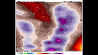
That enhanced data becomes crucial as forecasters track a storm system that could deliver three to five inches of rain across the Seattle metro area and push multiple rivers to major flood stage by Tuesday and Wednesday.
RELATED STORIES

Two waves of damaging winds hit Monday
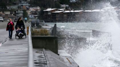
Before the heaviest rains arrive, gusty winds will strike the region in two distinct pulses Monday, creating hazardous conditions for the afternoon commute.
The first wave targets areas from Seattle southward, with winds ramping up around midday and continuing into early evening. Gusts of 40-45 mph are expected across the region, with isolated gusts potentially reaching 50 mph.
“Usually when we get a windstorm, we talk mostly about the north, like the San Juan Islands, but this one is mostly south,” Sistek said, noting the unusual wind pattern.
A second wind surge will follow as the storm passes, sending westerly winds howling down the Strait of Juan de Fuca. This post-frontal blast will hit Port Angeles, Sequim, Whidbey Island, and portions of western Snohomish and southwestern Skagit counties with sustained winds of 40-45 mph.
The dual wind events come on top of saturated soils from recent rainfall, raising concerns about trees toppling onto power lines and roadways.
Major flooding expected across Western Washington rivers
The Snoqualmie River ranks among the most serious flood threats, with forecasts predicting major flood stage both in Carnation and near Snoqualmie Falls by Tuesday. Residents in flood-prone areas of the Snoqualmie Valley should prepare for water inundating farm fields and crossing roadways.
The Skagit River has been hovering within a fraction of an inch of major flood stage, with the incoming deluge likely to push it over the threshold. Other rivers facing significant flooding include the Skykomish River in Monroe and the Cowlitz River in Southwest Washington.
“I don’t think any river may slip by without at least some sort of minor flooding or coming right up to flood stage,” Sistek warned. “For those other rivers, we’re not talking historic flooding, but definitely flooding that you’ll notice and need to be careful about.”
Flooding impacts are expected to peak Tuesday and Wednesday as rainfall accumulates and rivers crest.
Seattle to see month’s worth of rain in days
The atmospheric river will dump three to five inches of rain across the Seattle area between Monday and Wednesday, roughly equivalent to the city’s average rainfall for the entire month of November or December compressed into just three to five days.
“This is beyond Seattle’s usual rain,” Sistek emphasized. “Usually, a storm comes through, and it’s maybe a half inch. Some of our stronger storms, maybe an inch of rain in a day. This is more rain than we’re used to.”
The heaviest precipitation will concentrate from Seattle south through Tacoma and the Southern Cascades into Portland. While Whatcom County and other far northern areas will see substantial rainfall, the extreme totals have shifted slightly southward from earlier forecasts.
Storm downgraded to Category 4, but still dangerous
Forecasters have adjusted the atmospheric river’s classification from category 5 to category 4 on the five-point scale, though meteorologists caution that it remains an exceptionally strong system.
“You’re playing semantics here. A 4 is still a very strong atmospheric river,” Sistek explained. “It’s just the criteria that they use to reach a 5; it dipped just a little bit below it.”
The hurricane hunter data collected Monday could provide more precise measurements that might adjust the storm’s rating or refine flooding predictions for specific river basins. The aircraft will drop instruments through the storm system, measuring conditions that satellites and scattered buoy reports cannot capture in detail.
Urban flooding, landslides threaten even non-riverfront areas
Seattle residents who don’t live near rivers still face significant risks from the prolonged, heavy rainfall.
Clogged storm drains could trigger urban flooding across neighborhoods, while hillsides and bluffs saturated with moisture may give way in landslides. Anyone living on or near slopes should monitor conditions closely and watch for signs of ground movement.
Highway closures are likely in landslide-prone areas. One area that often sees landslides is along the West Valley Highway, a critical alternate route for commuters dealing with lane closures on Highway 167 in the Sumner, Pacific, and Auburn corridor.
What you should do now
Meteorologists and emergency officials urge Western Washington residents to take these steps:
Before the storm
- Clear gutters, downspouts, and storm drains of leaves and debris
- Secure outdoor furniture, trash cans, and other items that could blow away
- Charge phones and electronic devices in case of power outages
- Stock flashlights, batteries, and emergency supplies
- Know your flood risk and evacuation routes
During the storm
- Never drive through standing water on roadways
- Avoid unnecessary travel during peak wind and rain Monday afternoon through Wednesday
- Stay away from downed power lines
- Monitor river levels if you live in flood-prone areas
- Watch for landslide warning signs near hillsides
The widespread impacts mark this as a significant two- to five-year weather event for the region, not the most extreme on record, but far beyond typical December rainfall.
With hurricane hunter aircraft providing meteorologists their most detailed look yet at the storm’s inner workings, forecasters will continue updating predictions through Monday as the atmospheric river makes landfall and begins its wet, windy assault on the Pacific Northwest.
For the latest weather updates and river forecasts, follow meteorologist Scott Sistek at EmeraldCityWeather.com.
Charlie Harger is the host of “Seattle’s Morning News” on KIRO Newsradio. You can read more of his stories and commentaries here. Follow Charlie on X and email him here.












