
Frigid temperatures on the way after region gets popped with snow
Feb 1, 2025, 11:24 AM | Updated: Feb 3, 2025, 1:35 pm
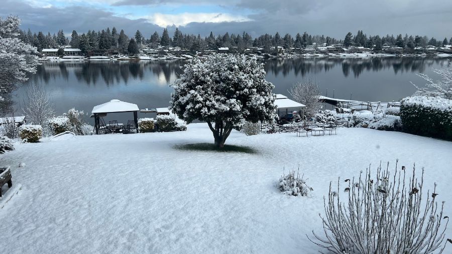
Angle Lake in Seatac got a significant dump of snow Monday. (Photo: Carlissa Markovich)
(Photo: Carlissa Markovich)
The snow came in bursts in Western Washington Monday and now the cold temperatures and ice take center stage.
Seattle got some powder, but it looked like a real winter storm out in the suburbs.

Snow fell in South Lake Union on Monday morning. (Photo: Frank Lenzi, KIRO Newsradio)
Jay DeFiitch of Seattle’s National Weather Service told KIRO Newsradio’s Heather Bosch, “Temperatures will drop to the mid-20s and remain chilly through Friday, with a slight warm-up to around 30 degrees by Saturday. The Cascades have seen significant snowfall, with Stevens Pass reporting 17 inches over the past 48 hours.”
Got at least 4 inches of #snow at Angle Lake. We are at the same altitude as @SeaTacAirport #wawx pic.twitter.com/SlntuhK93Z
— Matt Markovich (@mattmarkovich) February 3, 2025
Brrrrr… Baby, it’s cold outside; Chance of snow through the week
It actually looked more like Boston than Bremerton Monday morning as the city got more than just a dusting.
Snowing fairly decently this morning here in Bremerton! #wawx #wasnow pic.twitter.com/ouG0r7TFN6
— TerpKing710 (@terp_king710) February 3, 2025
Snow will continue on and off today and throughout the week according to KIRO 7 Meteorologist Nick Allard said. Temperatures in the 30s will be common.
Pockets of light to moderate snow. Be careful driving, visibility will be down and it’s still around freezing. These showers will move through fairly quickly. #NickKnows #wawx pic.twitter.com/WMQb7zy8ms
— Nick Allard (@NickAllardKIRO7) February 3, 2025
DeFiitch said, “As we start getting into tomorrow morning, there is a chance we start seeing a little bit of drier conditions, at least for Seattle area. There’ll probably be some snow showers lingering a little bit longer along the coast, kind of Pacific Coast area, Grays Harbor County. But tonight we’ll still see another round of snow showers before maybe some drier conditions around Seattle, really, by midday tomorrow.”
There was heavy snow over Interstate-5 in Federal Way around mid-morning.
Whatcom county also saw a good dumping overnight.
Snow north of Bellingham, WA pic.twitter.com/5FGbvtR8jP
— Joe Barnes (@joebarnes) February 3, 2025
“We’re around four, maybe even up to eight inches of snow up that way,” DeFiitch said.
Fun morning in Lynden! Heading out to livestream on Whatcom County Weather on FB soon! #wawx pic.twitter.com/IZ76J5LqYv
— Randy Small – Whatcom County Weather (@RandySmall) February 3, 2025
According to Cliff Mass, an atmospheric sciences professor at the University of Washington (UW), snow will only have a slight chance of sticking due to warm winds coming in from the ocean, but KIRO Newsradio meteorologist Ted Buehner said the roads are cold, so expect slick driving conditions.
Groundhog Day: Did Punxsutawney Phil see his shadow?
“We could see even an uptick tonight around the Seattle area, depending on where they set up. But certainly, another concern that we have is any, you know, residual moisture that’s kind of on the roads there as temperatures drop into the upper 20s tonight could freeze over,” DeFiitch said. “So it could be another morning like it was this morning, especially on the side streets.”
If you receive snow in your neighborhood, share your snow and other weather photos with us by submitting them here.
Contributing: Heather Bosch, KIRO Newsradio; Frank Sumrall, MyNorthwest; KIRO 7 Pinpoint Weather Team
Bill Kaczaraba is a content editor at MyNorthwest. You can read his stories here. Follow Bill on X and email him here.












