
Western WA approaches longest mid-winter dry streak in 60 years
Jan 26, 2026, 8:03 AM

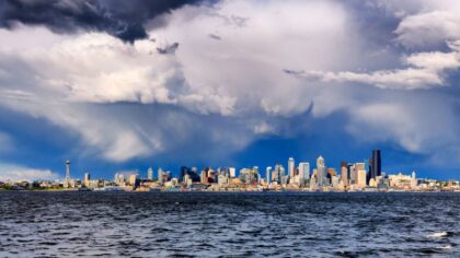
The downtown Seattle skyline as seen from Gas Works Park. (Photo courtesy of SDOT)
(Photo courtesy of SDOT)
On Sunday, under generally clear skies, the Seattle Seahawks punched their ticket to the Super Bowl after a monumental win over the division-rival Los Angeles Rams. Sunday also marked the thirteenth straight dry day in the region. This dry streak tied the longest mid-winter run of dry days this century, set just last year.
It has been reported that the record mid-winter dry streak is 15 days at Seattle-Tacoma International Airport (SEA), set in 1963. That stretch of dry weather ran from Jan. 16 to Jan. 30 that year. Weather records at SEA began in 1945.
Yet, going way back through all Seattle weather records dating back into the 1890s, there has been one longer mid-winter period of dry weather. The all-time record set at the Seattle Federal Building in 1901 was 18 days. Another long mid-winter dry streak occurred in 1915, lasting 14 days.
Such long mid-winter weather dry periods are rather unusual, yet have occurred from time to time.
RELATED STORIES

When will it rain?
Weather forecast charts show that the big ridge of high pressure over the Pacific Northwest region for the past two weeks is expected to begin to move inland Tuesday. That change will open the door for Pacific weather systems to approach. The first is likely to weaken Tuesday night and Wednesday, with the greatest chance for rain along the coast and in the Olympics.
Following weather systems later in the week are expected to have a better chance of dropping measurable rainfall across much of Western Washington.
If western interior rain gauges remain dry through Wednesday, that would make it 16 straight days without measurable rain, marking the region’s second-longest mid-winter dry streak in over 100 years. The 1901 all-time record would retain its number one position.
This dry stretch of weather has put this month’s rainfall well behind average. SEA had above-average rainfall in the first 12 days, with about three-and-a-third inches. Since then, it has been bone dry. The average rainfall for the entire month of January is 5.78 inches.
Olympia got three-and-a-quarter inches in those first 12 days, but has been dry since then. Olympia averages nearly eight inches of rain in January.
Everett – Paine Field is in the same boat. Only 1.69 inches of rain fell early this month, while the monthly average is about 4.5 inches.
Mountain snow
This period of mid-winter dry weather has put a damper on the mountain snowpack. At mid-month, the NW Avalanche Center reported the Olympics and Cascades were only ranging from 40-55% of average snow depth. And no snow has fallen since then.
The Natural Resources Conservation Service monitors the amount of water in the snowpack, reporting that the water content ranges from 40-50% of average, with the exception of around 85% in the North Cascades.
The anticipated weather systems later this week should drop some mountain snow for the first time in more than two weeks. Unfortunately, snow levels are expected to range from 5,000-6,000 feet, leaving rainfall in the lower elevations, including many of the Cascade passes.
Looking further ahead
The latest longer-range weather outlooks reflect warmer-than-average temperatures and a mix of wet and dry periods. These outlooks do not bode well for building the mountain snowpack. The snowpack usually peaks around April 1, leaving about two months to make a comeback.
Impacts
Unless there is a significant shift toward cooler, wetter weather through March, the impacts of limited water supplies will once again be felt later this summer and fall. Those impacts include water for electric power generation and irrigation, particularly in the agricultural areas of Eastern Washington; water for fish and recreation; and even consumer water supplies.
A limited mountain snowpack can also signal an earlier start to the wildfire season across the entire Pacific Northwest and much of Western Canada. Wildfires also mean smoke and poorer air quality.
So, as the Seattle Seahawks win the NFC Championship, perhaps the weather can surge forward soon, bringing wetter conditions and more snow in the mountains. Stay tuned!
Ted Buehner is the KIRO Newsradio meteorologist. Follow him on X and Bluesky. Read more of his stories here.












