
From snow to 60s: Western Washington’s weather whiplash continues
Mar 16, 2026, 1:01 PM | Updated: 3:41 pm

The Space Needle stands over the Seattle skyline in March in Seattle, Washington. (Photo: John Moore, Getty Images)
(Photo: John Moore, Getty Images)
After a much cooler-than-average week last week, which included some lowland snow in parts of western Washington, this week will bring a stark change. A much warmer weather pattern will be the rule through the week.
A strong ridge of high pressure has developed along the west coast of the U.S. with a moist flow of air aloft heading into southern British Columbia. The flow of moist air is expected to sag south across the northern half of western Washington on Monday and drop farther south on Tuesday.
The result is rain at times with much warmer temperatures. Highs this week will generally be in the mid- to upper 50s, with some locations cracking the 60-degree mark. The average high temperature in mid-March is in the mid-50s. Low temperatures will be much milder than last week, generally ranging from the mid-40s to the lower 50s.
This period of much milder, wet weather is expected to continue through the week.
In the mountains
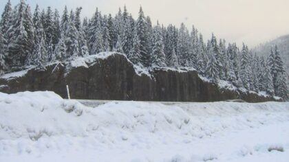
This past week produced considerable snowfall in the mountains, helping snow depths move closer to average after a rather dismal snow year. Snow totals reported by Northwest Weather and Avalanche Center data sites ranged from about a foot of new snow last week to between 3 and 6 feet of fresh snow from Stevens Pass south to White Pass. Paradise on Mt. Rainier received 56 inches of new snow during the week.
The water within the snowpack also improved from its well-below-average numbers. The recent snow pushed the averages to at least 50% higher than a week ago.

The amount of water in the snowpack on March 7. (Image courtesy of Washington SNOTEL)

The amount of water in the snowpack on March 14. (Image courtesy of Washington SNOTEL)
The big change in the overall weather pattern to a much warmer air mass this week, though, will push snow levels to at least 7,000 feet or higher. So the incoming weather will fall mainly as rain.
However, the newly fallen mountain snow will soak up the rain, limiting any threat of significant river flooding. The primary river expected to exceed its banks will likely be the Skokomish River in Mason County. Other regional rivers will likely rise and warrant watching, but are not expected to exceed flood stage.
Another concern in the mountains, though, is that the rain-soaking snow will also increase the weight of the snowpack, particularly on steep slopes. This situation will result in an elevated avalanche hazard. Monitor the Northwest Weather and Avalanche Center for the latest information on this evolving situation.
RELATED STORIES


Looking ahead
By this weekend, cooler air is forecast to move onshore, bringing snow levels closer to pass levels and reducing rainfall in western Washington.
This milder wet-weather trend will continue into the latter part of March. The latest extended weather outlook through March 29 indicates a good chance of around-average temperatures and wetter-than-average conditions.
In addition, and of special note, March 25 is also when the region has its first 7:30 p.m. sunset.
Ted Buehner is the KIRO Newsradio meteorologist. Follow him on X and Bluesky. Read more of his stories here.













