Seattle could be primed for ‘very active winter’ as snow arrives on Mt. Rainier
Sep 23, 2019, 1:13 PM | Updated: Sep 24, 2019, 11:15 am
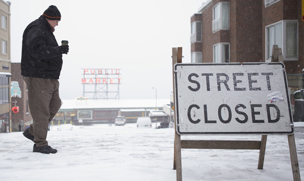
A pedestrian crossing a snow-closed street in Seattle back in 2012. (Stephen Brashear/Getty Images)
(Stephen Brashear/Getty Images)

With fall — and its appropriately gloomy weather — rolling in on Monday, the days ahead could come with even colder temperatures, a tough winter, and even some light snow showers on Mt. Rainier before the end of the week.
Western Washington should expect ‘Wet-tember’ to continue
“Would you like to see some snowflakes this week? Anyone living in Washington State will be able to do so with a short drive, as unseasonally cold air will be moving in,” said UW climate scientist Cliff Mass in a recent blog post.
The forecast at Mt. Rainier’s Sunrise peak calls for snow showers on Thursday and Friday. The National Weather Service expects a snow at 4,000 to 5,000 feet over the weekend, and a possible “light dusting” on grass in higher passes.
Cooler weather expected this weekend with morning temperatures in the 40's and even 30's in spots early next week! Snow levels around 4,000-5,000 feet with a light dusting of snow possible on the grassy surfaces of higher passes. #WAwx pic.twitter.com/g2k0SfwqGL
— NWS Seattle (@NWSSeattle) September 24, 2019
Mass pointed out that the cold air moving in bears striking similarities to the weather patterns we see when snow makes its way down to Seattle.
“If this was November or December I would be warning the Mayor to get the snowplows ready….but not in September,” he described. “Seriously, the large scale atmospheric configuration is a dead ringer for the one that provides lowland snow.”
That means we’re not likely to see snowflakes in Seattle any time soon, but it’s also a harbinger of colder days to come.
According to data cited by Mass, the normal high temperatures for this time a year typically sit in the upper 60s. By Friday, though, Seattle will see highs in the high 50s, roughly 10 degrees colder than usual.
“Not good,” he warned. “I suspect we have very active winter ahead.”
That tracks with reports from the NWS, evidenced by a “cool upper level trough” moving through Western Washington over the weekend. That will have early morning temperatures in parts of Washington in the 40s on Saturday and Sunday, and possible even the 30s come next Monday.
Meanwhile, “Wet-tember” continues to be out in full effect. Prior to Sept. 21, the National Weather Service noted that it was “already wetter than 58 out of 75 Septembers on record.”