
Snow, cold snaps coming to mountains: Will Puget Sound see the same?
Jan 4, 2024, 8:09 PM
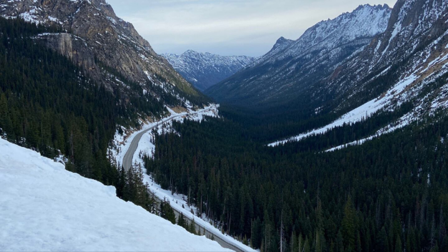
State Route 20 North Cascades Highway in March 2023. (Photo courtesy of KIRO 7)
(Photo courtesy of KIRO 7)
The big change from the unseasonably record-warm December is underway, and will really get rolling starting this weekend to delight skiers and snowboarders, while those driving through the Cascade Pass will need to be prepared.
A Pacific weather system is expected to roll onshore Friday, bringing rain and blustery conditions to the lowlands, and long-awaited snow in the mountains. This system will also usher in cooler air throughout the region.
Snow levels Friday will be around 3,000 feet, meaning snow for all of the Cascade Pass highways. By midday Saturday in the wake of this system, the snow level will drop to 2,000 feet with one to two feet of new snow on the ground. Cascade pass drivers should be well prepared for winter driving conditions. The Washington State Patrol (WSP) is reminding motorists that it is the law to at least carry chains and they should be ready to use them if signage is posted.
Cliff Mass on state’s warm winter: ‘I don’t think they can say’ 2023 was the hottest year on record
Higher pressure is forecast to build onshore later Saturday into Sunday with the lowland showers and mountain snows tapering off. Then next week, the flow aloft turns more out of the northwest from the Gulf of Alaska, a weather pattern very favorable for more mountain snow and even colder temperatures.
The next Pacific weather system is anticipated to swing onshore with more snow in the mountains and rain for the lowlands of Western Washington. A more showery weather pattern is then expected to develop as more cool air surges onshore. Mountain snow levels Monday and Tuesday will hover between 1,000 and 2,000 feet with up to three feet of new snow — great news for snow enthusiasts but a headache for motorists.
Lowland snow?
Another big question is whether the lowlands will see any snow next week. On Monday morning, hilly areas in the lowlands could see snowflakes in the air, but it will turn to rain by the afternoon.
The next lowland snow opportunity will begin later in the week. Colder air is expected to flow out of the interior of Western Canada through the Fraser River Canyon into parts of Western Washington on Wednesday and Thursday, bringing the coldest temperatures of the season thus far.
The best chance for any accumulating lowland snow will likely be confined to the north interior such as Whatcom County later in the week. However, this weather pattern does not look like a widespread snow scenario, yet it bears watching as the following weekend approaches.
Highs across much of Western Washington this weekend will remain in the 40s. But later next week, they will struggle to exceed 40. Lows will likely remain in the 30s though the north interior could drop into the 20s.
More from Ted Buehner: El Niño, drought, wildfires defined Washington’s weather in 2023
The mountain snowpack is currently in sad shape, running roughly only between 30-60% of the average for early January according to the Northwest Avalanche Center. The water in the snowpack is also well below average, ranging from only 30-60% of normal. The next week or so will permit the starving snowpack to be fed and play some catch-up with the long-awaited and much-anticipated fresh snow.
How long will this colder weather hang on? If longer-range weather charts are on track, a milder more westerly flow pattern is anticipated to develop around the middle of this month. Yet, that transition to this milder weather pattern could be interesting.
Ted Buehner is the KIRO Newsradio meteorologist. You can read more of Ted’s stories here and follow him on X, formerly known as Twitter.













