Christmas Eve windstorm possible in western WA as forecast models clash
Dec 23, 2025, 10:44 AM | Updated: 3:17 pm

A map of the High Wind Warning in western Washington. (Graphic courtesy of Scott Sistek, Emerald City Weather Blog)
(Graphic courtesy of Scott Sistek, Emerald City Weather Blog)
A potential Christmas Eve windstorm has Western Washington meteorologists facing one of the most uncertain forecasts in recent memory. The National Weather Service has issued a High Wind Watch for Seattle, the Puget Sound metro area, the coast, and the I-5 corridor for Wednesday, Dec. 24. But with less than 24 hours to go, forecast models remain sharply divided on whether this will be a significant December 2025 wind event or barely noticeable.
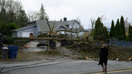
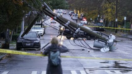
The High Wind Watch warns that winds will suddenly shift from east-northeast to southerly Wednesday afternoon, with speeds of 25-35 mph and gusts of 50-60 mph possible. The NWS says damaging winds could blow down trees and power lines, widespread power outages are possible, and travel could be difficult, especially for high-profile vehicles. The watch is in effect from Wednesday morning through Wednesday evening.
“I was going to start my update with ‘I’m sorry in advance’ because this forecast is incredibly complex,” Scott Sistek, meteorologist and author of the Emerald City Weather Blog, told Seattle’s Morning News on KIRO Newsradio Tuesday morning. “It’s kind of just popped up here in the last couple of days.”
Sistek said the models are nowhere near agreement.
“Usually by now, we’re talking a day ahead of time, the models have kind of said their piece, battled between them, and agreed on a scenario,” Sistek said. “That is not the case right now. It is almost an even 50/50 split.”
RELATED STORIES
American model v. European model: A Christmas Eve showdown
The split comes down to some of the most trusted tools in weather forecasting taking opposite positions.
“There’s the American model that a lot of people use. That one’s very aggressive. It’s thinking 60-mile-per-hour winds in Seattle tomorrow (Wednesday), midday,” Sistek said. “Then we have the European model that lots of people use and trust. It’s done very well for us. That one is not sold on this at all. It says the storm is turning inland, it’s not going to be as strong, and we’re looking at peak gusts of maybe 34, 29 miles an hour in Seattle. No big deal.”
Even the high-resolution models that update more frequently are not helping break the tie. One says, ‘No big deal.’ The other is showing alarming numbers.
“So we are still, as meteorologists, looking at this going, ‘Oh my gosh,'” Sistek said.
Sistek’s gut: Christmas Eve windstorm is an ‘underdog’
When asked what his instincts are telling him, Sistek said he leans toward the less extreme outcome.
“My gut is that the windstorm is an underdog,” Sistek said. “If I were to lay odds, I would say the less extreme solution, just another windy day, is the leader at this point.”
But he cautioned that underdogs sometimes win.
“I’m wearing my Kraken hoodie. Last night they played in Anaheim. They were probably an underdog in that game, and they ended up winning,” Sistek said. “I want everybody to be ready for it and prepare as if we may see 50 or 60 miles per hour winds.”
Sistek also noted the ghosts of forecasts past.
“I don’t know if you remember, there was that time about 10 years ago, 2016, where we all thought there was going to be this really big windstorm with 80-mile-per-hour winds in Seattle,” he said. “Everybody went crazy for days. And then it busted. It all stayed offshore, was much smaller, nothing really happened.”
An unusual storm coming from the south
If the windstorm does materialize, it will be unlike typical Pacific Northwest wind events.
“Most of our windstorms start on the coast because the storms come off the ocean,” Sistek explained. “This storm would be coming almost from due south. It’s coming up from California. So nothing’s happening until the storm gets here, and then it’s happening. It’ll go from calm to really windy, and then it’ll pass pretty quickly.”
The window for the strongest winds, if they occur, looks to be from about 1 p.m. to 4 p.m. Wednesday.
“It may just be a window from one to four tomorrow where we’re looking at some really decent winds, and then just as quick as it came, it slows down and is gone,” Sistek said.
Saturated soils raise power outage risk for Western Washington
Adding to the concern is the condition of the ground after two weeks of atmospheric rivers and record flooding across Washington state.
“The region is not as well equipped for a 60-mile-per-hour windstorm as we normally would be,” Sistek said. “All that rain and the flooding we just went through, the ground is still very wet, so it’s easier to knock stuff over right now. The roots aren’t as gripped as well as usual.”
If the stronger models verify, Sistek said he expects significant power outages.
“If this pans out, it’s going to be a pretty decent storm with some pretty decent impacts,” he said. “I expect there would be quite a few power outages.”
How to prepare for Christmas Eve power outages in Seattle
Sistek urged residents to prepare now and hope for the best.
“I want people to really stay in tune to the forecast,” he said. “Let’s hope that the favorite wins and it’s just 20 or 30 miles an hour and everything’s fine. The worst that happens is you’re all shaking your fist at the meteorologist for getting you excited about a storm that didn’t happen.
“I want people to be ready just in case some of those stronger models are right,” Sistek added. “This could be a pretty decent event that you need to be ready for. Be ready for power outages.”
His advice: charge your phones, make sure cars are gassed up or charged, and have flashlights ready. The NWS recommends fastening loose objects or sheltering them in a safe location before the winds arrive.
“Worst timing ever, I know, but start planning now,” Sistek said.
Good news for Snoqualmie Pass, Cascade Mountain travel on Christmas Eve
There is a silver lining for those traveling over the mountains on Christmas Eve.
“The snow levels will probably bump up a little to where even the passes will just be windy and maybe even a period of some rain, which would be good for people trying to get over,” Sistek said. “It looks like there may be a gap in the morning where it’s just rain or kind of slushy, and you can get over without too much snow impacts.”
The trade-off, he noted, is that lowland travel could be impacted instead.
“We’ve kind of taken some of the mountain travel issues out of the equation but replaced it with, you know, just trying to get from Auburn to Lynnwood, maybe being kind of crazy tomorrow afternoon,” Sistek said.
When will we know if the Christmas Eve windstorm is coming?
The forecast remains in flux. Meteorologists will be watching model updates throughout the day, but Sistek acknowledged it may come down to watching the storm form in real time.
“I kind of get the sense it’s going to be nowcasting and just watching the storm form,” he said. “It’s going to be a very quick storm that forms and moves.”
The storm is not expected to fully develop until later Tuesday into tonight off the Northern California coast. From there, the question is whether it tracks north toward Western Washington or turns inland into Oregon.
“Let’s hope the worst that happens is you all shake your fist at the meteorologist for getting you excited about a storm that didn’t happen,” Sistek said. “But I want people to be ready just in case.”
Charlie Harger is the host of “Seattle’s Morning News” on KIRO Newsradio. You can read more of his stories and commentaries here. Follow Charlie on X and email him here.
Follow @https://twitter.com/kirocharlie