When the I-5 Ship Canal Bridge almost became a “$13 million parking lot”
Sep 15, 2023, 9:24 AM


Commuters know it, they love it, they can’t live without it. Yes, it’s the Interstate 5 Ship Canal Bridge in Seattle. The span first opened to traffic December 18, 1962, and it’s been an important part of the daily commute and weekend travels through the Puget Sound region ever since.
A look into its history reveals that inanimate pieces of civic transportation infrastructure sometimes have interesting travel journeys of their own, and even the venerable 61-year-old Ship Canal Bridge was a character in two now mostly forgotten stories before a single car ever drove across its 180-foot high span.
Work to build the bridge, which was part of the national effort during the Eisenhower administration to create the interstate highway system, began in 1958. The route chosen for the highway faced many obstacles as planners worked to minimize disruption to long-existing neighborhoods and to meet the challenges of western Washington’s topography.
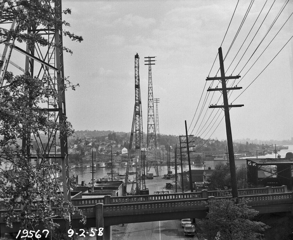
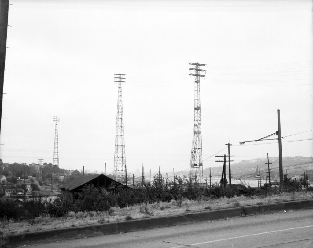
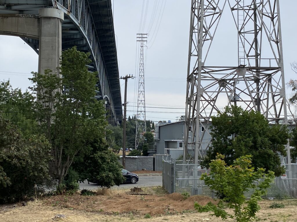
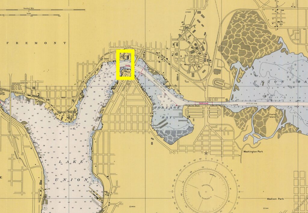
Where the highway route was to cross Lake Union and the Lake Washington Ship Canal turned out to be the same spot where, decades earlier, Seattle City Light had placed five high towers to carry a major electrical transmission line.
“Those tall transmission towers appear to have been built in 1931 per drawings and a historic photo, wrote Seattle City Light architectural historian Rebecca Ossa in an email.
“They likely carried a line from North Substation, which was then the northernmost substation in the City and which also received power directly from the Skagit River Hydroelectric Project’s Gorge Plant,” Ossa continued. “Today, it still brings in power from the Skagit Project but from a different substation.”
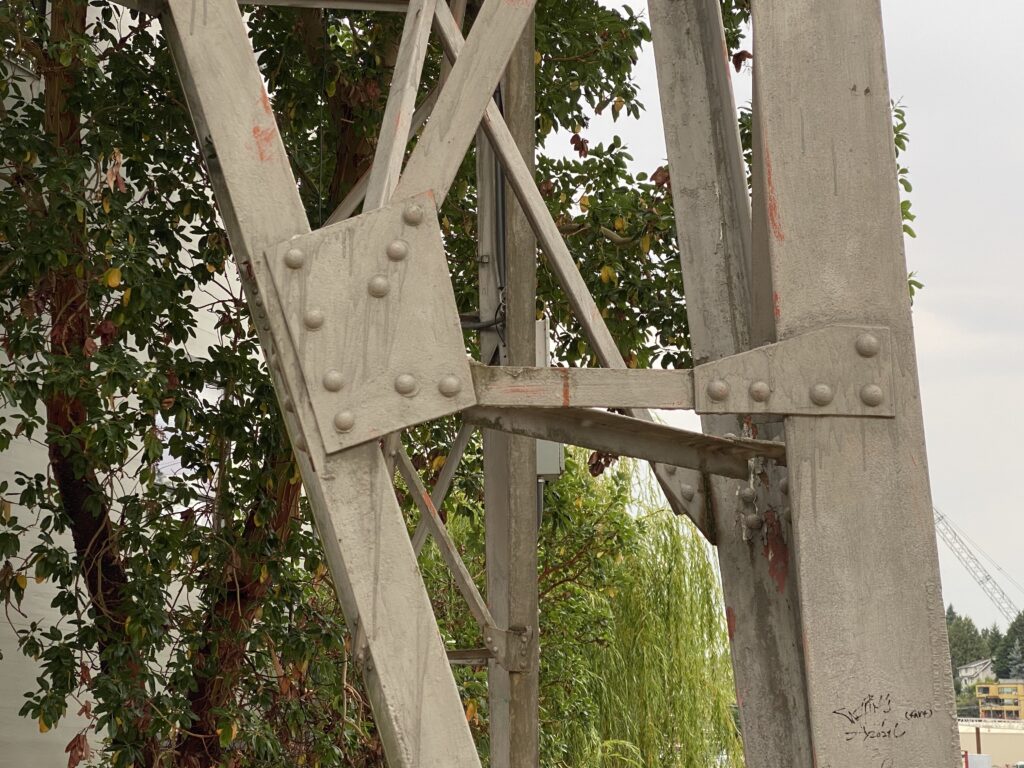
Thus, the towers alongside the Ship Canal Bridge, which City Light says are 246 feet tall, are an incredible 92 years old. This means they’ve been on the job for City Light customers 24/7, bringing hydropower from the Cascades since the Herbert Hoover administration.
The “alongside” part of the story is interesting because the towers originally stood about 100 feet east of where they currently stand. In order to build the bridge, the giant steel towers had to be moved out of the way.
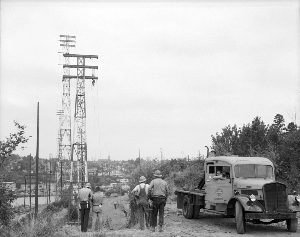
From August to October 1958, photos from the Seattle Municipal Archives show how a contractor hired by the city got the unique job done.
One of the five towers was eliminated from the configuration, and the remaining four were jacked up and then moved on rollers and log cribbing approximately 100 feet to the west (including the two tallest towers, which each weigh 45 tons).
New concrete footings had been poured in place in advance, and the towers were lowered off the cribbing and bolted down. The electricity had been turned off beforehand, the wires were taken down, and power was temporarily rerouted through other parts of the City Light grid.
A recent visit to the area under the Ship Canal bridge where the five towers originally stood reveals no evidence of the 1931 footings.
Once the towers were out of the way, highway construction continued for the next several years, with the Ship Canal Bridge mostly finished by June 1962.
Also under construction at roughly the same time on Lower Queen Anne Hill were many of the facilities that would house activities of the 1962 Seattle World’s Fair. As organizers prepared to welcome what turned out to be 10 million visitors to that landmark event, there were concerns there wouldn’t be nearly enough parking at or near the fairgrounds, now called Seattle Center.
With the aim of accommodating likely the largest crowds ever to visit the city, fair organizers and the old State Highway Commission February 20, 1962, signed an agreement to allow the not-yet-finished Ship Canal Bridge to be used as a temporary parking lot for up to 2,500 cars beginning in June 1962. Fair visitors would be charged $.75 for a full day, including a ride to and from the fairgrounds on shuttle buses.
According to old State Highway Commission documents, the plan only required moderate amounts of additional construction work to create three temporary ramps in order to temporarily convert the span into a sky-high parking structure. Other permanent ramps, which would be used once the bridge was open to traffic, were also part of the plan.
“Access and egress at the north side of the Canal to the upper level will be by way of two permanent ramps between East 45th Street and the Bridge,” wrote Kay Conger in a 1962 issue of the commission’s Highway News. “On the south end at the upper level, there will be a temporary ramp to Boylston Ave. and a permanent one to Hamlin St. At the lower level, there will be a permanent ramp built from East 42nd St. on the north, and two temporary ones on the south, leading to Franklin and Harvard Avenues.”
“This should be a popular parking area,” Highway News continued, “Especially during summer months when traffic to and around the Fairgrounds will be very heavy. Many local residents will take advantage of its proximity to their homes, and many will park there in order to see the magnificent view.”
“And some will use this facility just to say they parked their car on a 13-million-dollar parking lot,” the piece concluded. This was, perhaps, slightly tongue-in-cheek.
Clever readers (and traffic reporters, of course) are probably already sticking their own tongues into their cheeks and thinking of commuting ‘dad jokes’ about all the stopped cars on the Ship Canal Bridge “turning it into a parking lot.”
Alas, the “$13-million parking lot” was not to be, and it’s unclear if any of those temporary ramps were ever actually ever built.
As it turned out, fair organizers were so worried about having enough parking they turned what had been the old Interbay dump near Magnolia on 15th Avenue West south of Ballard into a parking lot for up to 4,500 cars. That lot opened in April 1962 in time for the fair. Attendants were on duty, and shuttle buses were in operation.
But the feared onslaught of cars never happened. Fair visitors found plenty of places to park much nearer to the fairgrounds. Newspaper accounts at the time said that the greatest number of cars ever counted in the Interbay lot at any one time was just 70.
The acres of vacant parking stalls were shut down in June 1962, which is the same time the Ship Canal Bridge parking lot had originally been expected to be open. It never did.
By the mid-1960s, the Interbay dump had been relegated to history, and the public space had been converted to a golf course (which, with a number of improvements, is still in business). The old fairgrounds were converted into Seattle Center, and the Ship Canal Bridge would only occasionally feel like a parking lot.
Cue the dad jokes.
You can hear Feliks every Wednesday and Friday morning on Seattle’s Morning News with Dave Ross and Colleen O’Brien, read more from him here, and subscribe to The Resident Historian Podcast here. If you have a story idea, please email Feliks here.