Storm causes roads to flood as Seattle breaks rain record
Oct 29, 2021, 9:51 AM | Updated: 11:09 am
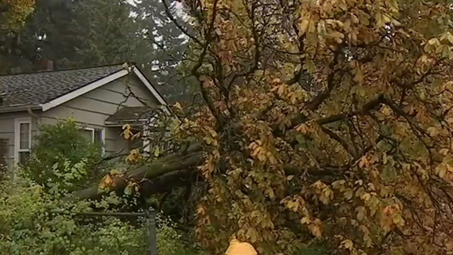
A downed tree from this week's storm. (KIRO 7)
(KIRO 7)
Heavy rain from Thursday’s storm has created hazardous conditions on some roads, but the good news is that the rain will subside later Friday.
Seattle saw a new daily record for rainfall Thursday, with 1.99 inches. The previous record was 1.53 inches in 1982.
An urban and small stream flood advisory that was set to expire at 5:45 a.m. Friday was extended to 9 a.m.
As expected, storm drains were overwhelmed in some areas and drivers are seeing a lot of standing water on roads across the region Friday.
In Kent, drivers encountered urban flooding with large pools of water flowing onto sidewalks. The city closed streets for safety and firefighters reminded people not to drive through standing water.
The intersection of East James and Central Avenue North remained closed Friday morning, with about six inches of water there. See which roads are closed in Kent at this link.
In Tacoma, flooding was seen near downtown, with some cars halfway underwater. Video shows a driver standing on the roof of his car while waiting to be rescued.
Check out this geyser from super-pressurized storm sewer lines in Tacoma. Heavy rains overwhelming storm drains on South Tacoma Way (Via Hailey Mayes) pic.twitter.com/7pTKhs3BXl
— Gary Horcher (@GaryKIRO7) October 29, 2021
When the wind picked up, trees came down or dropped branches.
In Seattle’s Capitol Hill neighborhood, large branches needed to be cleared from the road.
In Tukwila, there were large branches breaking and trees collapsing. The ground became so saturated in one spot that an entire tree tipped over, becoming entangled in power lines next to Ryan Hassett’s home.
“I just came out and I was going to go to the mailbox and I looked over and I was like, ‘Oh my gosh.’ So it was pretty surprising to say the least,” Hassett said.
Flood Warnings are in affect for the Snohomish, Snoqualmie, Skokomish, Nooksack, Stillaguamish, Skagit and Skykomish rivers.
The heavy rain likely caused a mudslide on the North Cascades Highway, closing a stretch of SR 20 Thursday.
What you see here is a slide on SR 20 North Cascades Highway.
With nightfall and rain still coming down we have closed the highway between MP 134-171 until we can reassess tomorrow in the daylight. Stay tuned. pic.twitter.com/k6sOs7JiOp
— WSDOT East (@WSDOT_East) October 29, 2021
Friday and the weekend outlook
The cold front over the area will continue to push south as the morning goes on, with some convergence zone rain behind it. However, most of the steady rain from the cold front should be done by late morning with just a few lingering showers possible into the afternoon.
Saturday will be cold to start with some patchy fog and frost possible. Then we’ll see sunshine and mid-50s for the afternoon. Look for the same on Halloween with sunny skies and near perfect weather for trick-or-treating.
Light rain is forecasted to move through on Monday, with a few showers Tuesday, some light rain Wednesday and a few showers Thursday.