White Christmas ‘not likely,’ cold weekend coming up
Dec 16, 2022, 9:02 AM | Updated: Dec 17, 2022, 11:42 am
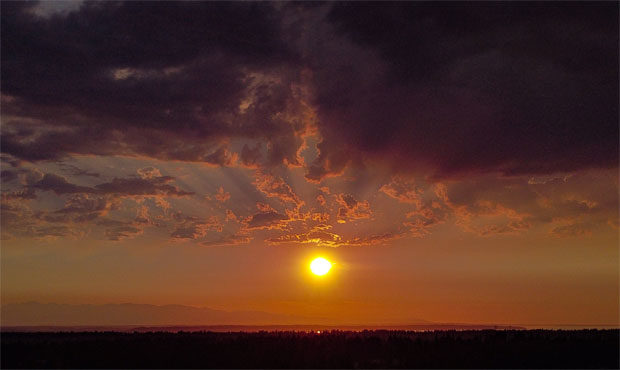
The sunset near the National Weather Service's Seattle headquarters. (NWS Seattle, Twitter)
(NWS Seattle, Twitter)
It’s going to be a cold weekend, with a mix of conditions. The significant snow may hold off until next week.
Highs on Friday will be in the low 40s – still cooler than average.
This weekend will be cold. KIRO Newsradio meteorologist Ted Buehner says temperatures will hang around freezing. Any snow will be dependent on whether moisture moves in.
KIRO 7 meteorologist Morgan Palmer writes in his weatherblog: “On Saturday, a trough of low pressure sinking south through British Columbia will bring a few late-day showers of snow or rain/snow mix mainly north of Snohomish County. There could be some minor accumulations of snow in Whatcom County into Saturday night but the rest of the area ought to be dry for Saturday. Highs will be in the 30s to low 40s.”
A Christmas weekend with snow actually falling in the lowlands is looking less and less like a possibility. Ted says it won’t happen, but long-range forecasts could change. Morgan says the chances of a White Christmas hinge on heavy snow around midweek and that it doesn’t melt by the holiday. Possible, but not likely.
The National Weather Service in Seattle says Friday will be dry and wintry conditions could move in next week.
One more dry day today before the pattern turns more active this weekend into early next week. We are watching the chance for more widespread wintry precipitation even into the Seattle area by early next week. ❄️ #WAwx pic.twitter.com/80Nd5FcOYM
— NWS Seattle (@NWSSeattle) December 16, 2022
KIRO 7 continues: The trough of low pressure sinks south and some colder air filters in Sunday through Monday. This won’t be bone-chilling cold and will mainly serve to sink snow levels for most of the lowlands of Puget Sound to around 500 feet during the day (meaning rain for many low-elevation spots) but lower later in the day into Sunday night and with any heavier precipitation. This will continue into Monday as snow levels sink further to near or just above sea level by daybreak Monday.
The thing is: there’s not a whole lot of moisture to work with on Sunday into Monday. Still, chances are there for some mainly minor snow accumulations of less than two inches across any part of Western Washington in the lowlands. There is a little better chance of heavier accumulation in any convergence zone that forms mainly north of Seattle during this period. While Monday morning’s commute does not look like a snowstorm by any means, there will be slowdowns and slick spots to contend with.
Morgan says there may be some ‘wintry mischief’ next week. The forecast is still in flux for Tuesday night through Thursday. There’s less of a chance for a full-blown snowstorm because of the absence of ‘arctic air.’ Pacific moisture is likely to surge on Wednesday into Thursday. We could see a mixed bag of rain, sleet, and snow.
There will be a chance of freezing rain too if warmer air coming in later on Wednesday and into Thursday morning does not arrive quickly enough.
If there are impacts from wintry weather on Tuesday night through Thursday morning, it looks like it could come to an abrupt end Thursday with warmer air moving in from the southwest.
No more snow days for Seattle Public Schools, remote learning instead
This would mean a changeover to just rain for lowland locations on Thursday with rain continuing at times all the way into Christmas weekend.
Still, we have a long way to go before we know exactly what will happen for sure in the long-range with timing and amounts, but we need to focus more on short-term with the prospects for some minor accumulations of snow from late Saturday and Sunday into early next week for many locations, especially north of Seattle and above a few hundred feet elevation.
Buehner says today is a good day to cross the passes, but that you are not going to want to do it from early to mid-week with heavy snow moving in.
KIRO 7 TV contributed to this report.