Which ‘Hurricane Hunters’ flew into Seattle’s storm? It’s more complicated than we thought
Dec 11, 2025, 2:00 PM | Updated: 4:48 pm
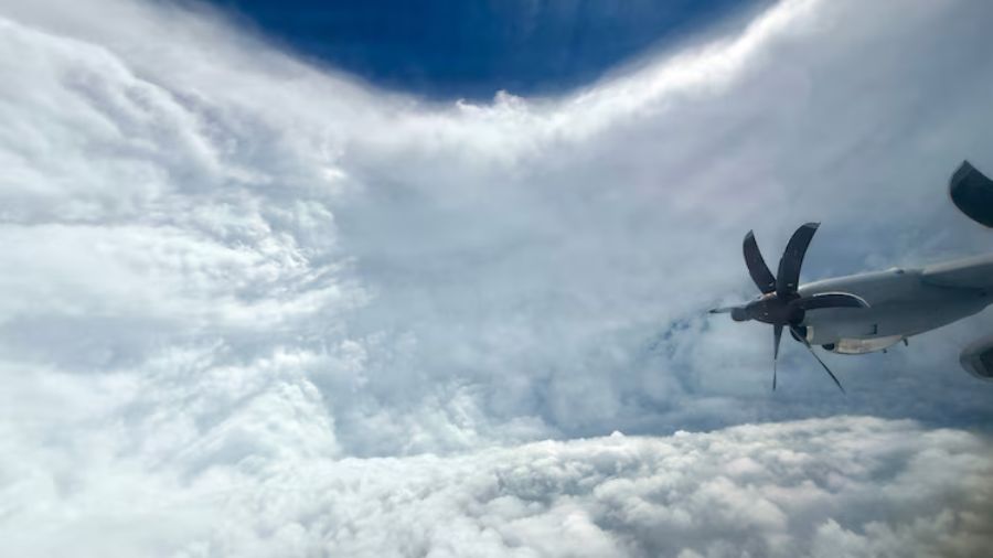
A U.S. Air Force Reserve crew from the 53rd Weather Reconnaissance Squadron, known as the "Hurricane Hunters," flies through Hurricane Melissa on Oct. 27, 2025. (Photo: Lt. Col. Mark Withee, U.S. Air Force)
(Photo: Lt. Col. Mark Withee, U.S. Air Force)
The Air Force Reserve’s 53rd Weather Reconnaissance Squadron, not NOAA, flew into the December 2025 atmospheric river that caused historic flooding in Western Washington.
Earlier this week, we reported that NOAA was sending its Hurricane Hunter aircraft into the atmospheric river approaching Western Washington. NOAA let us know we had some of the details wrong, as the real story turns out to be more interesting.
First, a bit of background that might clear up some confusion: There are actually two different groups called Hurricane Hunters. NOAA operates its own Hurricane Hunters out of Lakeland, Florida, using WP-3D Orion aircraft. Separately, the Air Force Reserve’s 53rd Weather Reconnaissance Squadron, based at Keesler Air Force Base in Mississippi, has used the “Hurricane Hunters” nickname since 1946. Both organizations fly into tropical storms and conduct weather reconnaissance, but they operate independently.
The planes that flew into this week’s atmospheric river belonged to the Air Force, not NOAA. While some people use the term Pineapple Express to describe atmospheric rivers hitting the West Coast, that nickname technically refers only to moisture plumes originating near Hawaii. This storm reached much farther across the Pacific, stretching almost to Asia.
“While NOAA and the Air Force Reserve both fly atmospheric rivers research, the plane you’re asking about was an AFRES bird,” Douglas Jessmer, a NOAA spokesperson, said. “Both the 53rd Weather Reconnaissance Squadron and the NOAA Hurricane Hunters fly these taskings in the wintertime.”
The aircraft that flew into the storm, call sign Teal 71, was “forward-based out of Mather AFB near Sacramento,” Jessmer said. The 53rd Weather Reconnaissance Squadron made multiple flights over the Pacific Ocean on Monday, Tuesday, and Wednesday to drop instruments, called dropsondes, into the atmospheric river.
NOAA’s own aircraft won’t begin Pacific Northwest operations until later this winter.
“NOAA will send a high-altitude jet, call sign NOAA 49, nicknamed ‘Gonzo,’ from Feb. 1 to March 1, and that plane will be based in Portland, Oregon,” Jessmer said.
RELATED STORIES
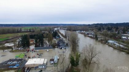


How the 53rd Weather Reconnaissance Squadron ended up flying into a Seattle storm
The flights are part of the Atmospheric River Reconnaissance program.
“Scripps Institution of Oceanography and NOAA jointly coordinate the atmospheric rivers research, so you could say both tasked the flight,” Jessmer explained.
Lauren Fimbres Wood, director of strategic communications at Scripps Institution of Oceanography, said the program currently operates on a “resources permitting” basis with the Air Force, “meaning they aren’t fully assigned to atmospheric river flights and only do them if Air Force technical and personnel resources are available.”
In other words, when the 53rd Weather Reconnaissance Squadron isn’t busy flying into Atlantic hurricanes, it can be deployed to gather data on Pacific atmospheric rivers threatening the West Coast.
How dropsonde data improved Western Washington flood forecasts
Whatever you call the planes, the information they gathered proved critical as the storm developed into one of the most significant flood events in Western Washington history. Meteorologist Scott Sistek, author of the Emerald City Weather Blog, said the reconnaissance flights helped forecasters sharpen their predictions as the atmospheric river intensified.
“By dropping those weather instruments through the clouds and getting real-time data, it helps our forecast models get better information,” Sistek told “Seattle’s Morning News” on KIRO Newsradio.
The timing lined up with a significant shift in the forecast. Early in the week, models suggested southern rivers like the Cowlitz might see the worst flooding. As reconnaissance data streamed into forecast models, meteorologists realized the atmospheric river was focusing its heaviest rainfall farther north, toward the Skagit and Snohomish river valleys.
“That’s where we saw the big jump in the Skagit and Snohomish river level forecasts,” Sistek said. “Any time we can use their help, we’ll take it.”
That updated forecast proved accurate. By Thursday morning, the Snohomish River had surpassed its 1990 record, and the Skagit River was on track to crest two feet above its record flood stage at Mount Vernon.
Weather balloons launching from Tacoma added more atmospheric river data
The reconnaissance flights were only part of the data-gathering effort. Researchers from Scripps have been launching weather balloons from McMillin Reservoir in Tacoma every three hours since 4 a.m. Monday, with launches expected to continue through Thursday morning.
“The data collected by the balloons are fed in real-time into state-of-the-art weather models tailored to atmospheric river forecasting and into global forecast models,” Fimbres Wood said.
The balloons carry instruments called radiosondes that measure temperature, humidity, and wind as they rise through the atmosphere. Like the dropsonde data from the reconnaissance flights, this information gives meteorologists a clearer picture of conditions as the storm made landfall.
One more correction about those Hurricane Hunter planes
We also used an image of a plane that doesn’t quite exist yet.
“While it sounds like nitpicking, sorry, the picture with your story is a rendering of an airplane that construction has barely begun on,” Jessmer said. “We’re still flying the legendary P-3s until NOAA’s C-130 variants come online in 2029 or 2030.”
Thanks to Douglas Jessmer at NOAA and Lauren Fimbres Wood at Scripps Institution of Oceanography for the corrections and additional details.
Charlie Harger is the host of “Seattle’s Morning News” on KIRO Newsradio. You can read more of his stories and commentaries here. Follow Charlie on X and email him here.