
Midweek rain won’t last long as sunny skies return just in time for the weekend
Mar 24, 2026, 5:00 AM | Updated: 2:58 pm
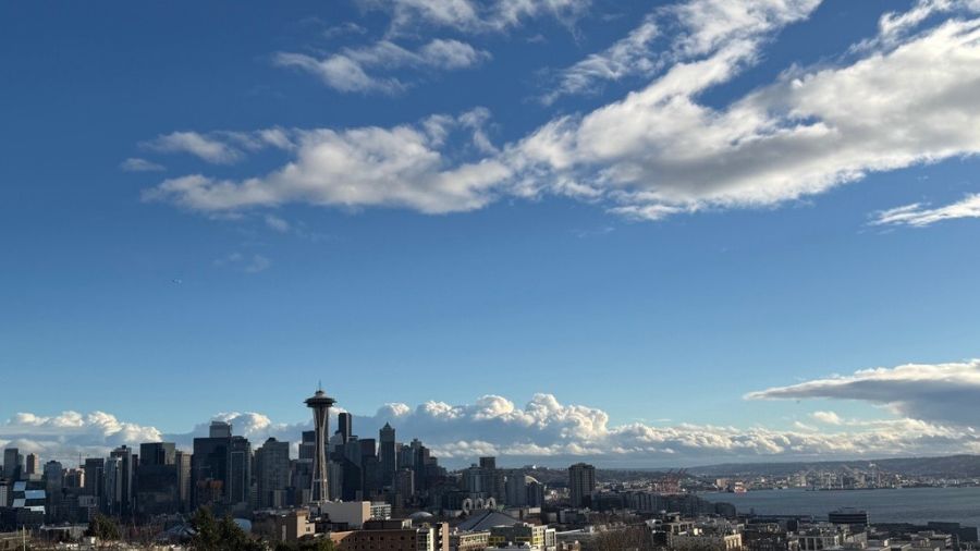
Clouds nest above Seattle, looking out from Kerry Park. (Photo: Julia Dallas, MyNorthwest)
(Photo: Julia Dallas, MyNorthwest)
The vernal equinox was this past Friday morning. Friday afternoon and the weekend greeted the first days of spring with welcome sunshine after 15 straight days of rainfall. The drier weather permitted swollen rivers to recede over the weekend.
Impact of last week’s warm rain
Last week’s atmospheric river of warm, moist air resulted in upwards of 10 inches of rain in the mountains with snow levels above 7,000 feet. The heavy amounts of snow the week prior were actually a saving grace, soaking in much of the warm rain.
U.S. Army Corps of Engineers studies have shown that no more than 15% of the mountain snowpack actually melts off and runs into river basins. That was the case last week during the warm rain event. The snowpack absorbed the bulk of the rain, resulting in more limited flooding. If that deeper snowpack was not in place, similar to the far more limited snowpack this past December, the recent flooding would have been far worse.
The warm rain did cut into the recently accumulated mountain snowpack from two weeks ago, though. Cascade snow depth measurements from the Northwest Weather and Avalanche Center showed Mt. Baker lost close to a foot of snow, and from Stevens Pass south to White Pass, between two and three feet of snow was lost from the snowpack depth.
The amount of water in the mountain snowpack also dipped to around 50% of average, about a 10% loss in just a week, thanks to the much warmer weather. The mountain snowpack usually peaks for the season around April 1.
Above-average rainfall for first time since 2022
In western Washington, the wet March thus far pushed annual rainfall amounts, since the first of the year, above average for the first time since 2022. The years 2023, 2024, and 2025 were all drier than average through mid-March and prompted below-normal rain totals for each of these years.
The Seattle-Tacoma International Airport (SEA), as of this past weekend, had received 12.64 inches for the year so far, with the average just shy of 12 and a half inches. Olympia was 4.90 inches above normal for the year, while Bellingham was over 8 inches ahead for the year.
Rain to return
The respite from last week’s wet weather with weekend sunshine is forecast to be short-lived. Monday will remain dry, but a developing Pacific weather system is expected to intensify as it approaches the coast. This system is being fueled by moisture that recently pummeled Hawaii with heavy rainfall amounts and flooding there.
This weather system, though, is expected to be a quick hitter, spreading rain and gusty winds onshore later Monday night and Tuesday before moving promptly inland. Showers will follow Wednesday and taper off Thursday with some clearing. High temperatures this week are forecast to generally be in the 50s, which is around average for this time of year.
RELATED STORIES
Spring sunshine resumes late this week
Higher pressure is expected to build over the region for the tail end of the week. In fact, Friday and Saturday are anticipated to have plenty of mild spring sunshine, offering good days to visit the Skagit Tulip Festival or the cherry blossoms on the University of Washington campus.
By Sunday, though, another Pacific weather system is forecast to swing onshore with some light rain across the region. Longer range charts reflect on-again, off-again showers as the calendar rolls over into early April next week.
Ted Buehner is the KIRO Newsradio meteorologist. Follow him on X and Bluesky. Read more of his stories here.













