More rain, strong winds expected Tuesday night across western Washington
Dec 16, 2025, 5:00 PM | Updated: 5:08 pm

In an aerial view, a person stands atop of property engulfed by floodwater on December 14, 2025 in Snohomish, Washington. (Photo: Brandon Bell, Getty Images)
(Photo: Brandon Bell, Getty Images)
This sequence of nasty December weather looks like it will go out with an exclamation point! More rain and strong winds will punctuate the region’s recent hazardous weather.
Tuesday afternoon into the night
One more warm, wet weather system is on schedule to gather strength and sweep onshore through Tuesday night. Rain will increase heading into the afternoon and overnight. Another one to three inches of rain is anticipated in the Olympics and Cascades, with an inch or less for the lowlands of western Washington.
Temperatures on Tuesday will again be rather mild with highs in the 50s. The average high temperature in mid-December is in the mid-40s.
Winds will also be on the increase heading into tonight. For much of western Washington, southerly winds will rise to 20 to 40 mph with gusts up to 60 mph. As this weather system’s associated cold front moves inland, strong westerly winds are expected through the Strait of Juan de Fuca that will blast Whidbey Island and the surrounding areas.
Given the soggy soils, the strong winds are more likely to knock down trees onto roadways and structures. Areas with power outages are more likely. Prepare for potential power outages Tuesday night into Wednesday morning. Have those flashlights with fresh batteries handy. Ensure any backup power generators are properly ventilated outdoors.
RELATED STORIES

Renewed river rises
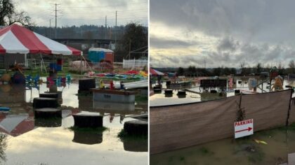
This final surge of rainfall will bump up already swollen rivers. Fortunately, this weather system is more of a quick hitter. So the river rises will be relatively minor. Nevertheless, those areas with ongoing flooding will experience another increase in rivers.
Major flooding is expected to resume on the Skagit River. At Concrete, the river is anticipated to crest again near 36.2 feet at 10 a.m. on Wednesday. Flood stage is 28 feet. At Mt. Vernon, the next crest is expected to be near 34.4 feet at 10 a.m. on Thursday, three feet less than the record set late last week. Flood stage is 28 feet.
Moderate flooding is likely again on the Skykomish, Snoqualmie, and Snohomish Rivers. The Skykomish at Gold Bar is forecast to crest at 17.7 feet near 4 a.m. on Wednesday. The Snoqualmie at Carnation, the forecast crest is 57.9 feet around 4 p.m. on Wednesday. The Snohomish River at Monroe is anticipated to crest at 16.2 feet, and at Snohomish near 27.7 feet – both around 4 p.m. on Wednesday.
The Cowlitz River at Randle is also expected to experience moderate flooding again, with a crest near 21.1 feet at 4 p.m. on Wednesday. Most other rivers will rise, with some reaching flood stage again with minor flooding.
The Green and White Rivers remain a concern. Both rivers around Auburn are expected to hover between 10,000 and 10,500 cubic feet per second through the weekend as the Mud Mountain and Howard Hanson Dams manage river inflows to their reservoirs. Lingering high water is anticipated through this period.
Much cooler – Mountain snows
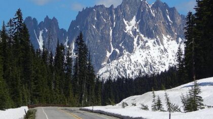
The good news is that this incoming cold front on Tuesday night will usher in a much cooler air mass onshore and knock snow levels down below the mountain passes. This big change will mean rain falling in the mountains will turn to snow and cut off the rain runoff into the region’s rivers, permitting streams to more fully recede.
The mountain snow will be substantial from Tuesday night through the end of the week. Two to four feet of new snow is anticipated. The accumulating snow will be aggravated by windy conditions, making visibility difficult.
Mountain pass highway travel will suddenly become a challenge. If planning to drive over the Cascades starting Wednesday, be prepared for winter weather driving conditions. By state law, be sure to carry chains and be ready to use them if conditions warrant.
For the rest of western Washington, temperatures will drop to more seasonable readings with highs in the 40s and lows in the mid-30s to lower 40s.
Looking ahead
Another developing weather system is expected to arrive on Thursday, with another surge of more typical rain and mountain snow. This system will also offer more windy conditions, maintaining the threat of fallen trees and power outages.
Showers will follow this weather system heading into the coming weekend.
One more thing: Landslides
Despite the end of the heavy rainfall amounts, the soils are saturated. Any additional rain will maintain the soggy conditions. Hillsides with steep slopes will remain vulnerable to landslides through at least this weekend.
Ted Buehner is the KIRO Newsradio meteorologist. Follow him on X and Bluesky. Read more of his stories here.