Deep freeze, some snow continues in Western Washington
Feb 13, 2025, 12:27 PM
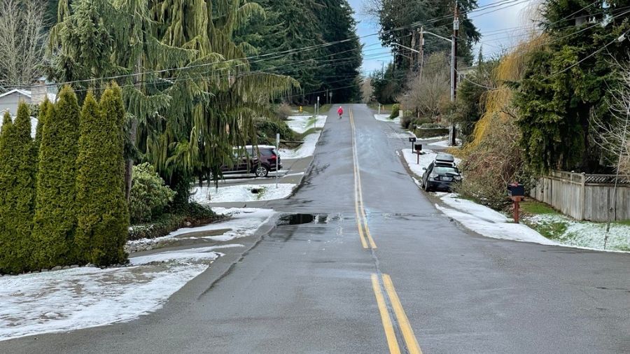
While the deep freeze continues, snow is likely in Southwest WA. Some remains north of Seatthe. (Photo: Bill Kaczaraba, MyNorthwest)
(Photo: Bill Kaczaraba, MyNorthwest)
Western Washington has been in the deep freeze since mid-January, over 4 weeks now. More often than not, the transition back to milder, more ‘normal’ weather can be messy.
That transition is getting underway. A Pacific weather system is working its way onshore with the center of low pressure moving into Oregon. Moisture from this system will spread north through Western Washington through Friday morning. Yet this moisture will encounter the current cold dry air. Touched a metal door knob or stroked your pet lately and experienced some static electricity?
Deep freeze, dry air, spotty freezing rain
With the dry air in place, it will take a while for any precipitation to reach the ground. Light amounts of snow will begin by late Thursday across southwest Washington. The snow will struggle to spread further north into the Puget Sound region, yet some light accumulation is likely overnight Thursday into Friday morning. Spotty light freezing rain is also possible.
Expected snow amounts will range from up to 3 inches in southwest Washington to perhaps an inch for the South Sound, Tacoma, and Shelton and a dusting or so from Seattle and Bremerton northward into Snohomish County. Areas further north will likely see no more than flurries.
Low temperatures overnight Thursday will be much milder than earlier this week, with lows mainly in the lower 30s. The Friday morning commute will likely be challenging with those temperatures and the likelihood of some light snow accumulation. Road crews will be out pre-treating roadways and clearing snow as needed.
This initial Pacific weather system marks a significant overall weather pattern change and will open the door to a parade of milder wet storms. The next weather system is due to spread rain into Western Washington Saturday and Sunday. High temperatures will rise well into the 40s with lows above freezing.
Normal PNW weather headed our way
Heading into next week, more wet weather systems are expected to swing onshore. More ‘normal’ Western Washington weather will be well underway.
For those who plan to head into or across the Cascades this holiday weekend, anticipate tough winter weather driving conditions. Yet for snow enthusiasts, this change in the weather means fresh snow on the slopes. In fact, a foot or more of new snow is expected by Monday, with upwards of two feet or so on the higher peaks, including the volcanoes.
Following this more than four-week cold, dry mid-winter weather pattern, the lowland rain and mountain snow are really needed. Seattle-Tacoma International Airport (SEA) has had only about two and a half inches of rain so far this year, over five inches below average. Olympia has three and a quarter inches of precipitation, nearly seven inches below average.
Strong winds and freezing rain: North Bend residents and businesses prepare
Even the coast has been abnormally dry. Hoquiam has received just over five and a half inches of rain so far this year, well over 8 inches below normal. Forks has had 6 inches of rain, a whopping 14 inches below normal. In all, Western Washington has had only between 30 and 50 percent of the average precipitation this year. The change to a wetter weather pattern is clearly needed.

The mountains are also running well behind for snowfall. Snow depths are between 60 and 90 percent of average with the south Cascades on the high end. The water in the snowpack is only between 67 percent for the Olympics and north and central Cascades, to just over 100 percent for the south Cascades. The usual peak of the mountain snowpack is around April 1st, leaving only 6 weeks for the snowpack to catch up to normal.
For those who have enjoyed this dry mid-winter chilly sunshine, it is coming to an end. More ‘normal’ Western Washington weather with lowland rain and mountain snow is about to return starting this holiday weekend.
Ted Buehner is the KIRO Newsradio meteorologist. You can read more of his stories here and follow him on X.