
Snow spotted across Puget Sound Tuesday morning, several schools delay start
Mar 10, 2026, 7:03 AM | Updated: 3:32 pm
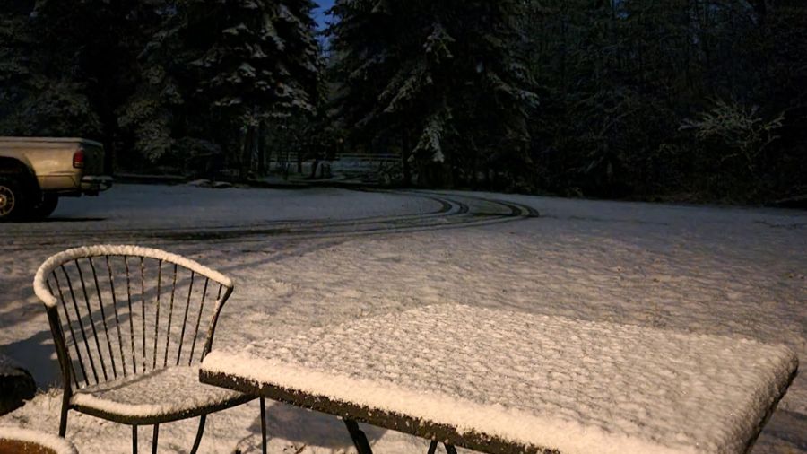
Snow collects over an Arlington resident's backyard early Tuesday morning. (Photo courtesy of "Seattle's Morning News")
(Photo courtesy of "Seattle's Morning News")
Snow is being spotted in several areas throughout the Puget Sound region early Tuesday morning.
KIRO Newsradio’s traffic team reported that snow is accumulating on the sides of I-5 in Marysville near the SR 529 off-ramp.
Check it out. Snow on the sides of the roads in Marysville. Watch those speeds. This is the off ramp at 529. @wsdot_traffic pic.twitter.com/bHNI1zimKA
— KIRO Newsradio Traffic (@KIROTraffic) March 10, 2026
The Marysville School District announced it is delaying its start time Tuesday by two hours.
RELATED STORIES



More school closures due to snow, inclement weather
The Arlington School District is delaying its start times by two hours after snow was reported falling early Tuesday morning.
“All schools will be starting two hours late this morning,” the Arlington School District stated at 5 a.m. Tuesday. “There will be no out-of-district transportation, no AM/PM APPLE Preschool or Presidents Preschool, no zero period, and no Skills Center or Regional Apprenticeship Program. All buses will be operating on limited transportation routes this morning.”
Other school districts delayed by two hours are Lakewood, Granite Falls, and Lake Stevens, in addition to the Snohomish Discovery School and the Northwest Regional Learning Center. Grace Academy will also delay its class start time by two hours. Follow MyNorthwest’s School Closing and Alerts page for up-to-date information.
Heavy mountain snow, blizzard conditions, expected Wednesday
Tuesday morning will be the coldest morning of this stretch in the lowlands, with most spots near freezing. Despite the cold temperatures, moisture late tonight into Tuesday morning will be rather sparse.
Still, any showers through Tuesday morning have a chance to produce some minor areas of slush or wet snow, mainly on grassy surfaces. Some more substantial snow could happen in the Skykomish, Sultan, and Gold Bar areas.
Rain showers will be on the uptick later Tuesday and Tuesday night in the lowlands as an atmospheric river approaches the area. Snow will increase a bit in the mountains late Tuesday and Tuesday night, so pass travel will become potentially difficult.
The main event is Wednesday, with increasing rain and wind in the lowlands (gusts 30+ mph) in the afternoon and evening, and very heavy mountain snow. A Blizzard Warning is out for Wednesday’s impacts in the Cascades and Olympics, with the worst of the conditions from Wednesday afternoon through early Thursday morning.
Two to four feet of snow will fall from early Wednesday through Thursday in the mountains, with isolated higher amounts on higher peaks. The passes will be difficult, if not impossible, to traverse during this period, and avalanche danger will be very high. Winds in the mountains will also gust to 40 mph or stronger, creating whiteout conditions and blowing and drifting snow.
Some snow will continue in the mountains Thursday and Friday as well, with lowland rainfall. There is some potential for heavier mountain snowfall again on Friday.
Contributing: KIRO 7












