
4 years of low snowpack could mean water shortages, wildfires, and higher power bills this summer
Apr 2, 2026, 5:00 AM | Updated: 3:03 pm
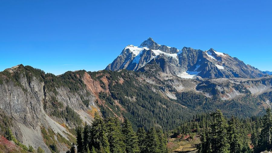
Mount Shuksan at Mt. Baker-Snoqualmie National Forest in Washington. (Photo: Jeff Hollett via Flickr Creative Commons)
(Photo: Jeff Hollett via Flickr Creative Commons)
The beginning of April is normally when the region’s mountain snowpack reaches its winter season peak. The snow depth report from the Northwest Weather and Avalanche Center was released on April 1, and it tells an unfortunate story.
The 100 inches of snow reported at Mt. Baker is as good as the report gets. Those 100 inches amount to 60% of what should be a normal snowpack. On the other end of the spectrum, White Pass came in at just 25% of normal with only 15 inches on the ground. The other mountain snow reports ranged from Hurricane Ridge in the Olympics at just 36% to Paradise on Mt. Rainier at 55% of normal for its current snow depth.
The amount of water in the snowpack is also dismal. For the Olympics and Cascades, the range of water in the current snow depth is from 43% of average in the Olympics to 72% in the North Cascades.
For both the current mountain snowpack and water within the snow, the amounts are less than what was measured during last year’s disappointing April 1 report.

The Snow Water Equivalent. (Image courtesy of the Washington SNOTEL)
What does all this mean?
This winter season’s underperforming mountain snowpack marks the fourth season in a row. Out of over a century of weather records, four years in a row have never happened before. To top it all off, this winter season has been the third warmest on record.
The mountain snowpack is literally “water in the bank.” In this season’s case and the three years prior, the snow deposits have been well below average, meaning a shortage of water in the bank.
March was, fortunately, a wet month. Rainfall at the Seattle-Tacoma International Airport (SEA) finished the month about one and a half inches above normal, pushing the year’s rainfall thus far just above average — the first time that has happened since 2023. Yet, the warm atmospheric river events in both December and March resulted in high snow levels with rain falling across much of the mountainous terrain instead of snow.
Reservoirs such as those in the upper Yakima River basin along I-90 captured much of that moisture and are close to full. Yet, Seattle City Light has reported that Ross Dam in the North Cascades has failed to reach full capacity.
The latest Drought Monitor report shows western Washington in generally good shape. Yet much of eastern Washington is in moderate to severe drought. The state may need to declare another drought emergency for the eastern half of the state as the calendar moves into summer.

The latest drought conditions. (Image courtesy of NOAA)
Impacts of low snowpack
Mountain snowpack covers far more terrain than all the limited number of man-made reservoirs. Thus, those reservoirs capture only a small amount of snowmelt. As the year rolls into summer and early fall, the mountain snowpack will melt off much earlier than usual, meaning less water for a wide variety of uses.
The impacts will include less water for electric power generation, less water for agriculture — particularly in eastern Washington, less water for seasonal fish runs, and even less domestic water consumption.
Summer weather outlook
The latest seasonal weather outlook from the National Weather Service’s Climate Prediction Center (CPC) for June, July, and August pushes the odds toward another warmer and drier summer than usual, a trend seen for much of this century thus far.
Warmer-than-average summer conditions mean additional electric power will be needed to help keep homes and buildings cooler, resulting in utilities purchasing power from out-of-region sources, pushing power prices upward.
Limited agricultural water supplies can translate to lower crop harvests, pushing grocery and commodity prices up. Less water in rivers and streams can once again stress fish runs.
Wildfire season
With a below normal mountain snowpack and a warmer and drier than average summer season anticipated, the odds increase for an earlier than normal start to the wildfire season. That has been the trend in recent years as well. Western Washington has suffered from wildfire smoke seven out of the last nine summers, with smoke coming both from within the state and from regions elsewhere in the western part of North America.
This summer could easily involve another period of time with poor air quality thanks to wildfire smoke.
RELATED STORIES

Looking ahead
The weak La Niña that accompanied this winter season has ended. It is way too early, yet the latest CPC seasonal weather outlook for this coming fall and winter is pointing toward the return of El Niño.
El Niño is when the sea surface temperatures in the eastern Pacific Ocean tropical waters — the waters west of Peru — are warmer than average.
The El Niño phenomenon results in a significant adjustment in how the storm track across the northern Pacific during the winter season behaves, spending much of the time across California and the southern tier states. For the Pacific Northwest, El Niño usually results in warmer-than-average winter season temperatures, not good for building a mountain snowpack.
It is only early April, and a lot of weather adjustments from the current expected conditions can occur. Yet, this summer and early fall may involve water shortages, wildfires and smoke, and rises in prices. We all need to brace for impact.
Ted Buehner is the KIRO Newsradio meteorologist. Follow him on X and Bluesky. Read more of his stories here.













