
WEATHER: Storms and fire danger, some haze possible
Aug 11, 2026, 5:36 AM
(Photo courtesy of KIRO 7)
(Photo courtesy of KIRO 7)
We have another nice summer day ahead, but there will be a few changes to watch as we head into Wednesday and Thursday. A weak weather system will bring more clouds, a chance for thunderstorms in the mountains, and potentially some elevated wildfire smoke into the region.
For Tuesday, we’re starting with areas of low clouds around western Washington, although they shouldn’t be as widespread as Monday morning. The clouds will gradually clear for increasing sunshine this afternoon, with temperatures slightly warmer in the mid to upper-70s.
Wednesday will look a little different. A weak system moving through the region will increase cloud cover and drop temperatures a few degrees. The western Washington lowlands should remain dry, but showers and thunderstorms will be possible over the Cascades and perhaps the Olympics, as well as along the east slopes of the Cascades into northeast Washington. Another round of mountain thunderstorms will be possible Thursday.
This does not look like the widespread lightning event we saw in mid-July, but any lightning is worth watching this time of year because of the potential to start new wildfires.
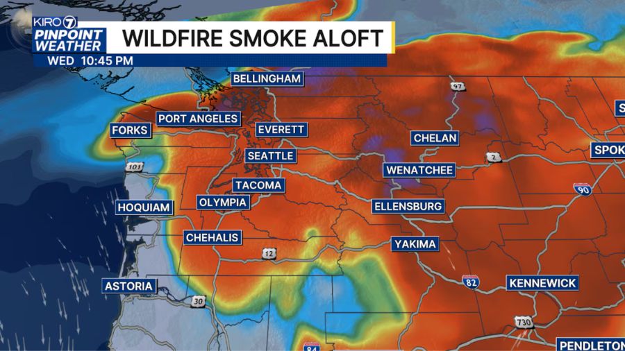
We may also notice some wildfire smoke returning to our skies later Wednesday and Thursday. Smoke from fires in British Columbia could drift overhead, adding some haze to the sky. At this point, much of that smoke looks to remain elevated rather than significantly impacting surface air quality, but it’s something we’ll continue to watch.
East of the Cascades, breezy to windy afternoon and evening conditions will continue through midweek, adding another concern for ongoing fire weather.
By Friday, our familiar August weather will take over again. Temperatures will warm into the 80s this weekend with plenty of afternoon sunshine and no rain in sight. We’ll still have varying amounts of morning low clouds, particularly Saturday, before sunshine takes over.













