
National Preparedness Month: what western WA should get ready for this fall, winter
Sep 7, 2026, 2:56 PM
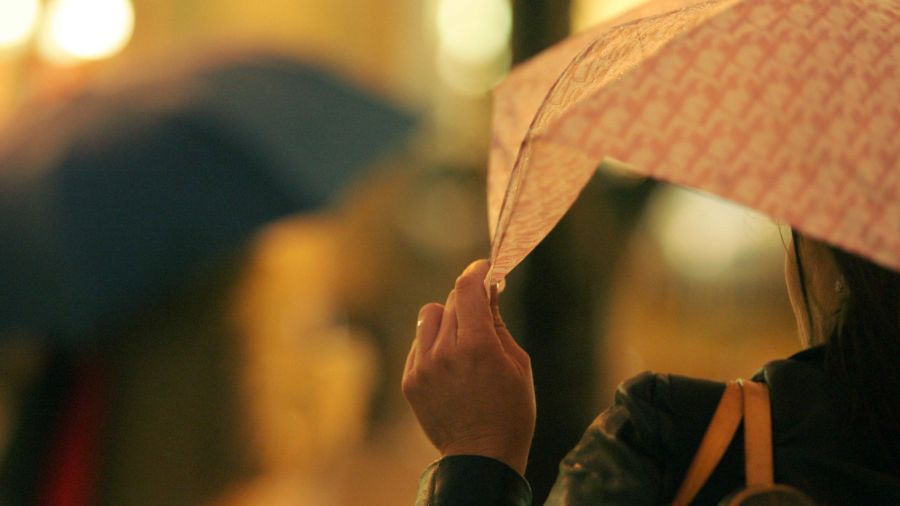
A commuter holds her umbrella while waiting for a bus in Rainier Square on 4th Avenue during evening rush hour. (Photo: Robert Sumner, Getty Images)
(Photo: Robert Sumner, Getty Images)
The final days of the summer season are here until the fall equinox on Tuesday, Sept. 22. Days are getting shorter and nights longer. This time of year, each day is shorter by close to three and a half minutes, a subtle reminder that the winter season is not far away.
That fact is why September is National Preparedness Month; the best time to prepare for whatever nature throws at us in the coming months is in advance. Western Washington fall and winter weather often involves heavy rainfall, flooding, and landslides; strong, damaging wind storms; and lowland snow and ice. These kinds of adverse weather are the key reason to prepare ahead of time. Last winter’s flooding events help to emphasize that fact.
Latest seasonal weather outlook
The latest seasonal weather outlook for the latter part of fall and into winter offers good odds of warmer-than-average temperatures and near- or below-average precipitation — a more typical El Niño weather outcome.
The latest seasonal weather outlook reflects a strengthening El Niño for this winter. El Niño is the opposite sibling of La Niña, when the ocean waters in the eastern Pacific Ocean tropical waters — the waters west of Peru — are warmer than average. La Niña is when those same tropical waters are cooler than average. This season’s El Niño is on track to be a record or a near-record warm event.
La Niña and El Niño make big adjustments in how the North Pacific storm track behaves. For La Niña, Pacific storms spend more time moving onshore into the Pacific Northwest, as opposed to El Niño, when the storm track takes a more consistent path into California and beyond to the east.
Impacts of El Niño
El Niño winter seasons for western Washington tend to be warmer than average and lean toward below-average precipitation and a poorer mountain snowpack. With on average warmer temperatures this winter, the average mountain snow level will tend to be higher, meaning yet another below-normal mountain snowpack by next spring.
Another subpar mountain snowpack would make five years in a row that will have been the case, not good for water supplies for agriculture, electric power generation, fish runs, recreation, and drinking water.
Ranking El Niño, ‘Neutral’ (around average tropical eastern Pacific sea surface temperatures), and La Niña winters, El Niño tends to rank last for flooding, wind storm, and lowland snow events. Yet these significant fall and winter season weather events do occur during El Niño events, just not as often.
Historically, the wind storm season usually begins in October. The nation’s strongest non-tropical wind storm for the lower 48 in American history occurred on October 12th, 1962 —the Columbus Day Storm. Winds in the interior of western Washington topped 100 mph, knocking down thousands of trees, damaging homes and utilities, with power out for over two weeks, and resulting in 46 fatalities.
This region usually gets a strong, widespread damaging wind storm about every 10 years or so. All other strong wind storms are compared to the granddaddy of them all, the Columbus Day Storm. The last significant widespread wind storm was the Hanukkah Eve Wind Storm of December 2006. This region is way overdue. Perhaps ask this question: What if another Columbus Day-type wind storm struck again? Would you be ready for an extended period of time without power?
Western Washington’s flood season usually can start as early as late October and extends into March. Last year’s big flood events occurred in December and again in March. Major flood events usually occur during an atmospheric river event, delivering heavy amounts of rainfall with relatively high mountain snow levels, resulting in tremendous runoff in the region’s rivers. The rainfall also soaks the landscape and can result in landslides along steeper slopes.
Flooding is number one for Presidentially Declared Natural Disasters in Washington. Given how warmer global temperatures hold more moisture, any storms that carry a higher volume of moisture can produce heavier rain amounts in the same time period. It is quite possible these wet storms could dump more rain and result in more significant flooding than in the past. This issue has been the case not only across the country in recent years, but also around the world.
The lowland snow season typically starts in mid-November and extends into March. Snow not only disrupts transportation, but often results in power outages as well. Three of the top 10 snowiest winters in western Washington have occurred during El Niño winters.
RELATED STORIES
Are you ready?
Are you ready for these weather hazards or perhaps an earthquake too? Now is the time to prepare. For helpful tips and checklists for your home, car, pets, and more, go to ready.gov or the CDC Winter Preparedness website.
One key item for your home, business, school, health care facility, or place of worship is a NOAA Weather Radio all-hazards — a lifesaver for the price of a pair of shoes. Remember, when you are weather aware, you are weather prepared.
According to a national preparedness survey by provider 4Patriots, Seattle ranks eighth in the nation of America’s most prepared cities. The survey measured elements for extreme weather, natural disasters, and blackouts. The Emerald City scored high in various social, infrastructure, environmental, and economic variables of preparedness, including emergency class attendance, power backups for public buildings, public shelter counts, history of natural disasters, and emergency response budgets.
The survey found San Diego, Phoenix, San Antonio, Denver, Austin, Portland, and Minneapolis ranked higher than Seattle.
Ranking high in preparedness compared to other cities across the nation is wonderful news, yet it also means still more readiness is needed for homes, businesses, and families.
To help protect you, your family, and your business, get prepared this month during National Preparedness Month, and you will be better prepared for whatever nature produces this fall and winter.
Ted Buehner is the KIRO Newsradio meteorologist. Follow him on X and Bluesky. Read more of his stories here.












