
From snow to sunshine: Western WA warms up after wintry spring blast
Apr 16, 2026, 6:05 PM

Spring weather in Seattle. (Photo: Karen Ducey, Getty Images)
(Photo: Karen Ducey, Getty Images)
Ready for a return to more spring-like weather?
Tuesday and Wednesday served as a reminder that spring weather can sometimes feel like more winter. A strong cold front from the Gulf of Alaska dumped rain across Western Washington Tuesday.
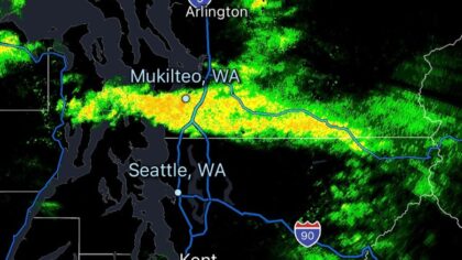
In its wake, Wednesday saw a cold, unstable air mass that generated unsettled weather, including showers, a Puget Sound Convergence Zone that spawned a few thunderstorms, and even a brief waterspout in Puget Sound just west of Elliott Bay and Seattle.
Western Washington averages fewer than 10 thunderstorms per year, which is quite low compared with much of the nation. Yet spring is the prime season for thunderstorms in the region, and Wednesday offered yet another example.
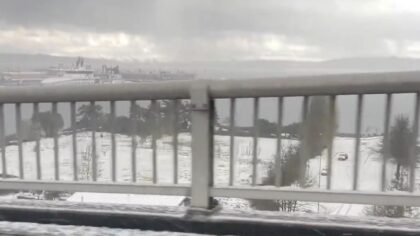
The unseasonably cold air mass Wednesday also dropped snow levels to around 1,500 feet with healthy snow accumulations in the mountains. I-90 Snoqualmie Pass was closed for a few hours as crews worked to clear the snow on the highway, along with a number of vehicle spinouts.
Skies cleared overnight, allowing temperatures to plunge. Low temperatures dropped to below freezing in a number of places, primarily in the South Sound, the Kitsap Peninsula, the Hood Canal region, and even on the coast.
Olympia reported 27 degrees as a low temperature Thursday morning. Shelton dipped to 28, Bremerton Airport 30, Quilcene 31, and McChord Field also 31. Along the coast, Forks had a chilly 28 degrees while Hoquiam bottomed out at 30 degrees.
RELATED STORIES
Warmer spring weather to return
More spring-like weather is set to return for the rest of this week, just in time for the first 8 p.m. sunset of the year Thursday night. Higher pressure is expected to build over the Pacific Northwest through Saturday, bringing a warmer air mass and more spring-like temperatures.
High temperatures Friday will warm into the 50s across much of the region, with the 60s for the weekend. The average high temperature for mid-April is close to 60. Lows will moderate quite a bit, dropping only into the mid-40s to lower 50s Friday night and through the weekend.
Unfortunately, the warmer air mass means that much of the snow that fell in the mountains Tuesday through Thursday morning will melt. Mountain pass temperatures are forecast to rise close to 50 degrees over the weekend.
Looking ahead to next week’s weather, the next chance of rain appears to be midweek, and even that is not certain. Temperatures should remain mild, at or just above average for this time of year.
The latest weather outlook toward the end of the month reflects odds tipped toward warmer-than-average temperatures and near-average precipitation.
Latest summer through winter weather outlook
The latest seasonal weather outlook was released by the National Weather Service’s Climate Prediction Center Thursday morning. This outlook is issued on the third Thursday of each month.
This latest seasonal weather outlook is something not seen very often. For temperatures, the odds favor warmer-than-average conditions for the rest of this spring, through summer, again through fall, and again this coming winter. For precipitation, the odds indicate near- or below-average conditions throughout this coming winter.
After suffering the fourth winter season with a below-average mountain snowpack, this seasonal weather outlook is not good news. The coming winter could have yet another below-average snowpack, breaking this past season’s record streak with records going back well over a century.
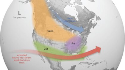
Evidence in the eastern Pacific Ocean tropical waters is trending toward an El Niño winter season ahead. El Niño occurs when tropical waters are warmer than average and, in turn, shifts the North Pacific storm track, bringing more storms into California and across the southern tier of the U.S.
For the Pacific Northwest, El Niño winters are usually warmer than average, with precipitation often below average. The latest seasonal weather outlook released Thursday morning reflects those El Niño conditions.
It has been reported that this El Niño could be what is called a Super El Niño – when those eastern Pacific tropical waters are unusually warm. Seasonal outlooks issued during the spring regarding the coming winter often do not have a great track record. So it is too early to bank on a Super El Niño. Yet, the trend is moving toward an El Niño winter season ahead. For that, stay tuned as the calendar moves into summer!
Impacts from a below-average mountain snowpack
In the meantime, given that this season’s mountain snowpack is roughly 50% of normal, the water supply is likely to become limited later in the summer and early fall. Washington State has already issued a Drought Declaration. Water for agricultural irrigation, particularly in Eastern Washington, will likely be more limited; water for electric power generation will be an issue, as will ensuring enough water in streams for migrating fish and recreation. Drinking water supplies may also become limited.
And then there is the wildfire season. As lingering mountain snow melts earlier than usual, the green-up of vegetation will occur earlier. With drier conditions heading into summer, the environment will tend to dry out, which could mean the wildfire season starts earlier than normal across the Pacific Northwest.
Wildfires also mean wildfire smoke and the potential for periods of poor air quality. Western Washington has suffered wildfire smoke in seven out of the last nine summers. This summer could be another wildfire smoke season.
The latest seasonal weather outlook offers another summer that is warmer and drier than usual, something that has become more common this century. Enjoy the longer days and warmer weather ahead. Just be prepared for what this weather could also bring.
Ted Buehner is the KIRO Newsradio meteorologist. Follow him on X and Bluesky. Read more of his stories here.












