Rain-snow mix, icy roads may greet Tuesday morning commuters
Jan 3, 2022, 5:26 AM | Updated: Jan 4, 2022, 6:16 am
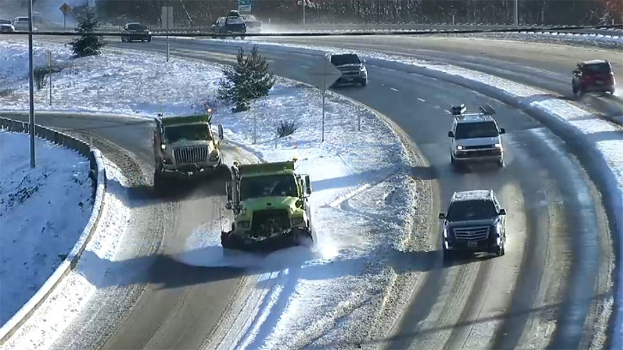
(WSDOT)
(WSDOT)
The Tuesday morning commute may look a little better than the slushy conditions drivers experienced on Monday, though there is a risk of black ice on the roadways Tuesday.
Monitor school closures and delays
Check the traffic cams
Mountain pass webcams
The National Weather Service says temperatures are “hovering near freezing” across the area. Combine that with continued showers and NWS says “areas of black ice are likely on roadways.”
⚠️With temperatures hovering near freezing across the area and continued showers, areas of black ice are likely on roadways this morning! Be sure to plan accordingly and take it slow on your commute! #wawx pic.twitter.com/6xBL1i2jTb
— NWS Seattle (@NWSSeattle) January 4, 2022
Light precipitation around tonight. Temps are near freezing. Side roads are already getting slick ( personal experience from the drive in ). If you have to travel please be careful. The roads could look clear but that doesn't mean there isn't a thin sheet of ice on it. #wawx pic.twitter.com/dmrEQHz9Sv
— NWS Seattle (@NWSSeattle) January 4, 2022
On Monday, it was predicted that a rain-snow mix could fall overnight into Tuesday, particularly in areas of heavy precipitation.
“There is a chance of rain-snow mix in the Seattle metro area,” NWS Meteorologist Jeff Michalski told KIRO Newsradio. “However, significant accumulations are not expected.”
The only exception is the Eastside up against the Cascades, such as North Bend, where temperatures are cooler. Those areas could see some accumulation. A winter weather advisory is in effect for the Cascade Foothills and Kitsap areas.
Monday AM conditions
Frigid temperatures had snow on the ground for a seventh straight day in most of Western Washington to start Monday, Jan. 3. On Sunday night, another 2 inches of wet snow accumulated in hillier areas, leaving commuters with difficult conditions to slog through Monday morning.
That had several schools on delayed start times, with others closed entirely. Edmonds, Everett, Issaquah, Kent, Olympia, Renton, Snohomish, and Tacoma school districts were all on a two-hour delay. Vashon, San Juan Island, and Mount Baker districts were all closed.
The Seattle school district was also closed, albeit for non weather-related reasons, instead shutting down Monday for voluntary COVID-19 testing before the official start of the winter term.
Snoqualmie Pass and White Pass were closed in both directions on Monday due to snowy conditions. Snoqualmie was scheduled to open at 8 p.m. White Pass remained closed overnight with an update expected at 8 a.m. Tuesday.
Waste pickup services resumed in Seattle on Monday, following a week of weather-related delays. Residents will be permitted to put out twice as much trash, recycling, and yard waste this week for no additional charge.
Wednesday and beyond
A warm front is expected to move into the region by Wednesday, with “the potential to be a real weather maker” for the southwest portion of Western Washington, bringing heavy rainfall and, in parts of the region, potentially more snow.
“Snow levels will be low so if any precipitation does reach the area in the afternoon it could start out as a rain snow mix,” the NWS said.
Michalski says areas over Everett and north into western Whatcom County may see some snow Wednesday evening into Thursday. But that will change to rain as a warm front moves north.
Follow @http://twitter.com/Mynorthwest